Barjac geodata
Barjac (Occitanie) is a populated place; located in France in Europe/Paris (GMT+2) time zone. With population of 1,503 people, there are 6181 cities with bigger population in this country. Compared to other cities in France, 84.8% of cities are located further ↑North; 71% of cities are located further ←West and 62.5% of cities have lower elevation than Barjac. Note1
Administrative division(s):
- Level 1: Occitanie
- Level 2: Gard
- Level 3: Arrondissement d’Alès
- Level 4: Barjac


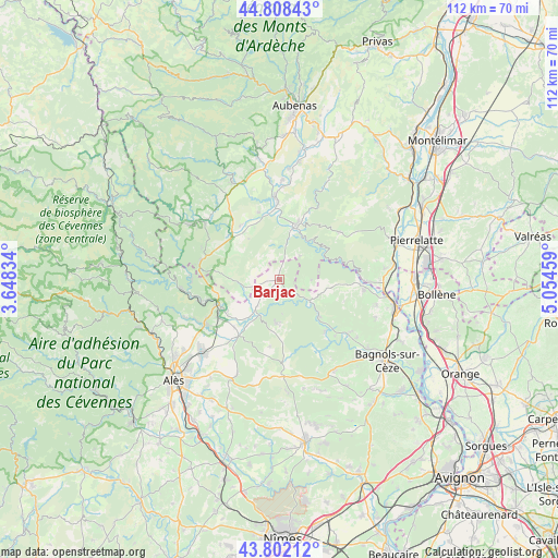
Barjac GPS coordinates[2]
44° 18' 26.748" North, 4° 21' 5.256" East
| Map corner | latitude | longitude |
|---|---|---|
| Upper-left | 44.80843°, | 3.64834° |
| Center: | 44.30743°, | 4.35146° |
| Lower-right: | 43.80212°, | 5.05459° |
| Map W x H: | 111.9×111.9 km | = 69.5×69.5mi |
| max Lat: | 51.07786° ⇑84.8% North |
| Barjac: | 44.30743° |
| min Lat: | ⇓15.2% South 41.3874° |
| min Long | Barjac | max Long |
| -5.08615° | 4.35146° | 9.52242° |
| W 71%⇐ | ⇒29% E |
Elevation
Elevation of Barjac is 182 m = 597 ft, and this is 11.7 m = 38 ft below average elevation for this country.
| Max E: |
2333 m = 7654 ft | 37.5% |
| Avg. | 193.7 m = 635 ft | |
| Barjac | 182 m = 597 ft | |
Min E: |
-1 m = -3 ft | 62.5% |
See also: France elevation on elevation.city.
Geographical zone
Barjac is located in North temperate zone (between Tropic of Cancer and the Arctic Circle). Distance of this Northern Tropic circle is 2320.6 km =1442 mi to South.| Distance of | km | miles | from Barjac |
|---|---|---|---|
| North Pole | 5080.5 | 3156.9 | to North |
| Arctic Circle | 2474.6 | 1537.6 | to North |
| Tropic Cancer | 2320.6 | 1442 | to South |
| Equator | 4926.5 | 3061.2 | to South |


Nearby cities:
15 places around Barjac: (largest is in red/bold)
• Allègre-les-Fumades
14.7 km =9.1 mi,  215°
215°
• Berrias-et-Casteljau
13.7 km =8.5 mi,  298°
298°
• Cornillon
14.4 km =8.9 mi,  130°
130°
• Goudargues
13.9 km =8.6 mi,  138°
138°
• Grospierres
11.5 km =7.1 mi,  334°
334°
• Meyrannes
15.1 km =9.4 mi,  254°
254°
• Saint-Ambroix
13.3 km =8.3 mi, 246°
• Saint-André-de-Cruzières
10.8 km =6.7 mi,  274°
274°
• Saint-Jean-de-Maruéjols-et-Avéjan
7.3 km =4.5 mi, 218°
• Saint-Paul-le-Jeune
16.2 km =10.1 mi,  283°
283°
• Saint-Remèze
15.2 km =9.4 mi,  51°
51°
• Saint-Sauveur-de-Cruzières
7.8 km =4.8 mi,  263°
263°
• Saint-Victor-de-Malcap
12.1 km =7.5 mi,  238°
238°
• Salavas
9.9 km =6.2 mi,  12°
12°
• Vallon-Pont-d’Arc
11.6 km =7.2 mi,  16°
16°
Sources, notices
• [Note1] Compared only with cities in France existing in our database
• [Src1] Map data: © OpenStreetMap contributors (CC-BY-SA)
• [Src2] Other city data from geonames.org with taken over terms of usage.
• [Src3] Geographical zone / Annual Mean Temperature by Robert A. Rohde @ Wikipedia
