Saint-Saulve geodata
Saint-Saulve (Hauts-de-France) is a populated place; located in France in Europe/Paris (GMT+2) time zone. With population of 11,303 people, there are 851 cities with bigger population in this country. Compared to other cities in France, 96.2% of cities are located further ↓South; 64.7% of cities are located further ←West and 90.7% of cities have higher elevation than Saint-Saulve. Note1
Administrative division(s):
- Level 1: Hauts-de-France
- Level 2: Nord
- Level 3: Arrondissement de Valenciennes
- Level 4: Saint-Saulve


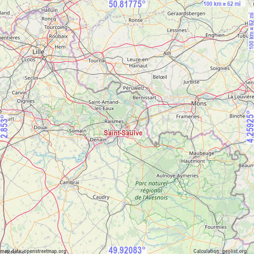
Saint-Saulve GPS coordinates[2]
50° 22' 17.076" North, 3° 33' 22.032" East
| Map corner | latitude | longitude |
|---|---|---|
| Upper-left | 50.81775°, | 2.853° |
| Center: | 50.37141°, | 3.55612° |
| Lower-right: | 49.92083°, | 4.25925° |
| Map W x H: | 99.7×99.7 km | = 62×62mi |
| max Lat: | 51.07786° ⇑3.8% North |
| Saint-Saulve: | 50.37141° |
| min Lat: | ⇓96.2% South 41.3874° |
| min Long | Saint-Saulve | max Long |
| -5.08615° | 3.55612° | 9.52242° |
| W 64.7%⇐ | ⇒35.3% E |
Elevation
Elevation of Saint-Saulve is 28 m = 92 ft, and this is 165.7 m = 544 ft below average elevation for this country.
| Max E: |
2333 m = 7654 ft | 90.7% |
| Avg. | 193.7 m = 635 ft | |
| Saint-Saulve | 28 m = 92 ft | |
Min E: |
-1 m = -3 ft | 9.3% |
See also: France elevation on elevation.city.
Geographical zone
Saint-Saulve is located in North temperate zone (between Tropic of Cancer and the Arctic Circle). Distance of this North polar circle is 1800.4 km =1118.7 mi to North.| Distance of | km | miles | from Saint-Saulve |
|---|---|---|---|
| North Pole | 4406.3 | 2737.9 | to North |
| Arctic Circle | 1800.4 | 1118.7 | to North |
| Tropic Cancer | 2994.9 | 1860.9 | to South |
| Equator | 5600.8 | 3480.2 | to South |


Nearby cities:
15 places around Saint-Saulve: (largest is in red/bold)
• Anzin
3.7 km =2.3 mi,  271°
271°
• Aulnoy-lez-Valenciennes
4.5 km =2.8 mi,  200°
200°
• Beuvrages
4.6 km =2.9 mi,  287°
287°
• Bruay-sur-l’Escaut
3.2 km =2 mi,  344°
344°
• Escautpont
5.3 km =3.3 mi,  357°
357°
• Estreux
3.5 km =2.2 mi,  129°
129°
• La Sentinelle
5.6 km =3.5 mi,  246°
246°
• Marly
2.9 km =1.8 mi,  189°
189°
• Onnaing
3.5 km =2.2 mi,  62°
62°
• Petite-Forêt
5.2 km =3.2 mi,  264°
264°
• Quarouble
5 km =3.1 mi,  70°
70°
• Raismes
5.3 km =3.3 mi,  284°
284°
• Saultain
4.1 km =2.5 mi,  158°
158°
• Valenciennes
2.6 km =1.6 mi,  238°
238°
• Vicq
5.2 km =3.2 mi,  40°
40°
Sources, notices
• [Note1] Compared only with cities in France existing in our database
• [Src1] Map data: © OpenStreetMap contributors (CC-BY-SA)
• [Src2] Other city data from geonames.org with taken over terms of usage.
• [Src3] Geographical zone / Annual Mean Temperature by Robert A. Rohde @ Wikipedia
