Onnaing geodata
Onnaing (Hauts-de-France) is a populated place; located in France in Europe/Paris (GMT+2) time zone. With population of 8,703 people, there are 1105 cities with bigger population in this country. Compared to other cities in France, 96.3% of cities are located further ↓South; 65% of cities are located further ←West and 90.3% of cities have higher elevation than Onnaing. Note1
Administrative division(s):
- Level 1: Hauts-de-France
- Level 2: Nord
- Level 3: Arrondissement de Valenciennes
- Level 4: Onnaing


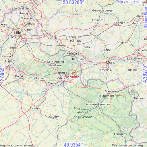
Onnaing GPS coordinates[2]
50° 23' 9.024" North, 3° 35' 58.668" East
| Map corner | latitude | longitude |
|---|---|---|
| Upper-left | 50.83205°, | 2.8965° |
| Center: | 50.38584°, | 3.59963° |
| Lower-right: | 49.9354°, | 4.30275° |
| Map W x H: | 99.7×99.7 km | = 62×62mi |
| max Lat: | 51.07786° ⇑3.7% North |
| Onnaing: | 50.38584° |
| min Lat: | ⇓96.3% South 41.3874° |
| min Long | Onnaing | max Long |
| -5.08615° | 3.59963° | 9.52242° |
| W 65%⇐ | ⇒35% E |
Elevation
Elevation of Onnaing is 29 m = 95 ft, and this is 164.7 m = 540 ft below average elevation for this country.
| Max E: |
2333 m = 7654 ft | 90.3% |
| Avg. | 193.7 m = 635 ft | |
| Onnaing | 29 m = 95 ft | |
Min E: |
-1 m = -3 ft | 9.7% |
See also: France elevation on elevation.city.
Geographical zone
Onnaing is located in North temperate zone (between Tropic of Cancer and the Arctic Circle). Distance of this North polar circle is 1798.8 km =1117.7 mi to North.| Distance of | km | miles | from Onnaing |
|---|---|---|---|
| North Pole | 4404.7 | 2737 | to North |
| Arctic Circle | 1798.8 | 1117.7 | to North |
| Tropic Cancer | 2996.5 | 1861.9 | to South |
| Equator | 5602.4 | 3481.2 | to South |


Nearby cities:
15 places around Onnaing: (largest is in red/bold)
• Bruay-sur-l’Escaut
4.2 km =2.6 mi,  290°
290°
• Crespin
5.9 km =3.7 mi,  48°
48°
• Curgies
6.2 km =3.9 mi,  177°
177°
• Escautpont
4.9 km =3 mi,  318°
318°
• Estreux
3.9 km =2.4 mi,  185°
185°
• Fresnes-sur-Escaut
5.6 km =3.5 mi,  343°
343°
• Marly
5.7 km =3.5 mi,  218°
218°
• Quarouble
1.7 km =1.1 mi,  88°
88°
• Quiévrechain
4.9 km =3 mi,  82°
82°
• Rombies-et-Marchipont
3.8 km =2.4 mi,  128°
128°
• Saint-Saulve
3.5 km =2.2 mi,  242°
242°
• Saultain
5.7 km =3.5 mi,  196°
196°
• Sebourg
5.7 km =3.5 mi,  147°
147°
• Valenciennes
6.1 km =3.8 mi, 240°
• Vicq
2.4 km =1.5 mi,  6°
6°
Sources, notices
• [Note1] Compared only with cities in France existing in our database
• [Src1] Map data: © OpenStreetMap contributors (CC-BY-SA)
• [Src2] Other city data from geonames.org with taken over terms of usage.
• [Src3] Geographical zone / Annual Mean Temperature by Robert A. Rohde @ Wikipedia
