Saint-Rémy-en-Rollat geodata
Saint-Rémy-en-Rollat (Auvergne-Rhône-Alpes) is a populated place; located in France in Europe/Paris (GMT+2) time zone. With population of 1,483 people, there are 6246 cities with bigger population in this country. Compared to other cities in France, 63.8% of cities are located further ↑North; 63.1% of cities are located further ←West and 76.5% of cities have lower elevation than Saint-Rémy-en-Rollat. Note1
Administrative division(s):
- Level 1: Auvergne-Rhône-Alpes
- Level 2: Département de l'Allier
- Level 3: Arrondissement de Vichy
- Level 4: Saint-Rémy-en-Rollat
Current local time in Saint-Rémy-en-Rollat:
08:59 AM, WednesdayDifference from your time zone: hours


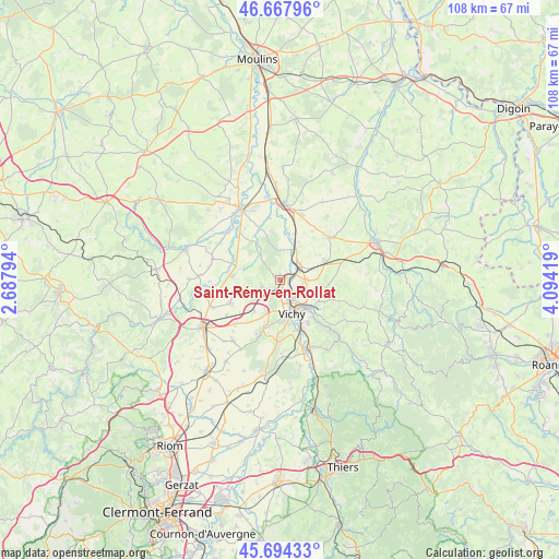
Saint-Rémy-en-Rollat GPS coordinates[2]
46° 10' 59.88" North, 3° 23' 27.816" East
| Map corner | latitude | longitude |
|---|---|---|
| Upper-left | 46.66796°, | 2.68794° |
| Center: | 46.1833°, | 3.39106° |
| Lower-right: | 45.69433°, | 4.09419° |
| Map W x H: | 108.3×108.3 km | = 67.3×67.3mi |
| max Lat: | 51.07786° ⇑63.8% North |
| Saint-Rémy-en-Rollat: | 46.1833° |
| min Lat: | ⇓36.2% South 41.3874° |
| min Long | Saint-Rémy-en- | max Long |
| -5.08615° | 3.39106° | 9.52242° |
| W 63.1%⇐ | ⇒36.9% E |
Elevation
Elevation of Saint-Rémy-en-Rollat is 260 m = 853 ft, and this is 66.3 m = 218 ft above average elevation for this country.
| Max E: |
2333 m = 7654 ft | 23.5% |
| Saint-Rémy-en-Rollat | 260 m 853 ft | |
| Avg. | 193.7 m = 635 ft | |
Min E: |
-1 m = -3 ft | 76.5% |
See also: France elevation on elevation.city.
Geographical zone
Saint-Rémy-en-Rollat is located in North temperate zone (between Tropic of Cancer and the Arctic Circle). Distance of this North polar circle is 2266.1 km =1408.1 mi to North.| Distance of | km | miles | from Saint-Rémy-en-Rollat |
|---|---|---|---|
| North Pole | 4872 | 3027.3 | to North |
| Arctic Circle | 2266.1 | 1408.1 | to North |
| Tropic Cancer | 2529.2 | 1571.6 | to South |
| Equator | 5135.1 | 3190.8 | to South |


Nearby cities:
15 places around Saint-Rémy-en-Rollat: (largest is in red/bold)
• Abrest
10.3 km =6.4 mi,  156°
156°
• Bellerive-sur-Allier
7.5 km =4.7 mi,  172°
172°
• Billy
6.6 km =4.1 mi,  26°
26°
• Broût-Vernet
9.1 km =5.7 mi,  272°
272°
• Charmeil
2.4 km =1.5 mi,  176°
176°
• Cognat-Lyonne
10.4 km =6.5 mi,  216°
216°
• Creuzier-le-Neuf
4.5 km =2.8 mi,  91°
91°
• Creuzier-le-Vieux
4 km =2.5 mi,  125°
125°
• Cusset
7.4 km =4.6 mi,  137°
137°
• Espinasse-Vozelle
8.2 km =5.1 mi, 219°
• Magnet
9.3 km =5.8 mi,  69°
69°
• Saint-Germain-des-Fossés
4.2 km =2.6 mi,  51°
51°
• Serbannes
9.7 km =6 mi,  194°
194°
• Vendat
3.6 km =2.2 mi,  233°
233°
• Vichy
6.8 km =4.2 mi, 156°
Sources, notices
• [Note1] Compared only with cities in France existing in our database
• [Src1] Map data: © OpenStreetMap contributors (CC-BY-SA)
• [Src2] Other city data from geonames.org with taken over terms of usage.
• [Src3] Geographical zone / Annual Mean Temperature by Robert A. Rohde @ Wikipedia
