Broût-Vernet geodata
Broût-Vernet (Auvergne-Rhône-Alpes) is a populated place; located in France in Europe/Paris (GMT+2) time zone. With population of 1,124 people, there are 7981 cities with bigger population in this country. Compared to other cities in France, 63.8% of cities are located further ↑North; 61.7% of cities are located further ←West and 81.6% of cities have lower elevation than Broût-Vernet. Note1
Administrative division(s):
- Level 1: Auvergne-Rhône-Alpes
- Level 2: Département de l'Allier
- Level 3: Arrondissement de Vichy
- Level 4: Broût-Vernet


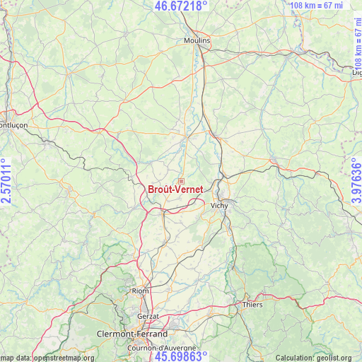
Broût-Vernet GPS coordinates[2]
46° 11' 15.216" North, 3° 16' 23.664" East
| Map corner | latitude | longitude |
|---|---|---|
| Upper-left | 46.67218°, | 2.57011° |
| Center: | 46.18756°, | 3.27324° |
| Lower-right: | 45.69863°, | 3.97636° |
| Map W x H: | 108.2×108.2 km | = 67.2×67.2mi |
| max Lat: | 51.07786° ⇑63.8% North |
| Broût-Vernet: | 46.18756° |
| min Lat: | ⇓36.2% South 41.3874° |
| min Long | Broût-Vernet | max Long |
| -5.08615° | 3.27324° | 9.52242° |
| W 61.7%⇐ | ⇒38.3% E |
Elevation
Elevation of Broût-Vernet is 306 m = 1004 ft, and this is 112.3 m = 368 ft above average elevation for this country.
| Max E: |
2333 m = 7654 ft | 18.4% |
| Broût-Vernet | 306 m 1004 ft | |
| Avg. | 193.7 m = 635 ft | |
Min E: |
-1 m = -3 ft | 81.6% |
See also: France elevation on elevation.city.
Geographical zone
Broût-Vernet is located in North temperate zone (between Tropic of Cancer and the Arctic Circle). Distance of this North polar circle is 2265.6 km =1407.8 mi to North.| Distance of | km | miles | from Broût-Vernet |
|---|---|---|---|
| North Pole | 4871.5 | 3027 | to North |
| Arctic Circle | 2265.6 | 1407.8 | to North |
| Tropic Cancer | 2529.7 | 1571.9 | to South |
| Equator | 5135.6 | 3191.1 | to South |


Nearby cities:
15 places around Broût-Vernet: (largest is in red/bold)
• Bayet
6.8 km =4.2 mi,  357°
357°
• Biozat
12.3 km =7.6 mi,  180°
180°
• Chantelle
10.8 km =6.7 mi,  301°
301°
• Charmeil
9.7 km =6 mi,  107°
107°
• Cognat-Lyonne
9.3 km =5.8 mi,  162°
162°
• Creuzier-le-Vieux
12.6 km =7.8 mi,  102°
102°
• Escurolles
5 km =3.1 mi,  186°
186°
• Espinasse-Vozelle
7.9 km =4.9 mi,  150°
150°
• Gannat
11.3 km =7 mi,  210°
210°
• Saint-Bonnet-de-Rochefort
11.4 km =7.1 mi,  246°
246°
• Saint-Germain-des-Fossés
12.5 km =7.8 mi,  80°
80°
• Saint-Rémy-en-Rollat
9.1 km =5.7 mi,  92°
92°
• Serbannes
11.9 km =7.4 mi, 146°
• Vendat
6.7 km =4.2 mi, 113°
• Étroussat
5.3 km =3.3 mi,  310°
310°
Sources, notices
• [Note1] Compared only with cities in France existing in our database
• [Src1] Map data: © OpenStreetMap contributors (CC-BY-SA)
• [Src2] Other city data from geonames.org with taken over terms of usage.
• [Src3] Geographical zone / Annual Mean Temperature by Robert A. Rohde @ Wikipedia
