Creuzier-le-Vieux geodata
Creuzier-le-Vieux (Auvergne-Rhône-Alpes) is a populated place; located in France in Europe/Paris (GMT+2) time zone. With population of 3,099 people, there are 3149 cities with bigger population in this country. Compared to other cities in France, 64.1% of cities are located further ↑North; 63.6% of cities are located further ←West and 84.3% of cities have lower elevation than Creuzier-le-Vieux. Note1
Administrative division(s):
- Level 1: Auvergne-Rhône-Alpes
- Level 2: Département de l'Allier
- Level 3: Arrondissement de Vichy
- Level 4: Creuzier-le-Vieux


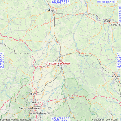
Creuzier-le-Vieux GPS coordinates[2]
46° 9' 45.108" North, 3° 25' 59.196" East
| Map corner | latitude | longitude |
|---|---|---|
| Upper-left | 46.64737°, | 2.72999° |
| Center: | 46.16253°, | 3.43311° |
| Lower-right: | 45.67338°, | 4.13624° |
| Map W x H: | 108.3×108.3 km | = 67.3×67.3mi |
| max Lat: | 51.07786° ⇑64.1% North |
| Creuzier-le-Vieux: | 46.16253° |
| min Lat: | ⇓35.9% South 41.3874° |
| min Long | Creuzier-le-Vie | max Long |
| -5.08615° | 3.43311° | 9.52242° |
| W 63.6%⇐ | ⇒36.4% E |
Elevation
Elevation of Creuzier-le-Vieux is 339 m = 1112 ft, and this is 145.3 m = 477 ft above average elevation for this country.
| Max E: |
2333 m = 7654 ft | 15.7% |
| Creuzier-le-Vieux | 339 m 1112 ft | |
| Avg. | 193.7 m = 635 ft | |
Min E: |
-1 m = -3 ft | 84.3% |
See also: France elevation on elevation.city.
Geographical zone
Creuzier-le-Vieux is located in North temperate zone (between Tropic of Cancer and the Arctic Circle). Distance of this North polar circle is 2268.4 km =1409.5 mi to North.| Distance of | km | miles | from Creuzier-le-Vieux |
|---|---|---|---|
| North Pole | 4874.3 | 3028.7 | to North |
| Arctic Circle | 2268.4 | 1409.5 | to North |
| Tropic Cancer | 2526.9 | 1570.1 | to South |
| Equator | 5132.8 | 3189.4 | to South |


Nearby cities:
15 places around Creuzier-le-Vieux: (largest is in red/bold)
• Abrest
7.2 km =4.5 mi,  172°
172°
• Bellerive-sur-Allier
5.6 km =3.5 mi,  203°
203°
• Billy
8.2 km =5.1 mi,  357°
357°
• Brugheas
10.8 km =6.7 mi,  207°
207°
• Charmeil
3.1 km =1.9 mi,  267°
267°
• Creuzier-le-Neuf
2.6 km =1.6 mi,  30°
30°
• Cusset
3.6 km =2.2 mi,  150°
150°
• Espinasse-Vozelle
9.3 km =5.8 mi,  244°
244°
• Hauterive
8.3 km =5.2 mi, 172°
• Magnet
7.8 km =4.8 mi,  44°
44°
• Saint-Germain-des-Fossés
4.9 km =3 mi,  0°
0°
• Saint-Rémy-en-Rollat
4 km =2.5 mi,  305°
305°
• Serbannes
9.1 km =5.7 mi,  218°
218°
• Vendat
6.1 km =3.8 mi, 271°
• Vichy
4 km =2.5 mi,  188°
188°
Sources, notices
• [Note1] Compared only with cities in France existing in our database
• [Src1] Map data: © OpenStreetMap contributors (CC-BY-SA)
• [Src2] Other city data from geonames.org with taken over terms of usage.
• [Src3] Geographical zone / Annual Mean Temperature by Robert A. Rohde @ Wikipedia
