Saint-Perreux geodata
Saint-Perreux (Brittany) is a populated place; located in France in Europe/Paris (GMT+2) time zone. With population of 1,136 people, there are 7911 cities with bigger population in this country. Compared to other cities in France, 53.7% of cities are located further ↓South; 95.2% of cities are located further →East and 95% of cities have higher elevation than Saint-Perreux. Note1
Administrative division(s):
- Level 1: Brittany
- Level 2: Morbihan
- Level 3: Arrondissement de Vannes
- Level 4: Saint-Perreux


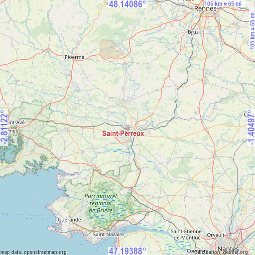
Saint-Perreux GPS coordinates[2]
47° 40' 10.272" North, 2° 6' 29.124" West
| Map corner | latitude | longitude |
|---|---|---|
| Upper-left | 48.14086°, | -2.81122° |
| Center: | 47.66952°, | -2.10809° |
| Lower-right: | 47.19388°, | -1.40497° |
| Map W x H: | 105.3×105.3 km | = 65.4×65.4mi |
| max Lat: | 51.07786° ⇑46.3% North |
| Saint-Perreux: | 47.66952° |
| min Lat: | ⇓53.7% South 41.3874° |
| min Long | Saint-Perreux | max Long |
| -5.08615° | -2.10809° | 9.52242° |
| W 4.8%⇐ | ⇒95.2% E |
Elevation
Elevation of Saint-Perreux is 17 m = 56 ft, and this is 176.7 m = 580 ft below average elevation for this country.
| Max E: |
2333 m = 7654 ft | 95% |
| Avg. | 193.7 m = 635 ft | |
| Saint-Perreux | 17 m = 56 ft | |
Min E: |
-1 m = -3 ft | 5% |
See also: France elevation on elevation.city.
Geographical zone
Saint-Perreux is located in North temperate zone (between Tropic of Cancer and the Arctic Circle). Distance of this North polar circle is 2100.8 km =1305.4 mi to North.| Distance of | km | miles | from Saint-Perreux |
|---|---|---|---|
| North Pole | 4706.7 | 2924.6 | to North |
| Arctic Circle | 2100.8 | 1305.4 | to North |
| Tropic Cancer | 2694.4 | 1674.2 | to South |
| Equator | 5300.4 | 3293.5 | to South |


Nearby cities:
15 places around Saint-Perreux: (largest is in red/bold)
• Allaire
5.5 km =3.4 mi,  229°
229°
• Avessac
9.1 km =5.7 mi,  101°
101°
• Bains-sur-Oust
4.7 km =2.9 mi,  36°
36°
• Cournon
8.5 km =5.3 mi,  0°
0°
• Fégréac
10.6 km =6.6 mi,  153°
153°
• Glénac
6.7 km =4.2 mi,  343°
343°
• La Gacilly
10.8 km =6.7 mi,  350°
350°
• Peillac
9.7 km =6 mi,  300°
300°
• Redon
2.7 km =1.7 mi,  139°
139°
• Rieux
8 km =5 mi,  180°
180°
• Saint-Jacut-les-Pins
8.2 km =5.1 mi,  282°
282°
• Saint-Jean-la-Poterie
3.9 km =2.4 mi,  197°
197°
• Saint-Nicolas-de-Redon
4.4 km =2.7 mi,  130°
130°
• Saint-Vincent-sur-Oust
4.5 km =2.8 mi,  319°
319°
• Sainte-Marie
8.4 km =5.2 mi,  70°
70°
Sources, notices
• [Note1] Compared only with cities in France existing in our database
• [Src1] Map data: © OpenStreetMap contributors (CC-BY-SA)
• [Src2] Other city data from geonames.org with taken over terms of usage.
• [Src3] Geographical zone / Annual Mean Temperature by Robert A. Rohde @ Wikipedia
