Saint-Jacut-les-Pins geodata
Saint-Jacut-les-Pins (Brittany) is a populated place; located in France in Europe/Paris (GMT+2) time zone. With population of 1,677 people, there are 5587 cities with bigger population in this country. Compared to other cities in France, 54% of cities are located further ↓South; 95.6% of cities are located further →East and 78.6% of cities have higher elevation than Saint-Jacut-les-Pins. Note1
Administrative division(s):
- Level 1: Brittany
- Level 2: Morbihan
- Level 3: Arrondissement de Vannes
- Level 4: Saint-Jacut-les-Pins
Current local time in Saint-Jacut-les-Pins:
06:01 AM, WednesdayDifference from your time zone: hours


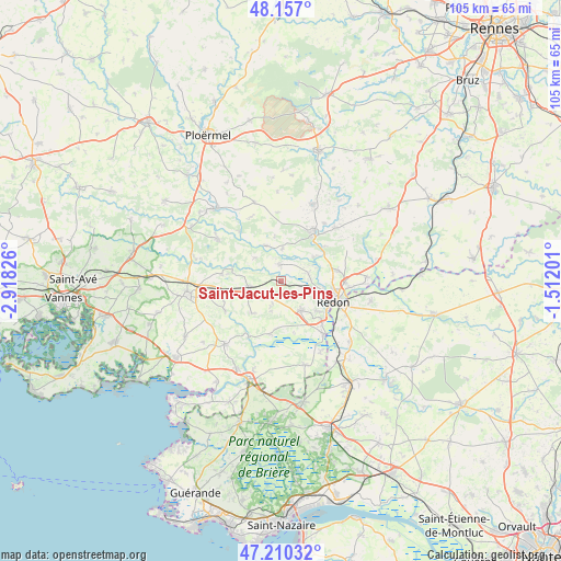
Saint-Jacut-les-Pins GPS coordinates[2]
47° 41' 8.916" North, 2° 12' 54.504" West
| Map corner | latitude | longitude |
|---|---|---|
| Upper-left | 48.157°, | -2.91826° |
| Center: | 47.68581°, | -2.21514° |
| Lower-right: | 47.21032°, | -1.51201° |
| Map W x H: | 105.3×105.3 km | = 65.4×65.4mi |
| max Lat: | 51.07786° ⇑46% North |
| Saint-Jacut-les-Pins: | 47.68581° |
| min Lat: | ⇓54% South 41.3874° |
| min Long | Saint-Jacut-les | max Long |
| -5.08615° | -2.21514° | 9.52242° |
| W 4.4%⇐ | ⇒95.6% E |
Elevation
Elevation of Saint-Jacut-les-Pins is 58 m = 190 ft, and this is 135.7 m = 445 ft below average elevation for this country.
| Max E: |
2333 m = 7654 ft | 78.6% |
| Avg. | 193.7 m = 635 ft | |
| Saint-Jacut-les-Pins | 58 m = 190 ft | |
Min E: |
-1 m = -3 ft | 21.4% |
See also: France elevation on elevation.city.
Geographical zone
Saint-Jacut-les-Pins is located in North temperate zone (between Tropic of Cancer and the Arctic Circle). Distance of this North polar circle is 2099 km =1304.3 mi to North.| Distance of | km | miles | from Saint-Jacut-les-Pins |
|---|---|---|---|
| North Pole | 4704.9 | 2923.5 | to North |
| Arctic Circle | 2099 | 1304.3 | to North |
| Tropic Cancer | 2696.2 | 1675.3 | to South |
| Equator | 5302.2 | 3294.6 | to South |


Nearby cities:
15 places around Saint-Jacut-les-Pins: (largest is in red/bold)
• Allaire
6.6 km =4.1 mi,  144°
144°
• Béganne
10.1 km =6.3 mi,  191°
191°
• Caden
8.1 km =5 mi,  221°
221°
• Cournon
10.4 km =6.5 mi,  50°
50°
• Glénac
7.6 km =4.7 mi, 53°
• Les Fougerêts
6.1 km =3.8 mi,  1°
1°
• Malansac
6.1 km =3.8 mi,  260°
260°
• Peillac
3.1 km =1.9 mi,  353°
353°
• Redon
10.5 km =6.5 mi,  111°
111°
• Rochefort-en-Terre
9 km =5.6 mi,  280°
280°
• Saint-Gravé
6.6 km =4.1 mi,  312°
312°
• Saint-Jean-la-Poterie
8.8 km =5.5 mi,  129°
129°
• Saint-Martin-sur-Oust
7.3 km =4.5 mi,  336°
336°
• Saint-Perreux
8.2 km =5.1 mi,  102°
102°
• Saint-Vincent-sur-Oust
5.4 km =3.4 mi,  72°
72°
Sources, notices
• [Note1] Compared only with cities in France existing in our database
• [Src1] Map data: © OpenStreetMap contributors (CC-BY-SA)
• [Src2] Other city data from geonames.org with taken over terms of usage.
• [Src3] Geographical zone / Annual Mean Temperature by Robert A. Rohde @ Wikipedia
