Saint-Paul geodata
Saint-Paul (Auvergne-Rhône-Alpes) is a populated place; located in France in Europe/Paris (GMT+2) time zone. With population of 1,353 people, there are 6797 cities with bigger population in this country. Compared to other cities in France, 75.3% of cities are located further ↑North; 69.9% of cities are located further ←West and 92.6% of cities have lower elevation than Saint-Paul. Note1
Administrative division(s):
- Level 1: Auvergne-Rhône-Alpes
- Level 2: Département de la Loire
- Level 3: Arrondissement de Saint-Étienne
- Level 4: Saint-Paul-en-Cornillon


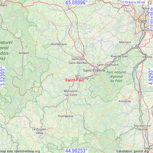
Saint-Paul GPS coordinates[2]
45° 23' 54.24" North, 4° 13' 34.212" East
| Map corner | latitude | longitude |
|---|---|---|
| Upper-left | 45.88996°, | 3.52305° |
| Center: | 45.3984°, | 4.22617° |
| Lower-right: | 44.90253°, | 4.9293° |
| Map W x H: | 109.8×109.8 km | = 68.2×68.2mi |
| max Lat: | 51.07786° ⇑75.3% North |
| Saint-Paul: | 45.3984° |
| min Lat: | ⇓24.7% South 41.3874° |
| min Long | Saint-Paul | max Long |
| -5.08615° | 4.22617° | 9.52242° |
| W 69.9%⇐ | ⇒30.1% E |
Elevation
Elevation of Saint-Paul is 494 m = 1621 ft, and this is 300.3 m = 985 ft above average elevation for this country.
| Max E: |
2333 m = 7654 ft | 7.4% |
| Saint-Paul | 494 m 1621 ft | |
| Avg. | 193.7 m = 635 ft | |
Min E: |
-1 m = -3 ft | 92.6% |
See also: France elevation on elevation.city.
Geographical zone
Saint-Paul is located in North temperate zone (between Tropic of Cancer and the Arctic Circle). Distance of this North polar circle is 2353.3 km =1462.3 mi to North.| Distance of | km | miles | from Saint-Paul |
|---|---|---|---|
| North Pole | 4959.2 | 3081.5 | to North |
| Arctic Circle | 2353.3 | 1462.3 | to North |
| Tropic Cancer | 2441.9 | 1517.3 | to South |
| Equator | 5047.8 | 3136.6 | to South |


Nearby cities:
15 places around Saint-Paul: (largest is in red/bold)
• Aurec-sur-Loire
3.8 km =2.4 mi,  210°
210°
• Chambles
5.3 km =3.3 mi,  6°
6°
• Firminy
5 km =3.1 mi,  101°
101°
• Fraisses
3.1 km =1.9 mi,  110°
110°
• La Ricamarie
11.2 km =7 mi,  86°
86°
• Le Chambon-Feugerolles
7.5 km =4.7 mi, 95°
• Pont-Salomon
7 km =4.3 mi,  165°
165°
• Périgneux
7.2 km =4.5 mi,  310°
310°
• Roche-la-Molière
8.7 km =5.4 mi,  65°
65°
• Saint-Didier-en-Velay
11.3 km =7 mi,  160°
160°
• Saint-Genest-Lerpt
10.2 km =6.3 mi,  60°
60°
• Saint-Just-Malmont
9.4 km =5.8 mi,  134°
134°
• Saint-Just-Saint-Rambert
11.3 km =7 mi, 6°
• Saint-Maurice-en-Gourgois
3.4 km =2.1 mi,  275°
275°
• Unieux
3.5 km =2.2 mi,  79°
79°
Sources, notices
• [Note1] Compared only with cities in France existing in our database
• [Src1] Map data: © OpenStreetMap contributors (CC-BY-SA)
• [Src2] Other city data from geonames.org with taken over terms of usage.
• [Src3] Geographical zone / Annual Mean Temperature by Robert A. Rohde @ Wikipedia
