Saint-Patrice geodata
Saint-Patrice (Centre) is a populated place; located in France in Europe/Paris (GMT+2) time zone. With population of 666 people, there are 12279 cities with bigger population in this country. Compared to other cities in France, 51.7% of cities are located further ↑North; 75.4% of cities are located further →East and 86.2% of cities have higher elevation than Saint-Patrice. Note1
Administrative division(s):
- Level 1: Centre
- Level 2: Département d'Indre-et-Loire
- Level 3: Arrondissement de Chinon
- Level 4: Coteaux-sur-Loire


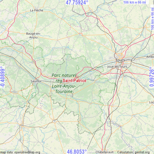
Saint-Patrice GPS coordinates[2]
47° 17' 3.912" North, 0° 17' 38.904" East
| Map corner | latitude | longitude |
|---|---|---|
| Upper-left | 47.75924°, | -0.40899° |
| Center: | 47.28442°, | 0.29414° |
| Lower-right: | 46.8053°, | 0.99726° |
| Map W x H: | 106.1×106.1 km | = 65.9×65.9mi |
| max Lat: | 51.07786° ⇑51.7% North |
| Saint-Patrice: | 47.28442° |
| min Lat: | ⇓48.3% South 41.3874° |
| min Long | Saint-Patrice | max Long |
| -5.08615° | 0.29414° | 9.52242° |
| W 24.6%⇐ | ⇒75.4% E |
Elevation
Elevation of Saint-Patrice is 39 m = 128 ft, and this is 154.7 m = 508 ft below average elevation for this country.
| Max E: |
2333 m = 7654 ft | 86.2% |
| Avg. | 193.7 m = 635 ft | |
| Saint-Patrice | 39 m = 128 ft | |
Min E: |
-1 m = -3 ft | 13.8% |
See also: France elevation on elevation.city.
Geographical zone
Saint-Patrice is located in North temperate zone (between Tropic of Cancer and the Arctic Circle). Distance of this North polar circle is 2143.6 km =1332 mi to North.| Distance of | km | miles | from Saint-Patrice |
|---|---|---|---|
| North Pole | 4749.5 | 2951.2 | to North |
| Arctic Circle | 2143.6 | 1332 | to North |
| Tropic Cancer | 2651.6 | 1647.6 | to South |
| Equator | 5257.5 | 3266.9 | to South |


Nearby cities:
15 places around Saint-Patrice: (largest is in red/bold)
• Benais
5.9 km =3.7 mi,  282°
282°
• Bourgueil
9.7 km =6 mi,  269°
269°
• Bréhémont
5 km =3.1 mi,  76°
76°
• Cheillé
8.8 km =5.5 mi,  107°
107°
• Huismes
6.6 km =4.1 mi,  209°
209°
• Ingrandes-de-Touraine
2.1 km =1.3 mi, 266°
• La Chapelle-aux-Naux
10.7 km =6.6 mi,  69°
69°
• La Chapelle-sur-Loire
6.8 km =4.2 mi,  236°
236°
• Langeais
9.3 km =5.8 mi,  60°
60°
• Lignières-de-Touraine
9.4 km =5.8 mi, 81°
• Restigné
5 km =3.1 mi, 267°
• Rigny-Ussé
3.6 km =2.2 mi,  173°
173°
• Rivarennes
4.9 km =3 mi, 113°
• Saint-Benoît-la-Forêt
7.2 km =4.5 mi,  162°
162°
• Saint-Michel-sur-Loire
4.9 km =3 mi, 57°
Sources, notices
• [Note1] Compared only with cities in France existing in our database
• [Src1] Map data: © OpenStreetMap contributors (CC-BY-SA)
• [Src2] Other city data from geonames.org with taken over terms of usage.
• [Src3] Geographical zone / Annual Mean Temperature by Robert A. Rohde @ Wikipedia
