Saint-Pantaléon-de-Larche geodata
Saint-Pantaléon-de-Larche (Nouvelle-Aquitaine) is a populated place; located in France in Europe/Paris (GMT+2) time zone. With population of 3,863 people, there are 2544 cities with bigger population in this country. Compared to other cities in France, 78% of cities are located further ↑North; 63.7% of cities are located further →East and 61.2% of cities have higher elevation than Saint-Pantaléon-de-Larche. Note1
Administrative division(s):
- Level 1: Nouvelle-Aquitaine
- Level 2: Département de la Corrèze
- Level 3: Arrondissement de Brive-la-Gaillarde
- Level 4: Saint-Pantaléon-de-Larche
Current local time in Saint-Pantaléon-de-Larche:
07:25 AM, SaturdayDifference from your time zone: hours


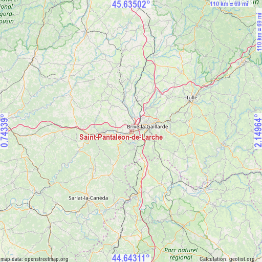
Saint-Pantaléon-de-Larche GPS coordinates[2]
45° 8' 28.392" North, 1° 26' 47.472" East
| Map corner | latitude | longitude |
|---|---|---|
| Upper-left | 45.63502°, | 0.74339° |
| Center: | 45.14122°, | 1.44652° |
| Lower-right: | 44.64311°, | 2.14964° |
| Map W x H: | 110.3×110.3 km | = 68.5×68.5mi |
| max Lat: | 51.07786° ⇑78% North |
| Saint-Pantaléon-de-Larche: | 45.14122° |
| min Lat: | ⇓22% South 41.3874° |
| min Long | Saint-Pantaléo | max Long |
| -5.08615° | 1.44652° | 9.52242° |
| W 36.3%⇐ | ⇒63.7% E |
Elevation
Elevation of Saint-Pantaléon-de-Larche is 99 m = 325 ft, and this is 94.7 m = 311 ft below average elevation for this country.
| Max E: |
2333 m = 7654 ft | 61.2% |
| Avg. | 193.7 m = 635 ft | |
| Saint-Pantaléon-de-Larche | 99 m = 325 ft | |
Min E: |
-1 m = -3 ft | 38.8% |
See also: France elevation on elevation.city.
Geographical zone
Saint-Pantaléon-de-Larche is located in North temperate zone (between Tropic of Cancer and the Arctic Circle). Distance of this North polar circle is 2381.9 km =1480 mi to North.| Distance of | km | miles | from Saint-Pantaléon-de-Larche |
|---|---|---|---|
| North Pole | 4987.8 | 3099.3 | to North |
| Arctic Circle | 2381.9 | 1480 | to North |
| Tropic Cancer | 2413.3 | 1499.6 | to South |
| Equator | 5019.2 | 3118.8 | to South |


Nearby cities:
15 places around Saint-Pantaléon-de-Larche: (largest is in red/bold)
• Brignac-la-Plaine
10 km =6.2 mi,  302°
302°
• Brive-la-Gaillarde
7.1 km =4.4 mi,  73°
73°
• Chasteaux
5.6 km =3.5 mi,  162°
162°
• Cosnac
10.9 km =6.8 mi,  94°
94°
• Cublac
11 km =6.8 mi,  272°
272°
• Larche
3.3 km =2.1 mi,  226°
226°
• Lissac-sur-Couze
4.3 km =2.7 mi, 164°
• Malemort-sur-Corrèze
9.8 km =6.1 mi, 70°
• Mansac
5.8 km =3.6 mi, 301°
• Noailles
7.3 km =4.5 mi,  125°
125°
• Pazayac
5.7 km =3.5 mi,  247°
247°
• Saint-Viance
8.5 km =5.3 mi,  3°
3°
• Ussac
7.9 km =4.9 mi,  41°
41°
• Varetz
5.9 km =3.7 mi, 3°
• Yssandon
9.3 km =5.8 mi,  323°
323°
Sources, notices
• [Note1] Compared only with cities in France existing in our database
• [Src1] Map data: © OpenStreetMap contributors (CC-BY-SA)
• [Src2] Other city data from geonames.org with taken over terms of usage.
• [Src3] Geographical zone / Annual Mean Temperature by Robert A. Rohde @ Wikipedia
