Noailles geodata
Noailles (Nouvelle-Aquitaine) is a populated place; located in France in Europe/Paris (GMT+2) time zone. With population of 743 people, there are 11253 cities with bigger population in this country. Compared to other cities in France, 78.5% of cities are located further ↑North; 62.8% of cities are located further →East and 76.5% of cities have lower elevation than Noailles. Note1
Administrative division(s):
- Level 1: Nouvelle-Aquitaine
- Level 2: Département de la Corrèze
- Level 3: Arrondissement de Brive-la-Gaillarde
- Level 4: Noailles


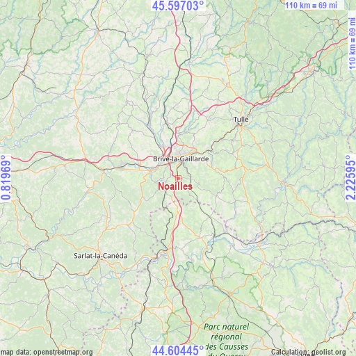
Noailles GPS coordinates[2]
45° 6' 10.44" North, 1° 31' 22.152" East
| Map corner | latitude | longitude |
|---|---|---|
| Upper-left | 45.59703°, | 0.81969° |
| Center: | 45.1029°, | 1.52282° |
| Lower-right: | 44.60445°, | 2.22595° |
| Map W x H: | 110.4×110.4 km | = 68.6×68.6mi |
| max Lat: | 51.07786° ⇑78.5% North |
| Noailles: | 45.1029° |
| min Lat: | ⇓21.5% South 41.3874° |
| min Long | Noailles | max Long |
| -5.08615° | 1.52282° | 9.52242° |
| W 37.2%⇐ | ⇒62.8% E |
Elevation
Elevation of Noailles is 260 m = 853 ft, and this is 66.3 m = 218 ft above average elevation for this country.
| Max E: |
2333 m = 7654 ft | 23.5% |
| Noailles | 260 m 853 ft | |
| Avg. | 193.7 m = 635 ft | |
Min E: |
-1 m = -3 ft | 76.5% |
See also: France elevation on elevation.city.
Geographical zone
Noailles is located in North temperate zone (between Tropic of Cancer and the Arctic Circle). Distance of this North polar circle is 2386.2 km =1482.7 mi to North.| Distance of | km | miles | from Noailles |
|---|---|---|---|
| North Pole | 4992.1 | 3101.9 | to North |
| Arctic Circle | 2386.2 | 1482.7 | to North |
| Tropic Cancer | 2409.1 | 1496.9 | to South |
| Equator | 5015 | 3116.2 | to South |


Nearby cities:
15 places around Noailles: (largest is in red/bold)
• Brive-la-Gaillarde
6.3 km =3.9 mi,  7°
7°
• Chasteaux
4.5 km =2.8 mi,  255°
255°
• Cosnac
6 km =3.7 mi,  54°
54°
• Cressensac
8.9 km =5.5 mi,  181°
181°
• Dampniat
11.2 km =7 mi, 49°
• Jugeals-Nazareth
3.7 km =2.3 mi,  129°
129°
• Larche
8.6 km =5.3 mi,  283°
283°
• Lissac-sur-Couze
4.8 km =3 mi,  271°
271°
• Malemort-sur-Corrèze
8.2 km =5.1 mi,  23°
23°
• Nespouls
6.1 km =3.8 mi,  195°
195°
• Pazayac
11.4 km =7.1 mi, 280°
• Saint-Pantaléon-de-Larche
7.3 km =4.5 mi,  305°
305°
• Sarrazac
10.9 km =6.8 mi,  151°
151°
• Turenne
7.2 km =4.5 mi,  139°
139°
• Ussac
10.1 km =6.3 mi,  355°
355°
Sources, notices
• [Note1] Compared only with cities in France existing in our database
• [Src1] Map data: © OpenStreetMap contributors (CC-BY-SA)
• [Src2] Other city data from geonames.org with taken over terms of usage.
• [Src3] Geographical zone / Annual Mean Temperature by Robert A. Rohde @ Wikipedia
