Saint-Nizier-du-Moucherotte geodata
Saint-Nizier-du-Moucherotte (Auvergne-Rhône-Alpes) is a populated place; located in France in Europe/Paris (GMT+2) time zone. With population of 871 people, there are 9891 cities with bigger population in this country. Compared to other cities in France, 77.8% of cities are located further ↑North; 83.9% of cities are located further ←West and 99.6% of cities have lower elevation than Saint-Nizier-du-Moucherotte. Note1
Administrative division(s):
- Level 1: Auvergne-Rhône-Alpes
- Level 2: Département de l'Isère
- Level 3: Arrondissement de Grenoble
- Level 4: Saint-Nizier-du-Moucherotte
Current local time in Saint-Nizier-du-Moucherotte:
05:55 AM, WednesdayDifference from your time zone: hours


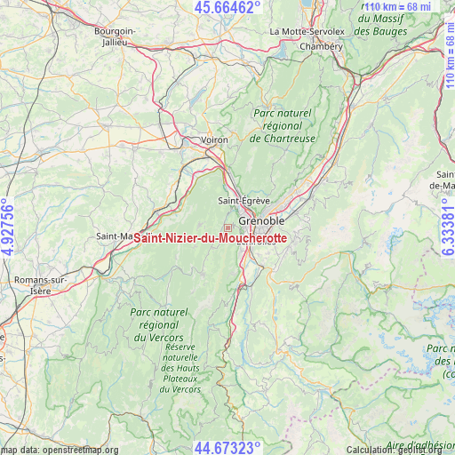
Saint-Nizier-du-Moucherotte GPS coordinates[2]
45° 10' 15.888" North, 5° 37' 50.448" East
| Map corner | latitude | longitude |
|---|---|---|
| Upper-left | 45.66462°, | 4.92756° |
| Center: | 45.17108°, | 5.63068° |
| Lower-right: | 44.67323°, | 6.33381° |
| Map W x H: | 110.2×110.2 km | = 68.5×68.5mi |
| max Lat: | 51.07786° ⇑77.8% North |
| Saint-Nizier-du-Moucherotte: | 45.17108° |
| min Lat: | ⇓22.2% South 41.3874° |
| min Long | Saint-Nizier-du | max Long |
| -5.08615° | 5.63068° | 9.52242° |
| W 83.9%⇐ | ⇒16.1% E |
Elevation
Elevation of Saint-Nizier-du-Moucherotte is 1163 m = 3816 ft, and this is 969.3 m = 3180 ft above average elevation for this country.
| Max E: |
2333 m = 7654 ft | 0.40000000000001% |
| Saint-Nizier-du-Moucherotte | 1163 m 3816 ft | |
| Avg. | 193.7 m = 635 ft | |
Min E: |
-1 m = -3 ft | 99.6% |
See also: France elevation on elevation.city.
Geographical zone
Saint-Nizier-du-Moucherotte is located in North temperate zone (between Tropic of Cancer and the Arctic Circle). Distance of this North polar circle is 2378.6 km =1478 mi to North.| Distance of | km | miles | from Saint-Nizier-du-Moucherotte |
|---|---|---|---|
| North Pole | 4984.5 | 3097.2 | to North |
| Arctic Circle | 2378.6 | 1478 | to North |
| Tropic Cancer | 2416.6 | 1501.6 | to South |
| Equator | 5022.6 | 3120.9 | to South |


Nearby cities:
15 places around Saint-Nizier-du-Moucherotte: (largest is in red/bold)
• Allières-et-Risset
8.8 km =5.5 mi,  154°
154°
• Autrans
6.9 km =4.3 mi,  274°
274°
• Claix
6.6 km =4.1 mi, 149°
• Fontaine
5.1 km =3.2 mi,  61°
61°
• Grenoble
6.6 km =4.1 mi,  82°
82°
• Lans-en-Vercors
5.9 km =3.7 mi,  216°
216°
• Le Pont-de-Claix
7.5 km =4.7 mi,  135°
135°
• Méaudre
9.2 km =5.7 mi,  240°
240°
• Noyarey
8.1 km =5 mi,  1°
1°
• Saint-Martin-le-Vinoux
7.6 km =4.7 mi, 62°
• Saint-Égrève
8 km =5 mi,  30°
30°
• Sassenage
5.3 km =3.3 mi, 28°
• Seyssinet-Pariset
5 km =3.1 mi, 82°
• Seyssins
4.5 km =2.8 mi,  102°
102°
• Échirolles
7.1 km =4.4 mi,  112°
112°
Sources, notices
• [Note1] Compared only with cities in France existing in our database
• [Src1] Map data: © OpenStreetMap contributors (CC-BY-SA)
• [Src2] Other city data from geonames.org with taken over terms of usage.
• [Src3] Geographical zone / Annual Mean Temperature by Robert A. Rohde @ Wikipedia
