Saint-Nazaire-sur-Charente geodata
Saint-Nazaire-sur-Charente (Nouvelle-Aquitaine) is a populated place; located in France in Europe/Paris (GMT+2) time zone. With population of 907 people, there are 9598 cities with bigger population in this country. Compared to other cities in France, 67.1% of cities are located further ↑North; 88.7% of cities are located further →East and 95.7% of cities have higher elevation than Saint-Nazaire-sur-Charente. Note1
Administrative division(s):
- Level 1: Nouvelle-Aquitaine
- Level 2: Charente-Maritime
- Level 3: Arrondissement de Rochefort
- Level 4: Saint-Nazaire-sur-Charente
Current local time in Saint-Nazaire-sur-Charente:
10:00 AM, SaturdayDifference from your time zone: hours


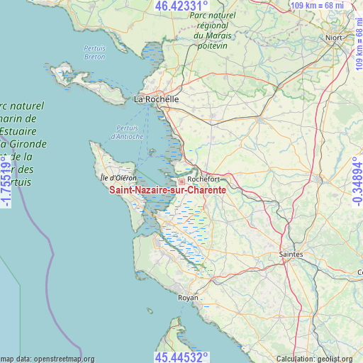
Saint-Nazaire-sur-Charente GPS coordinates[2]
45° 56' 11.292" North, 1° 3' 7.452" West
| Map corner | latitude | longitude |
|---|---|---|
| Upper-left | 46.42331°, | -1.75519° |
| Center: | 45.93647°, | -1.05207° |
| Lower-right: | 45.44532°, | -0.34894° |
| Map W x H: | 108.7×108.7 km | = 67.5×67.5mi |
| max Lat: | 51.07786° ⇑67.1% North |
| Saint-Nazaire-sur-Charente: | 45.93647° |
| min Lat: | ⇓32.9% South 41.3874° |
| min Long | Saint-Nazaire-s | max Long |
| -5.08615° | -1.05207° | 9.52242° |
| W 11.3%⇐ | ⇒88.7% E |
Elevation
Elevation of Saint-Nazaire-sur-Charente is 15 m = 49 ft, and this is 178.7 m = 586 ft below average elevation for this country.
| Max E: |
2333 m = 7654 ft | 95.7% |
| Avg. | 193.7 m = 635 ft | |
| Saint-Nazaire-sur-Charente | 15 m = 49 ft | |
Min E: |
-1 m = -3 ft | 4.3% |
See also: France elevation on elevation.city.
Geographical zone
Saint-Nazaire-sur-Charente is located in North temperate zone (between Tropic of Cancer and the Arctic Circle). Distance of this North polar circle is 2293.5 km =1425.1 mi to North.| Distance of | km | miles | from Saint-Nazaire-sur-Charente |
|---|---|---|---|
| North Pole | 4899.4 | 3044.3 | to North |
| Arctic Circle | 2293.5 | 1425.1 | to North |
| Tropic Cancer | 2501.7 | 1554.5 | to South |
| Equator | 5107.7 | 3173.8 | to South |


Nearby cities:
15 places around Saint-Nazaire-sur-Charente: (largest is in red/bold)
• Bourcefranc-le-Chapus
12.2 km =7.6 mi,  218°
218°
• Breuil-Magné
8.9 km =5.5 mi,  52°
52°
• Fouras
6.5 km =4 mi,  330°
330°
• Hiers-Brouage
9.9 km =6.2 mi,  189°
189°
• Moëze
3.8 km =2.4 mi,  160°
160°
• Port-des-Barques
2.4 km =1.5 mi,  301°
301°
• Rochefort
6.6 km =4.1 mi,  84°
84°
• Saint-Agnant
9.9 km =6.2 mi,  134°
134°
• Saint-Hippolyte
12.5 km =7.8 mi,  98°
98°
• Saint-Laurent-de-la-Prée
5.3 km =3.3 mi,  13°
13°
• Soubise
3.6 km =2.2 mi,  112°
112°
• Tonnay-Charente
12.3 km =7.6 mi, 83°
• Vergeroux
6.3 km =3.9 mi,  57°
57°
• Yves
9.2 km =5.7 mi,  1°
1°
• Échillais
8.7 km =5.4 mi,  117°
117°
Sources, notices
• [Note1] Compared only with cities in France existing in our database
• [Src1] Map data: © OpenStreetMap contributors (CC-BY-SA)
• [Src2] Other city data from geonames.org with taken over terms of usage.
• [Src3] Geographical zone / Annual Mean Temperature by Robert A. Rohde @ Wikipedia
