Saint-Martin-de-Queyrières geodata
Saint-Martin-de-Queyrières (Provence-Alpes-Côte d'Azur) is a populated place; located in France in Europe/Paris (GMT+2) time zone. With population of 1,007 people, there are 8791 cities with bigger population in this country. Compared to other cities in France, 81.2% of cities are located further ↑North; 92.2% of cities are located further ←West and 99.7% of cities have lower elevation than Saint-Martin-de-Queyrières. Note1
Administrative division(s):
- Level 1: Provence-Alpes-Côte d'Azur
- Level 2: Hautes-Alpes
- Level 3: Arrondissement de Briançon
- Level 4: Saint-Martin-de-Queyrières
Current local time in Saint-Martin-de-Queyrières:
05:51 AM, WednesdayDifference from your time zone: hours


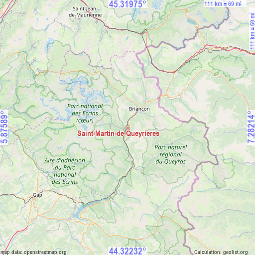
Saint-Martin-de-Queyrières GPS coordinates[2]
44° 49' 23.484" North, 6° 34' 44.436" East
| Map corner | latitude | longitude |
|---|---|---|
| Upper-left | 45.31975°, | 5.87589° |
| Center: | 44.82319°, | 6.57901° |
| Lower-right: | 44.32232°, | 7.28214° |
| Map W x H: | 110.9×110.9 km | = 68.9×68.9mi |
| max Lat: | 51.07786° ⇑81.2% North |
| Saint-Martin-de-Queyrières: | 44.82319° |
| min Lat: | ⇓18.8% South 41.3874° |
| min Long | Saint-Martin-de | max Long |
| -5.08615° | 6.57901° | 9.52242° |
| W 92.2%⇐ | ⇒7.8% E |
Elevation
Elevation of Saint-Martin-de-Queyrières is 1224 m = 4016 ft, and this is 1030.3 m = 3380 ft above average elevation for this country.
| Max E: |
2333 m = 7654 ft | 0.3% |
| Saint-Martin-de-Queyrières | 1224 m 4016 ft | |
| Avg. | 193.7 m = 635 ft | |
Min E: |
-1 m = -3 ft | 99.7% |
See also: France elevation on elevation.city.
Geographical zone
Saint-Martin-de-Queyrières is located in North temperate zone (between Tropic of Cancer and the Arctic Circle). Distance of this Northern Tropic circle is 2378 km =1477.6 mi to South.| Distance of | km | miles | from Saint-Martin-de-Queyrières |
|---|---|---|---|
| North Pole | 5023.2 | 3121.3 | to North |
| Arctic Circle | 2417.3 | 1502 | to North |
| Tropic Cancer | 2378 | 1477.6 | to South |
| Equator | 4983.9 | 3096.9 | to South |


Nearby cities:
15 places around Saint-Martin-de-Queyrières: (largest is in red/bold)
• Briançon
9.9 km =6.2 mi,  30°
30°
• Châteauroux-les-Alpes
23.6 km =14.7 mi,  191°
191°
• Guillestre
19 km =11.8 mi,  162°
162°
• La Roche-de-Rame
8.1 km =5 mi,  179°
179°
• Le Monêtier-les-Bains
17.9 km =11.1 mi,  342°
342°
• Montgenèvre
16.5 km =10.3 mi,  42°
42°
• Orcières
25.3 km =15.7 mi,  232°
232°
• Risoul
20 km =12.4 mi,  166°
166°
• Saint-Chaffrey
11.6 km =7.2 mi,  11°
11°
• Saint-Crépin
13.2 km =8.2 mi, 170°
• Val-des-Prés
16 km =9.9 mi, 29°
• Vallouise
7.5 km =4.7 mi,  289°
289°
• Vars
26.6 km =16.5 mi, 160°
• Villar-Saint-Pancrace
6.7 km =4.2 mi, 34°
• Villeneuve
13.6 km =8.5 mi,  355°
355°
Sources, notices
• [Note1] Compared only with cities in France existing in our database
• [Src1] Map data: © OpenStreetMap contributors (CC-BY-SA)
• [Src2] Other city data from geonames.org with taken over terms of usage.
• [Src3] Geographical zone / Annual Mean Temperature by Robert A. Rohde @ Wikipedia
