Risoul geodata
Risoul (Provence-Alpes-Côte d'Azur) is a populated place; located in France in Europe/Paris (GMT+2) time zone. With population of 673 people, there are 12171 cities with bigger population in this country. Compared to other cities in France, 82.5% of cities are located further ↑North; 92.6% of cities are located further ←West and 99.5% of cities have lower elevation than Risoul. Note1
Administrative division(s):
- Level 1: Provence-Alpes-Côte d'Azur
- Level 2: Hautes-Alpes
- Level 3: Arrondissement de Briançon
- Level 4: Risoul


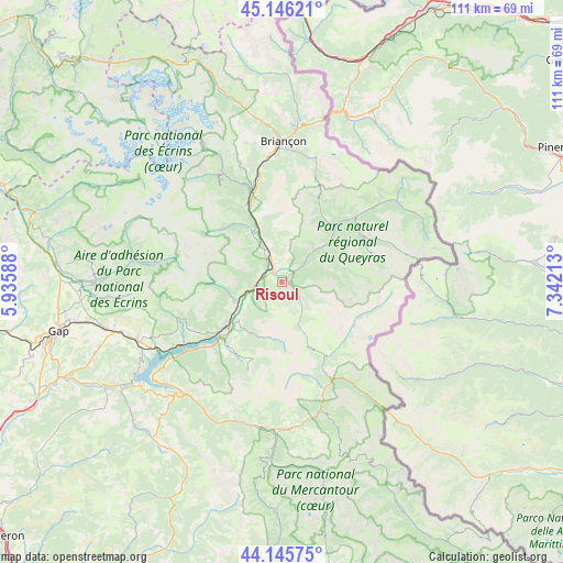
Risoul GPS coordinates[2]
44° 38' 53.304" North, 6° 38' 20.4" East
| Map corner | latitude | longitude |
|---|---|---|
| Upper-left | 45.14621°, | 5.93588° |
| Center: | 44.64814°, | 6.639° |
| Lower-right: | 44.14575°, | 7.34213° |
| Map W x H: | 111.2×111.2 km | = 69.1×69.1mi |
| max Lat: | 51.07786° ⇑82.5% North |
| Risoul: | 44.64814° |
| min Lat: | ⇓17.5% South 41.3874° |
| min Long | Risoul | max Long |
| -5.08615° | 6.639° | 9.52242° |
| W 92.6%⇐ | ⇒7.4% E |
Elevation
Elevation of Risoul is 1124 m = 3688 ft, and this is 930.3 m = 3052 ft above average elevation for this country.
| Max E: |
2333 m = 7654 ft | 0.5% |
| Risoul | 1124 m 3688 ft | |
| Avg. | 193.7 m = 635 ft | |
Min E: |
-1 m = -3 ft | 99.5% |
See also: France elevation on elevation.city.
Geographical zone
Risoul is located in North temperate zone (between Tropic of Cancer and the Arctic Circle). Distance of this Northern Tropic circle is 2358.5 km =1465.5 mi to South.| Distance of | km | miles | from Risoul |
|---|---|---|---|
| North Pole | 5042.7 | 3133.4 | to North |
| Arctic Circle | 2436.8 | 1514.2 | to North |
| Tropic Cancer | 2358.5 | 1465.5 | to South |
| Equator | 4964.4 | 3084.7 | to South |


Nearby cities:
15 places around Risoul: (largest is in red/bold)
• Barcelonnette
29.1 km =18.1 mi,  178°
178°
• Briançon
28 km =17.4 mi,  0°
0°
• Chorges
30.7 km =19.1 mi,  248°
248°
• Châteauroux-les-Alpes
10 km =6.2 mi, 248°
• Embrun
14.7 km =9.1 mi,  230°
230°
• Guillestre
1.5 km =0.9 mi,  33°
33°
• Jausiers
26.7 km =16.6 mi,  164°
164°
• La Roche-de-Rame
12.3 km =7.6 mi,  337°
337°
• Orcières
25.2 km =15.7 mi,  279°
279°
• Saint-Crépin
7 km =4.3 mi, 338°
• Saint-Martin-de-Queyrières
20 km =12.4 mi,  346°
346°
• Savines-le-Lac
23 km =14.3 mi, 233°
• Vallouise
25 km =15.5 mi,  331°
331°
• Vars
7 km =4.3 mi,  143°
143°
• Villar-Saint-Pancrace
25 km =15.5 mi,  357°
357°
Sources, notices
• [Note1] Compared only with cities in France existing in our database
• [Src1] Map data: © OpenStreetMap contributors (CC-BY-SA)
• [Src2] Other city data from geonames.org with taken over terms of usage.
• [Src3] Geographical zone / Annual Mean Temperature by Robert A. Rohde @ Wikipedia
