Saint-Martin-de-Crau geodata
Saint-Martin-de-Crau (Provence-Alpes-Côte d'Azur) is a populated place; located in France in Europe/Paris (GMT+2) time zone. With population of 11,555 people, there are 833 cities with bigger population in this country. Compared to other cities in France, 91.4% of cities are located further ↑North; 75.3% of cities are located further ←West and 93.1% of cities have higher elevation than Saint-Martin-de-Crau. Note1
Administrative division(s):
- Level 1: Provence-Alpes-Côte d'Azur
- Level 2: Département des Bouches-du-Rhône
- Level 3: Arles
- Level 4: Saint-Martin-de-Crau


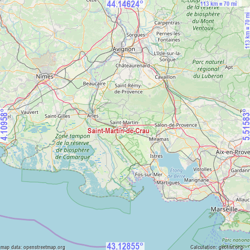
Saint-Martin-de-Crau GPS coordinates[2]
43° 38' 22.38" North, 4° 48' 45.72" East
| Map corner | latitude | longitude |
|---|---|---|
| Upper-left | 44.14624°, | 4.10958° |
| Center: | 43.63955°, | 4.8127° |
| Lower-right: | 43.12855°, | 5.51583° |
| Map W x H: | 113.2×113.2 km | = 70.3×70.3mi |
| max Lat: | 51.07786° ⇑91.4% North |
| Saint-Martin-de-Crau: | 43.63955° |
| min Lat: | ⇓8.6% South 41.3874° |
| min Long | Saint-Martin-de | max Long |
| -5.08615° | 4.8127° | 9.52242° |
| W 75.3%⇐ | ⇒24.7% E |
Elevation
Elevation of Saint-Martin-de-Crau is 22 m = 72 ft, and this is 171.7 m = 563 ft below average elevation for this country.
| Max E: |
2333 m = 7654 ft | 93.1% |
| Avg. | 193.7 m = 635 ft | |
| Saint-Martin-de-Crau | 22 m = 72 ft | |
Min E: |
-1 m = -3 ft | 6.9% |
See also: France elevation on elevation.city.
Geographical zone
Saint-Martin-de-Crau is located in North temperate zone (between Tropic of Cancer and the Arctic Circle). Distance of this Northern Tropic circle is 2246.3 km =1395.8 mi to South.| Distance of | km | miles | from Saint-Martin-de-Crau |
|---|---|---|---|
| North Pole | 5154.8 | 3203 | to North |
| Arctic Circle | 2548.9 | 1583.8 | to North |
| Tropic Cancer | 2246.3 | 1395.8 | to South |
| Equator | 4852.3 | 3015.1 | to South |


Nearby cities:
15 places around Saint-Martin-de-Crau: (largest is in red/bold)
• Arles
15.2 km =9.4 mi,  285°
285°
• Aureille
13.2 km =8.2 mi,  54°
54°
• Eygalières
17.4 km =10.8 mi,  39°
39°
• Eyguières
18.6 km =11.6 mi,  70°
70°
• Fontvieille
12.9 km =8 mi,  319°
319°
• Fourques
17.5 km =10.9 mi, 290°
• Grans
20.4 km =12.7 mi,  99°
99°
• Istres
19.9 km =12.4 mi,  134°
134°
• Maussane-les-Alpilles
9.2 km =5.7 mi,  356°
356°
• Miramas
16.4 km =10.2 mi,  111°
111°
• Mouriès
7.3 km =4.5 mi, 39°
• Paradou
8.9 km =5.5 mi,  346°
346°
• Saint-Chamas
20.5 km =12.7 mi,  118°
118°
• Saint-Rémy-de-Provence
16.6 km =10.3 mi,  5°
5°
• Saint-Étienne-du-Grès
17.2 km =10.7 mi,  335°
335°
Sources, notices
• [Note1] Compared only with cities in France existing in our database
• [Src1] Map data: © OpenStreetMap contributors (CC-BY-SA)
• [Src2] Other city data from geonames.org with taken over terms of usage.
• [Src3] Geographical zone / Annual Mean Temperature by Robert A. Rohde @ Wikipedia
