Saint-Laurent-la-Conche geodata
Saint-Laurent-la-Conche (Auvergne-Rhône-Alpes) is a populated place; located in France in Europe/Paris (GMT+2) time zone. With population of 558 people, there are 14045 cities with bigger population in this country. Compared to other cities in France, 71.1% of cities are located further ↑North; 69.8% of cities are located further ←West and 84.6% of cities have lower elevation than Saint-Laurent-la-Conche. Note1
Administrative division(s):
- Level 1: Auvergne-Rhône-Alpes
- Level 2: Département de la Loire
- Level 3: Arrondissement de Montbrison
- Level 4: Saint-Laurent-la-Conche
Current local time in Saint-Laurent-la-Conche:
12:40 PM, SaturdayDifference from your time zone: hours


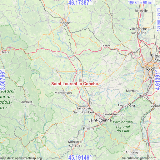
Saint-Laurent-la-Conche GPS coordinates[2]
45° 41' 5.352" North, 4° 12' 38.808" East
| Map corner | latitude | longitude |
|---|---|---|
| Upper-left | 46.17387°, | 3.50766° |
| Center: | 45.68482°, | 4.21078° |
| Lower-right: | 45.19146°, | 4.91391° |
| Map W x H: | 109.2×109.2 km | = 67.9×67.9mi |
| max Lat: | 51.07786° ⇑71.1% North |
| Saint-Laurent-la-Conche: | 45.68482° |
| min Lat: | ⇓28.9% South 41.3874° |
| min Long | Saint-Laurent-l | max Long |
| -5.08615° | 4.21078° | 9.52242° |
| W 69.8%⇐ | ⇒30.2% E |
Elevation
Elevation of Saint-Laurent-la-Conche is 341 m = 1119 ft, and this is 147.3 m = 483 ft above average elevation for this country.
| Max E: |
2333 m = 7654 ft | 15.4% |
| Saint-Laurent-la-Conche | 341 m 1119 ft | |
| Avg. | 193.7 m = 635 ft | |
Min E: |
-1 m = -3 ft | 84.6% |
See also: France elevation on elevation.city.
Geographical zone
Saint-Laurent-la-Conche is located in North temperate zone (between Tropic of Cancer and the Arctic Circle). Distance of this North polar circle is 2321.5 km =1442.5 mi to North.| Distance of | km | miles | from Saint-Laurent-la-Conche |
|---|---|---|---|
| North Pole | 4927.4 | 3061.7 | to North |
| Arctic Circle | 2321.5 | 1442.5 | to North |
| Tropic Cancer | 2473.8 | 1537.1 | to South |
| Equator | 5079.7 | 3156.4 | to South |


Nearby cities:
15 places around Saint-Laurent-la-Conche: (largest is in red/bold)
• Bellegarde-en-Forez
8.1 km =5 mi,  123°
123°
• Boisset-lès-Montrond
6.4 km =4 mi,  178°
178°
• Civens
11 km =6.8 mi,  16°
16°
• Craintilleux
11.5 km =7.1 mi,  173°
173°
• Cuzieu
9.3 km =5.8 mi,  157°
157°
• Feurs
5.6 km =3.5 mi,  13°
13°
• Maringes
11.2 km =7 mi,  103°
103°
• Montrond-les-Bains
5 km =3.1 mi, 155°
• Montverdun
11.7 km =7.3 mi,  289°
289°
• Poncins
5.5 km =3.4 mi,  324°
324°
• Saint-André-le-Puy
5.6 km =3.5 mi,  137°
137°
• Saint-Barthélemy-Lestra
10.7 km =6.6 mi,  69°
69°
• Saint-Cyr-les-Vignes
6.9 km =4.3 mi, 103°
• Saint-Étienne-le-Molard
10.9 km =6.8 mi,  300°
300°
• Valeille
7.6 km =4.7 mi, 69°
Sources, notices
• [Note1] Compared only with cities in France existing in our database
• [Src1] Map data: © OpenStreetMap contributors (CC-BY-SA)
• [Src2] Other city data from geonames.org with taken over terms of usage.
• [Src3] Geographical zone / Annual Mean Temperature by Robert A. Rohde @ Wikipedia
