Valeille geodata
Valeille (Auvergne-Rhône-Alpes) is a populated place; located in France in Europe/Paris (GMT+2) time zone. With population of 526 people, there are 14691 cities with bigger population in this country. Compared to other cities in France, 70.8% of cities are located further ↑North; 70.6% of cities are located further ←West and 91.1% of cities have lower elevation than Valeille. Note1
Administrative division(s):
- Level 1: Auvergne-Rhône-Alpes
- Level 2: Département de la Loire
- Level 3: Arrondissement de Montbrison
- Level 4: Valeille


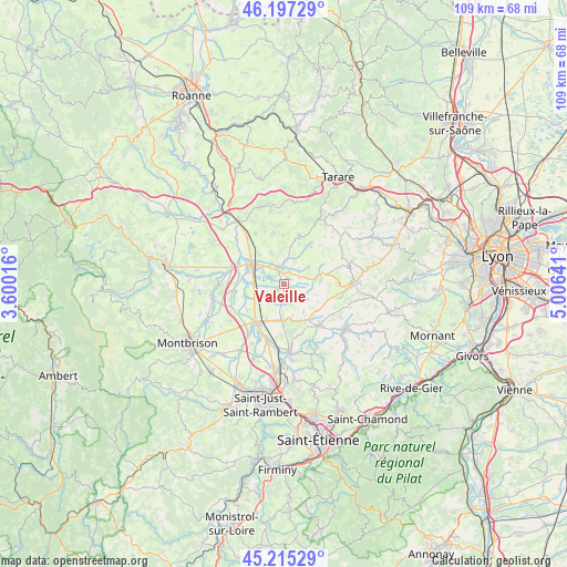
Valeille GPS coordinates[2]
45° 42' 30.42" North, 4° 18' 11.808" East
| Map corner | latitude | longitude |
|---|---|---|
| Upper-left | 46.19729°, | 3.60016° |
| Center: | 45.70845°, | 4.30328° |
| Lower-right: | 45.21529°, | 5.00641° |
| Map W x H: | 109.2×109.2 km | = 67.9×67.9mi |
| max Lat: | 51.07786° ⇑70.8% North |
| Valeille: | 45.70845° |
| min Lat: | ⇓29.2% South 41.3874° |
| min Long | Valeille | max Long |
| -5.08615° | 4.30328° | 9.52242° |
| W 70.6%⇐ | ⇒29.4% E |
Elevation
Elevation of Valeille is 452 m = 1483 ft, and this is 258.3 m = 847 ft above average elevation for this country.
| Max E: |
2333 m = 7654 ft | 8.9% |
| Valeille | 452 m 1483 ft | |
| Avg. | 193.7 m = 635 ft | |
Min E: |
-1 m = -3 ft | 91.1% |
See also: France elevation on elevation.city.
Geographical zone
Valeille is located in North temperate zone (between Tropic of Cancer and the Arctic Circle). Distance of this North polar circle is 2318.9 km =1440.9 mi to North.| Distance of | km | miles | from Valeille |
|---|---|---|---|
| North Pole | 4924.8 | 3060.1 | to North |
| Arctic Circle | 2318.9 | 1440.9 | to North |
| Tropic Cancer | 2476.4 | 1538.8 | to South |
| Equator | 5082.3 | 3158 | to South |


Nearby cities:
15 places around Valeille: (largest is in red/bold)
• Bellegarde-en-Forez
7.1 km =4.4 mi,  183°
183°
• Chambost-Longessaigne
8.8 km =5.5 mi,  35°
35°
• Civens
8.9 km =5.5 mi,  333°
333°
• Cottance
9.4 km =5.8 mi,  358°
358°
• Feurs
6.5 km =4 mi,  295°
295°
• Haute-Rivoire
7.3 km =4.5 mi,  83°
83°
• Maringes
6.4 km =4 mi,  145°
145°
• Meys
7.3 km =4.5 mi,  116°
116°
• Montrond-les-Bains
8.8 km =5.5 mi,  215°
215°
• Panissières
9.7 km =6 mi,  17°
17°
• Saint-André-le-Puy
7.6 km =4.7 mi,  207°
207°
• Saint-Barthélemy-Lestra
3.1 km =1.9 mi,  69°
69°
• Saint-Cyr-les-Vignes
4.3 km =2.7 mi,  186°
186°
• Saint-Laurent-la-Conche
7.6 km =4.7 mi,  249°
249°
• Saint-Martin-Lestra
4.2 km =2.6 mi, 72°
Sources, notices
• [Note1] Compared only with cities in France existing in our database
• [Src1] Map data: © OpenStreetMap contributors (CC-BY-SA)
• [Src2] Other city data from geonames.org with taken over terms of usage.
• [Src3] Geographical zone / Annual Mean Temperature by Robert A. Rohde @ Wikipedia
