Civens geodata
Civens (Auvergne-Rhône-Alpes) is a populated place; located in France in Europe/Paris (GMT+2) time zone. With population of 1,171 people, there are 7703 cities with bigger population in this country. Compared to other cities in France, 69.6% of cities are located further ↑North; 70.2% of cities are located further ←West and 87.6% of cities have lower elevation than Civens. Note1
Administrative division(s):
- Level 1: Auvergne-Rhône-Alpes
- Level 2: Département de la Loire
- Level 3: Arrondissement de Montbrison
- Level 4: Civens


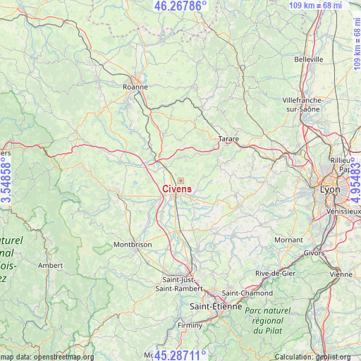
Civens GPS coordinates[2]
45° 46' 46.704" North, 4° 15' 6.12" East
| Map corner | latitude | longitude |
|---|---|---|
| Upper-left | 46.26786°, | 3.54858° |
| Center: | 45.77964°, | 4.2517° |
| Lower-right: | 45.28711°, | 4.95483° |
| Map W x H: | 109×109 km | = 67.7×67.7mi |
| max Lat: | 51.07786° ⇑69.6% North |
| Civens: | 45.77964° |
| min Lat: | ⇓30.4% South 41.3874° |
| min Long | Civens | max Long |
| -5.08615° | 4.2517° | 9.52242° |
| W 70.2%⇐ | ⇒29.8% E |
Elevation
Elevation of Civens is 383 m = 1257 ft, and this is 189.3 m = 621 ft above average elevation for this country.
| Max E: |
2333 m = 7654 ft | 12.4% |
| Civens | 383 m 1257 ft | |
| Avg. | 193.7 m = 635 ft | |
Min E: |
-1 m = -3 ft | 87.6% |
See also: France elevation on elevation.city.
Geographical zone
Civens is located in North temperate zone (between Tropic of Cancer and the Arctic Circle). Distance of this North polar circle is 2311 km =1436 mi to North.| Distance of | km | miles | from Civens |
|---|---|---|---|
| North Pole | 4916.8 | 3055.2 | to North |
| Arctic Circle | 2311 | 1436 | to North |
| Tropic Cancer | 2484.3 | 1543.7 | to South |
| Equator | 5090.2 | 3162.9 | to South |


Nearby cities:
15 places around Civens: (largest is in red/bold)
• Balbigny
6.5 km =4 mi,  312°
312°
• Bussières
6.4 km =4 mi,  13°
13°
• Chambost-Longessaigne
9.2 km =5.7 mi,  94°
94°
• Cottance
4 km =2.5 mi,  68°
68°
• Feurs
5.5 km =3.4 mi,  200°
200°
• Nervieux
8.3 km =5.2 mi,  288°
288°
• Néronde
6.4 km =4 mi,  349°
349°
• Panissières
7.1 km =4.4 mi,  78°
78°
• Poncins
8.8 km =5.5 mi,  226°
226°
• Pouilly-lès-Feurs
2.5 km =1.6 mi,  323°
323°
• Rozier-en-Donzy
3.1 km =1.9 mi,  40°
40°
• Saint-Barthélemy-Lestra
9.7 km =6 mi,  134°
134°
• Saint-Martin-Lestra
10.4 km =6.5 mi, 129°
• Valeille
8.9 km =5.5 mi,  153°
153°
• Épercieux-Saint-Paul
3.4 km =2.1 mi, 289°
Sources, notices
• [Note1] Compared only with cities in France existing in our database
• [Src1] Map data: © OpenStreetMap contributors (CC-BY-SA)
• [Src2] Other city data from geonames.org with taken over terms of usage.
• [Src3] Geographical zone / Annual Mean Temperature by Robert A. Rohde @ Wikipedia
