Saint-Jory-de-Chalais geodata
Saint-Jory-de-Chalais (Nouvelle-Aquitaine) is a populated place; located in France in Europe/Paris (GMT+2) time zone. With population of 658 people, there are 12412 cities with bigger population in this country. Compared to other cities in France, 74.2% of cities are located further ↑North; 69.7% of cities are located further →East and 76.7% of cities have lower elevation than Saint-Jory-de-Chalais. Note1
Administrative division(s):
- Level 1: Nouvelle-Aquitaine
- Level 2: Dordogne
- Level 3: Arrondissement de Nontron
- Level 4: Saint-Jory-de-Chalais
Current local time in Saint-Jory-de-Chalais:
12:02 PM, SaturdayDifference from your time zone: hours


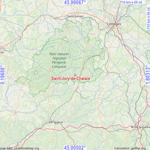
Saint-Jory-de-Chalais GPS coordinates[2]
45° 30' 0" North, 0° 54' 0" East
| Map corner | latitude | longitude |
|---|---|---|
| Upper-left | 45.99067°, | 0.19688° |
| Center: | 45.5°, | 0.9° |
| Lower-right: | 45.00502°, | 1.60313° |
| Map W x H: | 109.6×109.6 km | = 68.1×68.1mi |
| max Lat: | 51.07786° ⇑74.2% North |
| Saint-Jory-de-Chalais: | 45.5° |
| min Lat: | ⇓25.8% South 41.3874° |
| min Long | Saint-Jory-de-C | max Long |
| -5.08615° | 0.9° | 9.52242° |
| W 30.3%⇐ | ⇒69.7% E |
Elevation
Elevation of Saint-Jory-de-Chalais is 261 m = 856 ft, and this is 67.3 m = 221 ft above average elevation for this country.
| Max E: |
2333 m = 7654 ft | 23.3% |
| Saint-Jory-de-Chalais | 261 m 856 ft | |
| Avg. | 193.7 m = 635 ft | |
Min E: |
-1 m = -3 ft | 76.7% |
See also: France elevation on elevation.city.
Geographical zone
Saint-Jory-de-Chalais is located in North temperate zone (between Tropic of Cancer and the Arctic Circle). Distance of this North polar circle is 2342 km =1455.3 mi to North.| Distance of | km | miles | from Saint-Jory-de-Chalais |
|---|---|---|---|
| North Pole | 4947.9 | 3074.5 | to North |
| Arctic Circle | 2342 | 1455.3 | to North |
| Tropic Cancer | 2453.2 | 1524.3 | to South |
| Equator | 5059.1 | 3143.6 | to South |


Nearby cities:
15 places around Saint-Jory-de-Chalais: (largest is in red/bold)
• Abjat-sur-Bandiat
14.5 km =9 mi,  310°
310°
• Dournazac
14 km =8.7 mi,  5°
5°
• Eyzerac
12.5 km =7.8 mi,  172°
172°
• Jumilhac-le-Grand
12.7 km =7.9 mi,  92°
92°
• La Coquille
7.6 km =4.7 mi,  52°
52°
• Marval
16.2 km =10.1 mi,  330°
330°
• Mialet
5.5 km =3.4 mi,  3°
3°
• Milhac-de-Nontron
9.9 km =6.2 mi,  248°
248°
• Nantheuil
10.2 km =6.3 mi,  159°
159°
• Saint-Front-la-Rivière
13.8 km =8.6 mi,  256°
256°
• Saint-Pardoux-la-Rivière
12 km =7.5 mi,  266°
266°
• Saint-Paul-la-Roche
8 km =5 mi,  107°
107°
• Saint-Saud-Lacoussière
8 km =5 mi, 307°
• Thiviers
9.5 km =5.9 mi, 170°
• Villars
14.5 km =9 mi,  231°
231°
Sources, notices
• [Note1] Compared only with cities in France existing in our database
• [Src1] Map data: © OpenStreetMap contributors (CC-BY-SA)
• [Src2] Other city data from geonames.org with taken over terms of usage.
• [Src3] Geographical zone / Annual Mean Temperature by Robert A. Rohde @ Wikipedia
