Dournazac geodata
Dournazac (Nouvelle-Aquitaine) is a populated place; located in France in Europe/Paris (GMT+2) time zone. With population of 708 people, there are 11684 cities with bigger population in this country. Compared to other cities in France, 72.2% of cities are located further ↑North; 69.6% of cities are located further →East and 85.8% of cities have lower elevation than Dournazac. Note1
Administrative division(s):
- Level 1: Nouvelle-Aquitaine
- Level 2: Haute-Vienne
- Level 3: Arrondissement de Rochechouart
- Level 4: Dournazac


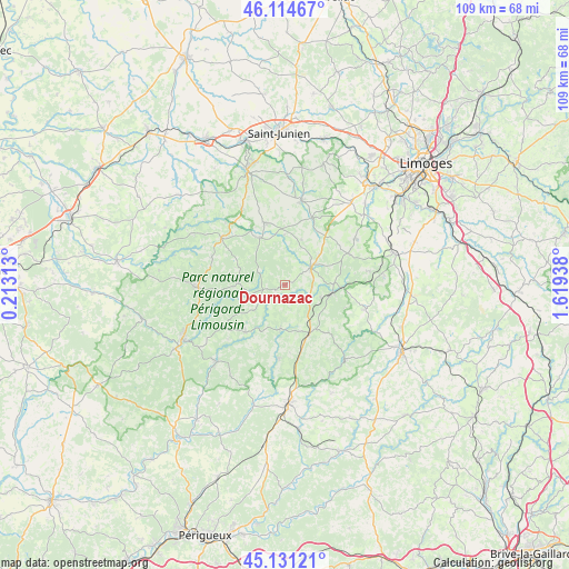
Dournazac GPS coordinates[2]
45° 37' 30.36" North, 0° 54' 58.536" East
| Map corner | latitude | longitude |
|---|---|---|
| Upper-left | 46.11467°, | 0.21313° |
| Center: | 45.6251°, | 0.91626° |
| Lower-right: | 45.13121°, | 1.61938° |
| Map W x H: | 109.4×109.3 km | = 68×67.9mi |
| max Lat: | 51.07786° ⇑72.2% North |
| Dournazac: | 45.6251° |
| min Lat: | ⇓27.8% South 41.3874° |
| min Long | Dournazac | max Long |
| -5.08615° | 0.91626° | 9.52242° |
| W 30.4%⇐ | ⇒69.6% E |
Elevation
Elevation of Dournazac is 359 m = 1178 ft, and this is 165.3 m = 542 ft above average elevation for this country.
| Max E: |
2333 m = 7654 ft | 14.2% |
| Dournazac | 359 m 1178 ft | |
| Avg. | 193.7 m = 635 ft | |
Min E: |
-1 m = -3 ft | 85.8% |
See also: France elevation on elevation.city.
Geographical zone
Dournazac is located in North temperate zone (between Tropic of Cancer and the Arctic Circle). Distance of this North polar circle is 2328.1 km =1446.6 mi to North.| Distance of | km | miles | from Dournazac |
|---|---|---|---|
| North Pole | 4934 | 3065.8 | to North |
| Arctic Circle | 2328.1 | 1446.6 | to North |
| Tropic Cancer | 2467.1 | 1533 | to South |
| Equator | 5073 | 3152.2 | to South |


Nearby cities:
15 places around Dournazac: (largest is in red/bold)
• Abjat-sur-Bandiat
13.1 km =8.1 mi,  249°
249°
• Bussière-Galant
9.3 km =5.8 mi,  88°
88°
• Champagnac-la-Rivière
9.5 km =5.9 mi,  358°
358°
• Champniers-et-Reilhac
15 km =9.3 mi,  288°
288°
• Champsac
9.2 km =5.7 mi,  19°
19°
• Châlus
6 km =3.7 mi,  56°
56°
• Cussac
10.4 km =6.5 mi,  330°
330°
• La Coquille
10.4 km =6.5 mi,  153°
153°
• Les Cars
13.6 km =8.5 mi, 63°
• Marval
9.2 km =5.7 mi,  271°
271°
• Mialet
8.5 km =5.3 mi,  186°
186°
• Oradour-sur-Vayres
12.5 km =7.8 mi,  342°
342°
• Pageas
8.7 km =5.4 mi,  47°
47°
• Saint-Jory-de-Chalais
14 km =8.7 mi, 185°
• Saint-Saud-Lacoussière
11.8 km =7.3 mi,  220°
220°
Sources, notices
• [Note1] Compared only with cities in France existing in our database
• [Src1] Map data: © OpenStreetMap contributors (CC-BY-SA)
• [Src2] Other city data from geonames.org with taken over terms of usage.
• [Src3] Geographical zone / Annual Mean Temperature by Robert A. Rohde @ Wikipedia
