Saint-Front-la-Rivière geodata
Saint-Front-la-Rivière (Nouvelle-Aquitaine) is a populated place; located in France in Europe/Paris (GMT+2) time zone. With population of 518 people, there are 14866 cities with bigger population in this country. Compared to other cities in France, 74.4% of cities are located further ↑North; 71.2% of cities are located further →East and 50.6% of cities have lower elevation than Saint-Front-la-Rivière. Note1
Administrative division(s):
- Level 1: Nouvelle-Aquitaine
- Level 2: Dordogne
- Level 3: Arrondissement de Nontron
- Level 4: Saint-Front-la-Rivière
Current local time in Saint-Front-la-Rivière:
01:16 PM, SaturdayDifference from your time zone: hours


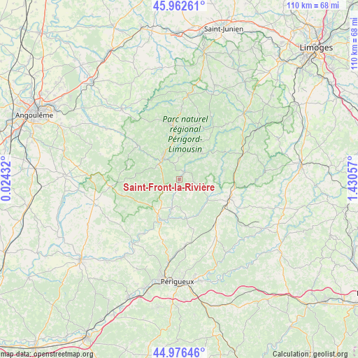
Saint-Front-la-Rivière GPS coordinates[2]
45° 28' 18.084" North, 0° 43' 38.82" East
| Map corner | latitude | longitude |
|---|---|---|
| Upper-left | 45.96261°, | 0.02432° |
| Center: | 45.47169°, | 0.72745° |
| Lower-right: | 44.97646°, | 1.43057° |
| Map W x H: | 109.6×109.6 km | = 68.1×68.1mi |
| max Lat: | 51.07786° ⇑74.4% North |
| Saint-Front-la-Rivière: | 45.47169° |
| min Lat: | ⇓25.6% South 41.3874° |
| min Long | Saint-Front-la- | max Long |
| -5.08615° | 0.72745° | 9.52242° |
| W 28.8%⇐ | ⇒71.2% E |
Elevation
Elevation of Saint-Front-la-Rivière is 134 m = 440 ft, and this is 59.7 m = 196 ft below average elevation for this country.
| Max E: |
2333 m = 7654 ft | 49.4% |
| Avg. | 193.7 m = 635 ft | |
| Saint-Front-la-Rivière | 134 m = 440 ft | |
Min E: |
-1 m = -3 ft | 50.6% |
See also: France elevation on elevation.city.
Geographical zone
Saint-Front-la-Rivière is located in North temperate zone (between Tropic of Cancer and the Arctic Circle). Distance of this North polar circle is 2345.2 km =1457.2 mi to North.| Distance of | km | miles | from Saint-Front-la-Rivière |
|---|---|---|---|
| North Pole | 4951.1 | 3076.5 | to North |
| Arctic Circle | 2345.2 | 1457.2 | to North |
| Tropic Cancer | 2450.1 | 1522.4 | to South |
| Equator | 5056 | 3141.7 | to South |


Nearby cities:
15 places around Saint-Front-la-Rivière: (largest is in red/bold)
• Abjat-sur-Bandiat
12.8 km =8 mi,  10°
10°
• Augignac
13.3 km =8.3 mi,  350°
350°
• Brantôme
13.6 km =8.5 mi,  204°
204°
• Champagnac-de-Belair
8.3 km =5.2 mi, 195°
• Javerlhac-et-la-Chapelle-Saint-Robert
16.9 km =10.5 mi,  310°
310°
• Mialet
16.3 km =10.1 mi,  57°
57°
• Milhac-de-Nontron
4.3 km =2.7 mi,  96°
96°
• Nontron
8.2 km =5.1 mi,  321°
321°
• Saint-Estèphe
14.3 km =8.9 mi,  339°
339°
• Saint-Jory-de-Chalais
13.8 km =8.6 mi,  76°
76°
• Saint-Martial-de-Valette
7.8 km =4.8 mi, 309°
• Saint-Pardoux-la-Rivière
2.9 km =1.8 mi,  31°
31°
• Saint-Saud-Lacoussière
10.7 km =6.6 mi,  41°
41°
• Thiviers
16.2 km =10.1 mi,  112°
112°
• Villars
6.1 km =3.8 mi,  160°
160°
Sources, notices
• [Note1] Compared only with cities in France existing in our database
• [Src1] Map data: © OpenStreetMap contributors (CC-BY-SA)
• [Src2] Other city data from geonames.org with taken over terms of usage.
• [Src3] Geographical zone / Annual Mean Temperature by Robert A. Rohde @ Wikipedia
