Saint-Hilaire-Peyroux geodata
Saint-Hilaire-Peyroux (Nouvelle-Aquitaine) is a populated place; located in France in Europe/Paris (GMT+2) time zone. With population of 811 people, there are 10468 cities with bigger population in this country. Compared to other cities in France, 77.3% of cities are located further ↑North; 61% of cities are located further →East and 79.8% of cities have lower elevation than Saint-Hilaire-Peyroux. Note1
Administrative division(s):
- Level 1: Nouvelle-Aquitaine
- Level 2: Département de la Corrèze
- Level 3: Arrondissement de Tulle
- Level 4: Saint-Hilaire-Peyroux
Current local time in Saint-Hilaire-Peyroux:
08:49 AM, SaturdayDifference from your time zone: hours


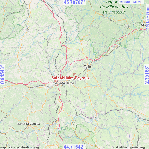
Saint-Hilaire-Peyroux GPS coordinates[2]
45° 12' 50.04" North, 1° 38' 54.78" East
| Map corner | latitude | longitude |
|---|---|---|
| Upper-left | 45.70707°, | 0.94543° |
| Center: | 45.2139°, | 1.64855° |
| Lower-right: | 44.71642°, | 2.35168° |
| Map W x H: | 110.1×110.1 km | = 68.4×68.4mi |
| max Lat: | 51.07786° ⇑77.3% North |
| Saint-Hilaire-Peyroux: | 45.2139° |
| min Lat: | ⇓22.7% South 41.3874° |
| min Long | Saint-Hilaire-P | max Long |
| -5.08615° | 1.64855° | 9.52242° |
| W 39%⇐ | ⇒61% E |
Elevation
Elevation of Saint-Hilaire-Peyroux is 288 m = 945 ft, and this is 94.3 m = 309 ft above average elevation for this country.
| Max E: |
2333 m = 7654 ft | 20.2% |
| Saint-Hilaire-Peyroux | 288 m 945 ft | |
| Avg. | 193.7 m = 635 ft | |
Min E: |
-1 m = -3 ft | 79.8% |
See also: France elevation on elevation.city.
Geographical zone
Saint-Hilaire-Peyroux is located in North temperate zone (between Tropic of Cancer and the Arctic Circle). Distance of this North polar circle is 2373.9 km =1475.1 mi to North.| Distance of | km | miles | from Saint-Hilaire-Peyroux |
|---|---|---|---|
| North Pole | 4979.7 | 3094.2 | to North |
| Arctic Circle | 2373.9 | 1475.1 | to North |
| Tropic Cancer | 2421.4 | 1504.6 | to South |
| Equator | 5027.3 | 3123.8 | to South |


Nearby cities:
15 places around Saint-Hilaire-Peyroux: (largest is in red/bold)
• Aubazine
4.7 km =2.9 mi,  156°
156°
• Brive-la-Gaillarde
10.9 km =6.8 mi,  235°
235°
• Chameyrat
4.5 km =2.8 mi,  59°
59°
• Chanteix
10.7 km =6.6 mi,  355°
355°
• Cornil
3.4 km =2.1 mi,  96°
96°
• Cosnac
10.1 km =6.3 mi,  209°
209°
• Dampniat
5.3 km =3.3 mi,  194°
194°
• Donzenac
9.9 km =6.2 mi,  278°
278°
• Laguenne
10.9 km =6.8 mi,  73°
73°
• Malemort-sur-Corrèze
8.2 km =5.1 mi,  234°
234°
• Saint-Germain-les-Vergnes
6.7 km =4.2 mi,  350°
350°
• Saint-Mexant
8 km =5 mi,  5°
5°
• Sainte-Fortunade
9.6 km =6 mi,  94°
94°
• Sainte-Féréole
5.5 km =3.4 mi,  288°
288°
• Ussac
10.8 km =6.7 mi,  258°
258°
Sources, notices
• [Note1] Compared only with cities in France existing in our database
• [Src1] Map data: © OpenStreetMap contributors (CC-BY-SA)
• [Src2] Other city data from geonames.org with taken over terms of usage.
• [Src3] Geographical zone / Annual Mean Temperature by Robert A. Rohde @ Wikipedia
