Sainte-Fortunade geodata
Sainte-Fortunade (Nouvelle-Aquitaine) is a populated place; located in France in Europe/Paris (GMT+2) time zone. With population of 1,809 people, there are 5243 cities with bigger population in this country. Compared to other cities in France, 77.4% of cities are located further ↑North; 59.7% of cities are located further →East and 92.9% of cities have lower elevation than Sainte-Fortunade. Note1
Administrative division(s):
- Level 1: Nouvelle-Aquitaine
- Level 2: Département de la Corrèze
- Level 3: Arrondissement de Tulle
- Level 4: Sainte-Fortunade


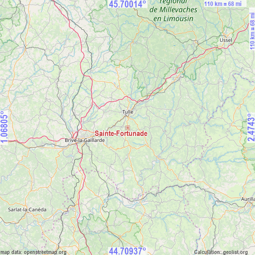
Sainte-Fortunade GPS coordinates[2]
45° 12' 24.876" North, 1° 46' 16.212" East
| Map corner | latitude | longitude |
|---|---|---|
| Upper-left | 45.70014°, | 1.06805° |
| Center: | 45.20691°, | 1.77117° |
| Lower-right: | 44.70937°, | 2.4743° |
| Map W x H: | 110.2×110.2 km | = 68.5×68.5mi |
| max Lat: | 51.07786° ⇑77.4% North |
| Sainte-Fortunade: | 45.20691° |
| min Lat: | ⇓22.6% South 41.3874° |
| min Long | Sainte-Fortunad | max Long |
| -5.08615° | 1.77117° | 9.52242° |
| W 40.3%⇐ | ⇒59.7% E |
Elevation
Elevation of Sainte-Fortunade is 501 m = 1644 ft, and this is 307.3 m = 1008 ft above average elevation for this country.
| Max E: |
2333 m = 7654 ft | 7.1% |
| Sainte-Fortunade | 501 m 1644 ft | |
| Avg. | 193.7 m = 635 ft | |
Min E: |
-1 m = -3 ft | 92.9% |
See also: France elevation on elevation.city.
Geographical zone
Sainte-Fortunade is located in North temperate zone (between Tropic of Cancer and the Arctic Circle). Distance of this North polar circle is 2374.6 km =1475.5 mi to North.| Distance of | km | miles | from Sainte-Fortunade |
|---|---|---|---|
| North Pole | 4980.5 | 3094.7 | to North |
| Arctic Circle | 2374.6 | 1475.5 | to North |
| Tropic Cancer | 2420.6 | 1504.1 | to South |
| Equator | 5026.5 | 3123.3 | to South |


Nearby cities:
15 places around Sainte-Fortunade: (largest is in red/bold)
• Albussac
9.2 km =5.7 mi,  146°
146°
• Aubazine
8.5 km =5.3 mi,  245°
245°
• Beynat
9.9 km =6.2 mi,  202°
202°
• Chameyrat
6.5 km =4 mi,  297°
297°
• Chanac-les-Mines
7.4 km =4.6 mi,  30°
30°
• Cornil
6.2 km =3.9 mi,  273°
273°
• Dampniat
11.7 km =7.3 mi, 248°
• Gimel-les-Cascades
12 km =7.5 mi, 31°
• Lagarde-Enval
3.6 km =2.2 mi,  128°
128°
• Laguenne
4 km =2.5 mi,  11°
11°
• Naves
11.9 km =7.4 mi,  358°
358°
• Saint-Germain-les-Vergnes
13 km =8.1 mi, 304°
• Saint-Hilaire-Peyroux
9.6 km =6 mi, 274°
• Saint-Mexant
12.4 km =7.7 mi,  314°
314°
• Tulle
6.6 km =4.1 mi,  0°
0°
Sources, notices
• [Note1] Compared only with cities in France existing in our database
• [Src1] Map data: © OpenStreetMap contributors (CC-BY-SA)
• [Src2] Other city data from geonames.org with taken over terms of usage.
• [Src3] Geographical zone / Annual Mean Temperature by Robert A. Rohde @ Wikipedia
