Saint-Hilaire-des-Loges geodata
Saint-Hilaire-des-Loges (Pays de la Loire) is a populated place; located in France in Europe/Paris (GMT+2) time zone. With population of 1,781 people, there are 5326 cities with bigger population in this country. Compared to other cities in France, 60.3% of cities are located further ↑North; 85.2% of cities are located further →East and 80.6% of cities have higher elevation than Saint-Hilaire-des-Loges. Note1
Administrative division(s):
- Level 1: Pays de la Loire
- Level 2: Département de la Vendée
- Level 3: Arrondissement de Fontenay-le-Comte
- Level 4: Saint-Hilaire-des-Loges
Current local time in Saint-Hilaire-des-Loges:
09:33 AM, SaturdayDifference from your time zone: hours


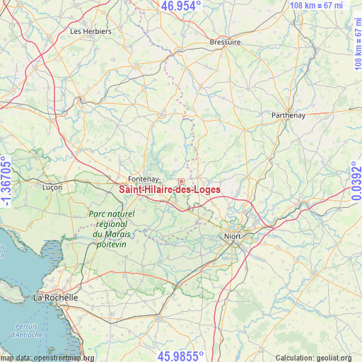
Saint-Hilaire-des-Loges GPS coordinates[2]
46° 28' 18.84" North, 0° 39' 50.148" West
| Map corner | latitude | longitude |
|---|---|---|
| Upper-left | 46.954°, | -1.36705° |
| Center: | 46.4719°, | -0.66393° |
| Lower-right: | 45.9855°, | 0.0392° |
| Map W x H: | 107.7×107.7 km | = 66.9×66.9mi |
| max Lat: | 51.07786° ⇑60.3% North |
| Saint-Hilaire-des-Loges: | 46.4719° |
| min Lat: | ⇓39.7% South 41.3874° |
| min Long | Saint-Hilaire-d | max Long |
| -5.08615° | -0.66393° | 9.52242° |
| W 14.8%⇐ | ⇒85.2% E |
Elevation
Elevation of Saint-Hilaire-des-Loges is 53 m = 174 ft, and this is 140.7 m = 462 ft below average elevation for this country.
| Max E: |
2333 m = 7654 ft | 80.6% |
| Avg. | 193.7 m = 635 ft | |
| Saint-Hilaire-des-Loges | 53 m = 174 ft | |
Min E: |
-1 m = -3 ft | 19.4% |
See also: France elevation on elevation.city.
Geographical zone
Saint-Hilaire-des-Loges is located in North temperate zone (between Tropic of Cancer and the Arctic Circle). Distance of this North polar circle is 2234 km =1388.1 mi to North.| Distance of | km | miles | from Saint-Hilaire-des-Loges |
|---|---|---|---|
| North Pole | 4839.9 | 3007.4 | to North |
| Arctic Circle | 2234 | 1388.1 | to North |
| Tropic Cancer | 2561.3 | 1591.5 | to South |
| Equator | 5167.2 | 3210.7 | to South |


Nearby cities:
15 places around Saint-Hilaire-des-Loges: (largest is in red/bold)
• Ardin
8.1 km =5 mi,  88°
88°
• Béceleuf
12 km =7.5 mi, 90°
• Coulonges-sur-l’Autize
5.1 km =3.2 mi,  75°
75°
• Fontenay-le-Comte
10.9 km =6.8 mi,  267°
267°
• Foussais-Payré
7 km =4.3 mi,  347°
347°
• Maillezais
12.5 km =7.8 mi,  207°
207°
• Mervent
9 km =5.6 mi,  308°
308°
• Oulmes
8 km =5 mi,  181°
181°
• Pissotte
11.3 km =7 mi,  284°
284°
• Saint-Martin-de-Fraigneau
7.4 km =4.6 mi,  237°
237°
• Saint-Michel-le-Cloucq
6.9 km =4.3 mi, 282°
• Saint-Pierre-le-Vieux
11.5 km =7.1 mi, 214°
• Saint-Pompain
6 km =3.7 mi,  124°
124°
• Villiers-en-Plaine
12 km =7.5 mi,  125°
125°
• Xanton-Chassenon
3.2 km =2 mi,  229°
229°
Sources, notices
• [Note1] Compared only with cities in France existing in our database
• [Src1] Map data: © OpenStreetMap contributors (CC-BY-SA)
• [Src2] Other city data from geonames.org with taken over terms of usage.
• [Src3] Geographical zone / Annual Mean Temperature by Robert A. Rohde @ Wikipedia
