Coulonges-sur-l’Autize geodata
Coulonges-sur-l’Autize (Nouvelle-Aquitaine) is a populated place; located in France in Europe/Paris (GMT+2) time zone. With population of 2,373 people, there are 4074 cities with bigger population in this country. Compared to other cities in France, 60.2% of cities are located further ↑North; 84.5% of cities are located further →East and 70.1% of cities have higher elevation than Coulonges-sur-l’Autize. Note1
Administrative division(s):
- Level 1: Nouvelle-Aquitaine
- Level 2: Département des Deux-Sèvres
- Level 3: Arrondissement de Parthenay
- Level 4: Coulonges-sur-l'Autize
Current local time in Coulonges-sur-l’Autize:
09:37 AM, SaturdayDifference from your time zone: hours


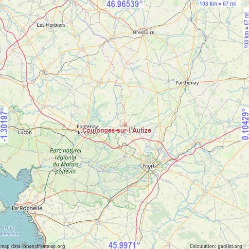
Coulonges-sur-l’Autize GPS coordinates[2]
46° 29' 0.24" North, 0° 35' 55.824" West
| Map corner | latitude | longitude |
|---|---|---|
| Upper-left | 46.96539°, | -1.30197° |
| Center: | 46.4834°, | -0.59884° |
| Lower-right: | 45.9971°, | 0.10429° |
| Map W x H: | 107.7×107.7 km | = 66.9×66.9mi |
| max Lat: | 51.07786° ⇑60.2% North |
| Coulonges-sur-l’Autize: | 46.4834° |
| min Lat: | ⇓39.8% South 41.3874° |
| min Long | Coulonges-sur-l | max Long |
| -5.08615° | -0.59884° | 9.52242° |
| W 15.5%⇐ | ⇒84.5% E |
Elevation
Elevation of Coulonges-sur-l’Autize is 78 m = 256 ft, and this is 115.7 m = 380 ft below average elevation for this country.
| Max E: |
2333 m = 7654 ft | 70.1% |
| Avg. | 193.7 m = 635 ft | |
| Coulonges-sur-l’Autize | 78 m = 256 ft | |
Min E: |
-1 m = -3 ft | 29.9% |
See also: France elevation on elevation.city.
Geographical zone
Coulonges-sur-l’Autize is located in North temperate zone (between Tropic of Cancer and the Arctic Circle). Distance of this North polar circle is 2232.7 km =1387.3 mi to North.| Distance of | km | miles | from Coulonges-sur-l’Autize |
|---|---|---|---|
| North Pole | 4838.6 | 3006.6 | to North |
| Arctic Circle | 2232.7 | 1387.3 | to North |
| Tropic Cancer | 2562.6 | 1592.3 | to South |
| Equator | 5168.5 | 3211.6 | to South |


Nearby cities:
15 places around Coulonges-sur-l’Autize: (largest is in red/bold)
• Ardin
3.3 km =2.1 mi,  108°
108°
• Benet
12.6 km =7.8 mi,  178°
178°
• Béceleuf
7.2 km =4.5 mi,  100°
100°
• Foussais-Payré
8.5 km =5.3 mi,  310°
310°
• Le Busseau
10.8 km =6.7 mi,  1°
1°
• Oulmes
10.6 km =6.6 mi,  209°
209°
• Saint-Hilaire-de-Voust
12.6 km =7.8 mi,  342°
342°
• Saint-Hilaire-des-Loges
5.1 km =3.2 mi,  255°
255°
• Saint-Martin-de-Fraigneau
12.4 km =7.7 mi,  244°
244°
• Saint-Michel-le-Cloucq
11.8 km =7.3 mi,  270°
270°
• Saint-Pompain
4.7 km =2.9 mi, 181°
• Sainte-Ouenne
12.6 km =7.8 mi, 110°
• Surin
10.7 km =6.6 mi, 103°
• Villiers-en-Plaine
9.5 km =5.9 mi,  150°
150°
• Xanton-Chassenon
8.1 km =5 mi,  245°
245°
Sources, notices
• [Note1] Compared only with cities in France existing in our database
• [Src1] Map data: © OpenStreetMap contributors (CC-BY-SA)
• [Src2] Other city data from geonames.org with taken over terms of usage.
• [Src3] Geographical zone / Annual Mean Temperature by Robert A. Rohde @ Wikipedia
