Saint-Germain-du-Puy geodata
Saint-Germain-du-Puy (Centre) is a populated place; located in France in Europe/Paris (GMT+2) time zone. With population of 5,057 people, there are 1951 cities with bigger population in this country. Compared to other cities in France, 54.2% of cities are located further ↑North; 50.3% of cities are located further ←West and 55.3% of cities have lower elevation than Saint-Germain-du-Puy. Note1
Administrative division(s):
- Level 1: Centre
- Level 2: Cher
- Level 3: Arrondissement de Bourges
- Level 4: Saint-Germain-du-Puy


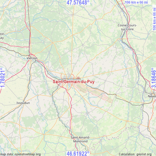
Saint-Germain-du-Puy GPS coordinates[2]
47° 6' 0" North, 2° 28' 59.988" East
| Map corner | latitude | longitude |
|---|---|---|
| Upper-left | 47.57648°, | 1.78021° |
| Center: | 47.1°, | 2.48333° |
| Lower-right: | 46.61922°, | 3.18646° |
| Map W x H: | 106.4×106.4 km | = 66.1×66.1mi |
| max Lat: | 51.07786° ⇑54.2% North |
| Saint-Germain-du-Puy: | 47.1° |
| min Lat: | ⇓45.8% South 41.3874° |
| min Long | Saint-Germain-d | max Long |
| -5.08615° | 2.48333° | 9.52242° |
| W 50.3%⇐ | ⇒49.7% E |
Elevation
Elevation of Saint-Germain-du-Puy is 151 m = 495 ft, and this is 42.7 m = 140 ft below average elevation for this country.
| Max E: |
2333 m = 7654 ft | 44.7% |
| Avg. | 193.7 m = 635 ft | |
| Saint-Germain-du-Puy | 151 m = 495 ft | |
Min E: |
-1 m = -3 ft | 55.3% |
See also: France elevation on elevation.city.
Geographical zone
Saint-Germain-du-Puy is located in North temperate zone (between Tropic of Cancer and the Arctic Circle). Distance of this North polar circle is 2164.1 km =1344.7 mi to North.| Distance of | km | miles | from Saint-Germain-du-Puy |
|---|---|---|---|
| North Pole | 4770 | 2963.9 | to North |
| Arctic Circle | 2164.1 | 1344.7 | to North |
| Tropic Cancer | 2631.1 | 1634.9 | to South |
| Equator | 5237 | 3254.1 | to South |


Nearby cities:
15 places around Saint-Germain-du-Puy: (largest is in red/bold)
• Bourges
6.6 km =4.1 mi,  253°
253°
• Brécy
10.7 km =6.6 mi,  75°
75°
• Fussy
6.3 km =3.9 mi,  320°
320°
• Les Aix-d’Angillon
12.4 km =7.7 mi,  29°
29°
• Pigny
9 km =5.6 mi,  338°
338°
• Plaimpied-Givaudins
11.6 km =7.2 mi,  190°
190°
• Saint-Doulchard
9.9 km =6.2 mi,  272°
272°
• Saint-Georges-sur-Moulon
11 km =6.8 mi, 335°
• Saint-Just
12 km =7.5 mi,  170°
170°
• Saint-Éloy-de-Gy
12.3 km =7.6 mi,  300°
300°
• Sainte-Solange
6.5 km =4 mi,  51°
51°
• Savigny-en-Septaine
8.5 km =5.3 mi,  137°
137°
• Soye-en-Septaine
8.1 km =5 mi,  177°
177°
• Vasselay
9.5 km =5.9 mi,  311°
311°
• Vignoux-sous-les-Aix
9.9 km =6.2 mi,  351°
351°
Sources, notices
• [Note1] Compared only with cities in France existing in our database
• [Src1] Map data: © OpenStreetMap contributors (CC-BY-SA)
• [Src2] Other city data from geonames.org with taken over terms of usage.
• [Src3] Geographical zone / Annual Mean Temperature by Robert A. Rohde @ Wikipedia
