Saint-Éloy-de-Gy geodata
Saint-Éloy-de-Gy (Centre) is a populated place; located in France in Europe/Paris (GMT+2) time zone. With population of 1,392 people, there are 6638 cities with bigger population in this country. Compared to other cities in France, 53.6% of cities are located further ↑North; 52% of cities are located further →East and 56.8% of cities have lower elevation than Saint-Éloy-de-Gy. Note1
Administrative division(s):
- Level 1: Centre
- Level 2: Cher
- Level 3: Arrondissement de Bourges
- Level 4: Saint-Éloy-de-Gy


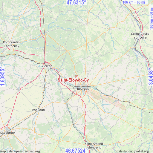
Saint-Éloy-de-Gy GPS coordinates[2]
47° 9' 19.872" North, 2° 20' 33.612" East
| Map corner | latitude | longitude |
|---|---|---|
| Upper-left | 47.6315°, | 1.63955° |
| Center: | 47.15552°, | 2.34267° |
| Lower-right: | 46.67524°, | 3.0458° |
| Map W x H: | 106.3×106.3 km | = 66.1×66.1mi |
| max Lat: | 51.07786° ⇑53.6% North |
| Saint-Éloy-de-Gy: | 47.15552° |
| min Lat: | ⇓46.4% South 41.3874° |
| min Long | Saint-Éloy-de- | max Long |
| -5.08615° | 2.34267° | 9.52242° |
| W 48%⇐ | ⇒52% E |
Elevation
Elevation of Saint-Éloy-de-Gy is 157 m = 515 ft, and this is 36.7 m = 120 ft below average elevation for this country.
| Max E: |
2333 m = 7654 ft | 43.2% |
| Avg. | 193.7 m = 635 ft | |
| Saint-Éloy-de-Gy | 157 m = 515 ft | |
Min E: |
-1 m = -3 ft | 56.8% |
See also: France elevation on elevation.city.
Geographical zone
Saint-Éloy-de-Gy is located in North temperate zone (between Tropic of Cancer and the Arctic Circle). Distance of this North polar circle is 2158 km =1340.9 mi to North.| Distance of | km | miles | from Saint-Éloy-de-Gy |
|---|---|---|---|
| North Pole | 4763.9 | 2960.1 | to North |
| Arctic Circle | 2158 | 1340.9 | to North |
| Tropic Cancer | 2637.3 | 1638.7 | to South |
| Equator | 5243.2 | 3258 | to South |


Nearby cities:
15 places around Saint-Éloy-de-Gy: (largest is in red/bold)
• Allogny
8 km =5 mi,  347°
347°
• Allouis
8.8 km =5.5 mi,  277°
277°
• Berry-Bouy
6.5 km =4 mi,  218°
218°
• Bourges
9.1 km =5.7 mi,  151°
151°
• Fussy
6.7 km =4.2 mi,  101°
101°
• La Chapelle-Saint-Ursin
10.4 km =6.5 mi,  187°
187°
• Marmagne
7.6 km =4.7 mi, 216°
• Mehun-sur-Yèvre
10.1 km =6.3 mi,  258°
258°
• Pigny
7.7 km =4.8 mi,  72°
72°
• Saint-Doulchard
5.8 km =3.6 mi,  173°
173°
• Saint-Georges-sur-Moulon
7.2 km =4.5 mi,  57°
57°
• Saint-Martin-d’Auxigny
7.7 km =4.8 mi,  45°
45°
• Saint-Palais
10.4 km =6.5 mi,  34°
34°
• Vasselay
3.6 km =2.2 mi,  87°
87°
• Vignoux-sous-les-Aix
9.9 km =6.2 mi, 68°
Sources, notices
• [Note1] Compared only with cities in France existing in our database
• [Src1] Map data: © OpenStreetMap contributors (CC-BY-SA)
• [Src2] Other city data from geonames.org with taken over terms of usage.
• [Src3] Geographical zone / Annual Mean Temperature by Robert A. Rohde @ Wikipedia
