Saint-Laurent-du-Mottay geodata
Saint-Laurent-du-Mottay (Pays de la Loire) is a populated place; located in France in Europe/Paris (GMT+2) time zone. With population of 746 people, there are 11210 cities with bigger population in this country. Compared to other cities in France, 50.7% of cities are located further ↑North; 87.7% of cities are located further →East and 70.1% of cities have higher elevation than Saint-Laurent-du-Mottay. Note1
Administrative division(s):
- Level 1: Pays de la Loire
- Level 2: Département de Maine-et-Loire
- Level 3: Arrondissement de Cholet
- Level 4: Mauges-sur-Loire
Current local time in Saint-Laurent-du-Mottay:
12:45 PM, SaturdayDifference from your time zone: hours


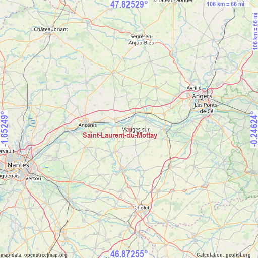
Saint-Laurent-du-Mottay GPS coordinates[2]
47° 21' 3.852" North, 0° 56' 57.732" West
| Map corner | latitude | longitude |
|---|---|---|
| Upper-left | 47.82529°, | -1.65249° |
| Center: | 47.35107°, | -0.94937° |
| Lower-right: | 46.87255°, | -0.24624° |
| Map W x H: | 105.9×105.9 km | = 65.8×65.8mi |
| max Lat: | 51.07786° ⇑50.7% North |
| Saint-Laurent-du-Mottay: | 47.35107° |
| min Lat: | ⇓49.3% South 41.3874° |
| min Long | Saint-Laurent-d | max Long |
| -5.08615° | -0.94937° | 9.52242° |
| W 12.3%⇐ | ⇒87.7% E |
Elevation
Elevation of Saint-Laurent-du-Mottay is 78 m = 256 ft, and this is 115.7 m = 380 ft below average elevation for this country.
| Max E: |
2333 m = 7654 ft | 70.1% |
| Avg. | 193.7 m = 635 ft | |
| Saint-Laurent-du-Mottay | 78 m = 256 ft | |
Min E: |
-1 m = -3 ft | 29.9% |
See also: France elevation on elevation.city.
Geographical zone
Saint-Laurent-du-Mottay is located in North temperate zone (between Tropic of Cancer and the Arctic Circle). Distance of this North polar circle is 2136.2 km =1327.4 mi to North.| Distance of | km | miles | from Saint-Laurent-du-Mottay |
|---|---|---|---|
| North Pole | 4742.1 | 2946.6 | to North |
| Arctic Circle | 2136.2 | 1327.4 | to North |
| Tropic Cancer | 2659 | 1652.2 | to South |
| Equator | 5264.9 | 3271.5 | to South |


Nearby cities:
15 places around Saint-Laurent-du-Mottay: (largest is in red/bold)
• Botz-en-Mauges
6.3 km =3.9 mi,  218°
218°
• Bourgneuf-en-Mauges
9.6 km =6 mi,  116°
116°
• Champtocé-sur-Loire
9.3 km =5.8 mi,  43°
43°
• Chaudron-en-Mauges
7.5 km =4.7 mi,  201°
201°
• Ingrandes
6.3 km =3.9 mi,  18°
18°
• La Chapelle-Saint-Florent
8.3 km =5.2 mi,  256°
256°
• La Chapelle-Saint-Sauveur
10.4 km =6.5 mi,  345°
345°
• La Pommeraye
6.8 km =4.2 mi,  85°
85°
• Le Fresne-sur-Loire
5.8 km =3.6 mi, 15°
• Le Marillais
9.6 km =6 mi,  274°
274°
• Le Mesnil-en-Vallée
1.9 km =1.2 mi,  34°
34°
• Montjean-sur-Loire
8 km =5 mi,  58°
58°
• Saint-Florent-le-Vieil
5.1 km =3.2 mi,  282°
282°
• Saint-Quentin-en-Mauges
7.2 km =4.5 mi,  156°
156°
• Varades
7 km =4.3 mi,  302°
302°
Sources, notices
• [Note1] Compared only with cities in France existing in our database
• [Src1] Map data: © OpenStreetMap contributors (CC-BY-SA)
• [Src2] Other city data from geonames.org with taken over terms of usage.
• [Src3] Geographical zone / Annual Mean Temperature by Robert A. Rohde @ Wikipedia
