Saint-Hilaire-sur-Erre geodata
Saint-Hilaire-sur-Erre (Normandy) is a populated place; located in France in Europe/Paris (GMT+2) time zone. With population of 534 people, there are 14532 cities with bigger population in this country. Compared to other cities in France, 64.8% of cities are located further ↓South; 71.1% of cities are located further →East and 51.4% of cities have higher elevation than Saint-Hilaire-sur-Erre. Note1
Administrative division(s):
- Level 1: Normandy
- Level 2: Département de l'Orne
- Level 3: Arrondissement de Mortagne-au-Perche
- Level 4: Saint-Hilaire-sur-Erre
Current local time in Saint-Hilaire-sur-Erre:
08:36 AM, SaturdayDifference from your time zone: hours


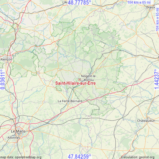
Saint-Hilaire-sur-Erre GPS coordinates[2]
48° 18' 44.496" North, 0° 44' 21.264" East
| Map corner | latitude | longitude |
|---|---|---|
| Upper-left | 48.77785°, | 0.03611° |
| Center: | 48.31236°, | 0.73924° |
| Lower-right: | 47.84259°, | 1.44237° |
| Map W x H: | 104×104 km | = 64.6×64.6mi |
| max Lat: | 51.07786° ⇑35.2% North |
| Saint-Hilaire-sur-Erre: | 48.31236° |
| min Lat: | ⇓64.8% South 41.3874° |
| min Long | Saint-Hilaire-s | max Long |
| -5.08615° | 0.73924° | 9.52242° |
| W 28.9%⇐ | ⇒71.1% E |
Elevation
Elevation of Saint-Hilaire-sur-Erre is 127 m = 417 ft, and this is 66.7 m = 219 ft below average elevation for this country.
| Max E: |
2333 m = 7654 ft | 51.4% |
| Avg. | 193.7 m = 635 ft | |
| Saint-Hilaire-sur-Erre | 127 m = 417 ft | |
Min E: |
-1 m = -3 ft | 48.6% |
See also: France elevation on elevation.city.
Geographical zone
Saint-Hilaire-sur-Erre is located in North temperate zone (between Tropic of Cancer and the Arctic Circle). Distance of this North polar circle is 2029.3 km =1260.9 mi to North.| Distance of | km | miles | from Saint-Hilaire-sur-Erre |
|---|---|---|---|
| North Pole | 4635.2 | 2880.2 | to North |
| Arctic Circle | 2029.3 | 1260.9 | to North |
| Tropic Cancer | 2765.9 | 1718.7 | to South |
| Equator | 5371.8 | 3337.9 | to South |


Nearby cities:
15 places around Saint-Hilaire-sur-Erre: (largest is in red/bold)
• Avezé
10.5 km =6.5 mi,  205°
205°
• Brunelles
11.5 km =7.1 mi,  83°
83°
• Ceton
9.6 km =6 mi,  175°
175°
• Cherreau
13.9 km =8.6 mi,  197°
197°
• Condé-sur-Huisne
11.2 km =7 mi,  47°
47°
• La Rouge
3.6 km =2.2 mi,  218°
218°
• Margon
7.5 km =4.7 mi,  69°
69°
• Mâle
4.5 km =2.8 mi, 181°
• Nocé
8.6 km =5.3 mi,  330°
330°
• Nogent-le-Rotrou
6.2 km =3.9 mi, 80°
• Préaux-du-Perche
2.9 km =1.8 mi,  324°
324°
• Préval
12.1 km =7.5 mi, 224°
• Rémalard
13.2 km =8.2 mi,  10°
10°
• Saint-Germain-de-la-Coudre
10.5 km =6.5 mi,  250°
250°
• Souancé-au-Perche
10 km =6.2 mi,  120°
120°
Sources, notices
• [Note1] Compared only with cities in France existing in our database
• [Src1] Map data: © OpenStreetMap contributors (CC-BY-SA)
• [Src2] Other city data from geonames.org with taken over terms of usage.
• [Src3] Geographical zone / Annual Mean Temperature by Robert A. Rohde @ Wikipedia
