Nontron geodata
Nontron (Nouvelle-Aquitaine) is a seat of a third-order administrative division; located in France in Europe/Paris (GMT+2) time zone. With population of 3,778 people, there are 2594 cities with bigger population in this country. Compared to other cities in France, 73.7% of cities are located further ↑North; 71.8% of cities are located further →East and 69% of cities have lower elevation than Nontron. Note1
Administrative division(s):
- Level 1: Nouvelle-Aquitaine
- Level 2: Dordogne
- Level 3: Arrondissement de Nontron
- Level 4: Nontron


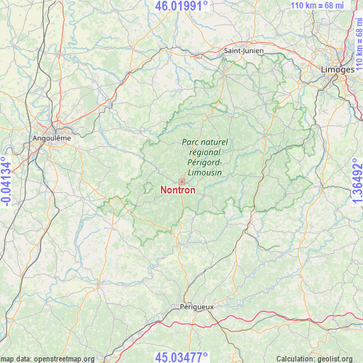
Nontron GPS coordinates[2]
45° 31' 46.2" North, 0° 39' 42.444" East
| Map corner | latitude | longitude |
|---|---|---|
| Upper-left | 46.01991°, | -0.04134° |
| Center: | 45.5295°, | 0.66179° |
| Lower-right: | 45.03477°, | 1.36492° |
| Map W x H: | 109.5×109.5 km | = 68×68mi |
| max Lat: | 51.07786° ⇑73.7% North |
| Nontron: | 45.5295° |
| min Lat: | ⇓26.3% South 41.3874° |
| min Long | Nontron | max Long |
| -5.08615° | 0.66179° | 9.52242° |
| W 28.2%⇐ | ⇒71.8% E |
Elevation
Elevation of Nontron is 214 m = 702 ft, and this is 20.3 m = 67 ft above average elevation for this country.
| Max E: |
2333 m = 7654 ft | 31% |
| Nontron | 214 m 702 ft | |
| Avg. | 193.7 m = 635 ft | |
Min E: |
-1 m = -3 ft | 69% |
See also: France elevation on elevation.city.
Geographical zone
Nontron is located in North temperate zone (between Tropic of Cancer and the Arctic Circle). Distance of this North polar circle is 2338.8 km =1453.3 mi to North.| Distance of | km | miles | from Nontron |
|---|---|---|---|
| North Pole | 4944.7 | 3072.5 | to North |
| Arctic Circle | 2338.8 | 1453.3 | to North |
| Tropic Cancer | 2456.5 | 1526.4 | to South |
| Equator | 5062.4 | 3145.6 | to South |


Nearby cities:
15 places around Nontron: (largest is in red/bold)
• Abjat-sur-Bandiat
9.7 km =6 mi,  50°
50°
• Augignac
7.3 km =4.5 mi,  23°
23°
• Bussière-Badil
14.3 km =8.9 mi,  341°
341°
• Champagnac-de-Belair
14.7 km =9.1 mi,  168°
168°
• Champniers-et-Reilhac
16.2 km =10.1 mi, 20°
• Javerlhac-et-la-Chapelle-Saint-Robert
9 km =5.6 mi,  299°
299°
• Marval
15.2 km =9.4 mi,  44°
44°
• Milhac-de-Nontron
11.6 km =7.2 mi,  126°
126°
• Piégut-Pluviers
10.6 km =6.6 mi,  11°
11°
• Saint-Estèphe
7 km =4.3 mi,  1°
1°
• Saint-Front-la-Rivière
8.2 km =5.1 mi,  141°
141°
• Saint-Martial-de-Valette
1.7 km =1.1 mi,  212°
212°
• Saint-Pardoux-la-Rivière
7.7 km =4.8 mi,  120°
120°
• Saint-Saud-Lacoussière
12.3 km =7.6 mi,  82°
82°
• Villars
14.2 km =8.8 mi,  149°
149°
Sources, notices
• [Note1] Compared only with cities in France existing in our database
• [Src1] Map data: © OpenStreetMap contributors (CC-BY-SA)
• [Src2] Other city data from geonames.org with taken over terms of usage.
• [Src3] Geographical zone / Annual Mean Temperature by Robert A. Rohde @ Wikipedia
