Javerlhac-et-la-Chapelle-Saint-Robert geodata
Javerlhac-et-la-Chapelle-Saint-Robert (Nouvelle-Aquitaine) is a populated place; located in France in Europe/Paris (GMT+2) time zone. With population of 892 people, there are 9724 cities with bigger population in this country. Compared to other cities in France, 73% of cities are located further ↑North; 72.8% of cities are located further →East and 51.4% of cities have higher elevation than Javerlhac-et-la-Chapelle-Saint-Robert. Note1
Administrative division(s):
- Level 1: Nouvelle-Aquitaine
- Level 2: Dordogne
- Level 3: Arrondissement de Nontron
- Level 4: Javerlhac-et-la-Chapelle-Saint-Robert
Current local time in Javerlhac-et-la-Chapelle-Saint-Robert:
05:56 AM, WednesdayDifference from your time zone: hours


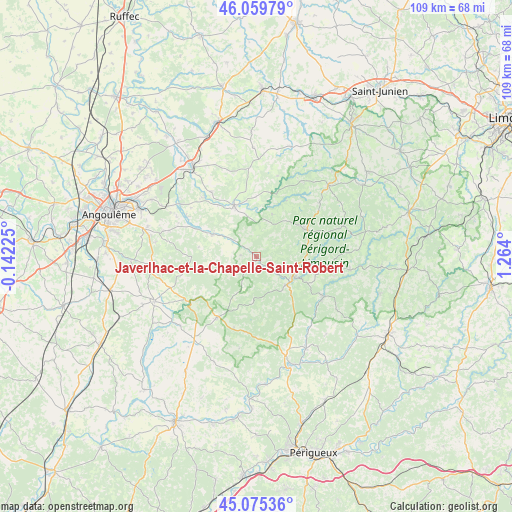
Javerlhac-et-la-Chapelle-Saint-Robert GPS coordinates[2]
45° 34' 11.028" North, 0° 33' 39.168" East
| Map corner | latitude | longitude |
|---|---|---|
| Upper-left | 46.05979°, | -0.14225° |
| Center: | 45.56973°, | 0.56088° |
| Lower-right: | 45.07536°, | 1.264° |
| Map W x H: | 109.5×109.5 km | = 68×68mi |
| max Lat: | 51.07786° ⇑73% North |
| Javerlhac-et-la-Chapelle-Saint-Robert: | 45.56973° |
| min Lat: | ⇓27% South 41.3874° |
| min Long | Javerlhac-et-la | max Long |
| -5.08615° | 0.56088° | 9.52242° |
| W 27.2%⇐ | ⇒72.8% E |
Elevation
Elevation of Javerlhac-et-la-Chapelle-Saint-Robert is 127 m = 417 ft, and this is 66.7 m = 219 ft below average elevation for this country.
| Max E: |
2333 m = 7654 ft | 51.4% |
| Avg. | 193.7 m = 635 ft | |
| Javerlhac-et-la-Chapelle-Saint-Robert | 127 m = 417 ft | |
Min E: |
-1 m = -3 ft | 48.6% |
See also: France elevation on elevation.city.
Geographical zone
Javerlhac-et-la-Chapelle-Saint-Robert is located in North temperate zone (between Tropic of Cancer and the Arctic Circle). Distance of this North polar circle is 2334.3 km =1450.5 mi to North.| Distance of | km | miles | from Javerlhac-et-la-Chapelle-Saint-Robert |
|---|---|---|---|
| North Pole | 4940.2 | 3069.7 | to North |
| Arctic Circle | 2334.3 | 1450.5 | to North |
| Tropic Cancer | 2461 | 1529.2 | to South |
| Equator | 5066.9 | 3148.4 | to South |


Nearby cities:
15 places around Javerlhac-et-la-Chapelle-Saint-Robert: (largest is in red/bold)
• Abjat-sur-Bandiat
15.5 km =9.6 mi,  83°
83°
• Augignac
11 km =6.8 mi, 78°
• Busserolles
13.5 km =8.4 mi,  28°
28°
• Bussière-Badil
9.7 km =6 mi,  20°
20°
• Mareuil
15.9 km =9.9 mi,  212°
212°
• Marthon
10.5 km =6.5 mi,  298°
298°
• Montbron
11.8 km =7.3 mi,  336°
336°
• Nontron
9 km =5.6 mi,  119°
119°
• Piégut-Pluviers
11.7 km =7.3 mi,  59°
59°
• Saint-Estèphe
8.4 km =5.2 mi,  72°
72°
• Saint-Martial-de-Valette
9.1 km =5.7 mi,  130°
130°
• Saint-Pardoux-la-Rivière
16.7 km =10.4 mi, 120°
• Saint-Sornin
16.8 km =10.4 mi,  324°
324°
• Vouzan
16.8 km =10.4 mi,  281°
281°
• Écuras
12.7 km =7.9 mi,  2°
2°
Sources, notices
• [Note1] Compared only with cities in France existing in our database
• [Src1] Map data: © OpenStreetMap contributors (CC-BY-SA)
• [Src2] Other city data from geonames.org with taken over terms of usage.
• [Src3] Geographical zone / Annual Mean Temperature by Robert A. Rohde @ Wikipedia
