Saint-Étienne-de-Baïgorry geodata
Saint-Étienne-de-Baïgorry (Nouvelle-Aquitaine) is a populated place; located in France in Europe/Paris (GMT+2) time zone. With population of 1,646 people, there are 5676 cities with bigger population in this country. Compared to other cities in France, 97.4% of cities are located further ↑North; 91.1% of cities are located further →East and 58.7% of cities have lower elevation than Saint-Étienne-de-Baïgorry. Note1
Administrative division(s):
- Level 1: Nouvelle-Aquitaine
- Level 2: Département des Pyrénées-Atlantiques
- Level 3: Arrondissement de Bayonne
- Level 4: Saint-Étienne-de-Baïgorry
Current local time in Saint-Étienne-de-Baïgorry:
05:25 PM, SaturdayDifference from your time zone: hours


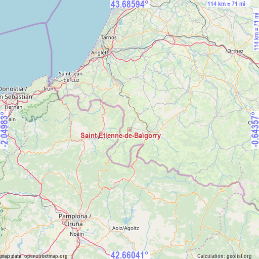
Saint-Étienne-de-Baïgorry GPS coordinates[2]
43° 10' 31.188" North, 1° 20' 48.12" West
| Map corner | latitude | longitude |
|---|---|---|
| Upper-left | 43.68594°, | -2.04983° |
| Center: | 43.17533°, | -1.3467° |
| Lower-right: | 42.66041°, | -0.64357° |
| Map W x H: | 114×114 km | = 70.8×70.8mi |
| max Lat: | 51.07786° ⇑97.4% North |
| Saint-Étienne-de-Baïgorry: | 43.17533° |
| min Lat: | ⇓2.6% South 41.3874° |
| min Long | Saint-Étienne- | max Long |
| -5.08615° | -1.3467° | 9.52242° |
| W 8.9%⇐ | ⇒91.1% E |
Elevation
Elevation of Saint-Étienne-de-Baïgorry is 164 m = 538 ft, and this is 29.7 m = 97 ft below average elevation for this country.
| Max E: |
2333 m = 7654 ft | 41.3% |
| Avg. | 193.7 m = 635 ft | |
| Saint-Étienne-de-Baïgorry | 164 m = 538 ft | |
Min E: |
-1 m = -3 ft | 58.7% |
See also: France elevation on elevation.city.
Geographical zone
Saint-Étienne-de-Baïgorry is located in North temperate zone (between Tropic of Cancer and the Arctic Circle). Distance of this Northern Tropic circle is 2194.7 km =1363.7 mi to South.| Distance of | km | miles | from Saint-Étienne-de-Baïgorry |
|---|---|---|---|
| North Pole | 5206.4 | 3235.1 | to North |
| Arctic Circle | 2600.5 | 1615.9 | to North |
| Tropic Cancer | 2194.7 | 1363.7 | to South |
| Equator | 4800.6 | 2983 | to South |


Nearby cities:
15 places around Saint-Étienne-de-Baïgorry: (largest is in red/bold)
• Ainhoa
18.6 km =11.6 mi,  318°
318°
• Bidarray
10.1 km =6.3 mi,  359°
359°
• Cambo-les-Bains
20.8 km =12.9 mi,  347°
347°
• Espelette
20.1 km =12.5 mi,  336°
336°
• Hélette
16.9 km =10.5 mi,  29°
29°
• Irissarry
13 km =8.1 mi,  45°
45°
• Ispoure
9.1 km =5.7 mi,  93°
93°
• Itxassou
17.7 km =11 mi, 344°
• Louhossoa
15.7 km =9.8 mi, 358°
• Macaye
17.5 km =10.9 mi,  7°
7°
• Mendionde
18.6 km =11.6 mi, 11°
• Ossès
8.9 km =5.5 mi, 34°
• Saint-Jean-Pied-de-Port
9 km =5.6 mi,  98°
98°
• Saint-Jean-le-Vieux
12.3 km =7.6 mi, 95°
• Uhart-Cize
8.5 km =5.3 mi, 99°
In other languages:
- In Spanish: Baigorri
- In France: Saint-Etienne-de-Baigorry, Saint-Étienne-de-Baïgorry
- In Russian: Сент-Этьен-де-Баигорри
- In Chinese: 圣埃蒂安德拜戈尔里
Sources, notices
• [Note1] Compared only with cities in France existing in our database
• [Src1] Map data: © OpenStreetMap contributors (CC-BY-SA)
• [Src2] Other city data from geonames.org with taken over terms of usage.
• [Src3] Geographical zone / Annual Mean Temperature by Robert A. Rohde @ Wikipedia
