Irissarry geodata
Irissarry (Nouvelle-Aquitaine) is a populated place; located in France in Europe/Paris (GMT+2) time zone. With population of 791 people, there are 10703 cities with bigger population in this country. Compared to other cities in France, 96.5% of cities are located further ↑North; 90.2% of cities are located further →East and 67% of cities have lower elevation than Irissarry. Note1
Administrative division(s):
- Level 1: Nouvelle-Aquitaine
- Level 2: Département des Pyrénées-Atlantiques
- Level 3: Arrondissement de Bayonne
- Level 4: Irissarry


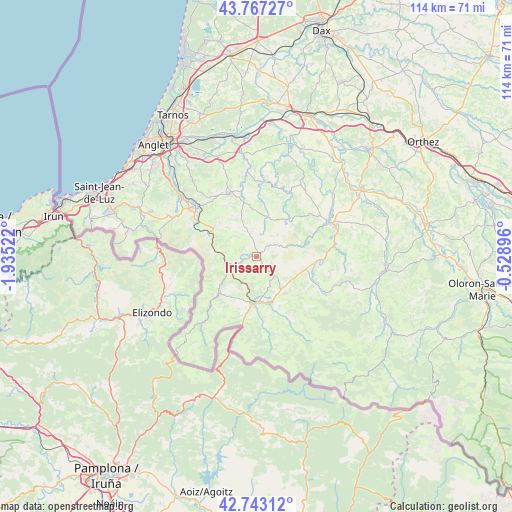
Irissarry GPS coordinates[2]
43° 15' 26.46" North, 1° 13' 55.524" West
| Map corner | latitude | longitude |
|---|---|---|
| Upper-left | 43.76727°, | -1.93522° |
| Center: | 43.25735°, | -1.23209° |
| Lower-right: | 42.74312°, | -0.52896° |
| Map W x H: | 113.9×113.9 km | = 70.8×70.8mi |
| max Lat: | 51.07786° ⇑96.5% North |
| Irissarry: | 43.25735° |
| min Lat: | ⇓3.5% South 41.3874° |
| min Long | Irissarry | max Long |
| -5.08615° | -1.23209° | 9.52242° |
| W 9.8%⇐ | ⇒90.2% E |
Elevation
Elevation of Irissarry is 204 m = 669 ft, and this is 10.3 m = 34 ft above average elevation for this country.
| Max E: |
2333 m = 7654 ft | 33% |
| Irissarry | 204 m 669 ft | |
| Avg. | 193.7 m = 635 ft | |
Min E: |
-1 m = -3 ft | 67% |
See also: France elevation on elevation.city.
Geographical zone
Irissarry is located in North temperate zone (between Tropic of Cancer and the Arctic Circle). Distance of this Northern Tropic circle is 2203.8 km =1369.4 mi to South.| Distance of | km | miles | from Irissarry |
|---|---|---|---|
| North Pole | 5197.3 | 3229.5 | to North |
| Arctic Circle | 2591.4 | 1610.2 | to North |
| Tropic Cancer | 2203.8 | 1369.4 | to South |
| Equator | 4809.8 | 2988.7 | to South |


Nearby cities:
15 places around Irissarry: (largest is in red/bold)
• Ayherre
15 km =9.3 mi,  353°
353°
• Beyrie-sur-Joyeuse
14.9 km =9.3 mi,  63°
63°
• Bidarray
9.4 km =5.8 mi,  275°
275°
• Hasparren
15.2 km =9.4 mi,  337°
337°
• Hélette
5.7 km =3.5 mi, 350°
• Ispoure
9.7 km =6 mi,  180°
180°
• Itxassou
16.2 km =10.1 mi,  299°
299°
• Louhossoa
11.7 km =7.3 mi, 304°
• Macaye
10.9 km =6.8 mi,  318°
318°
• Mendionde
10.6 km =6.6 mi,  328°
328°
• Ossès
4.6 km =2.9 mi,  247°
247°
• Saint-Jean-Pied-de-Port
10.4 km =6.5 mi, 182°
• Saint-Jean-le-Vieux
10.7 km =6.6 mi,  163°
163°
• Saint-Étienne-de-Baïgorry
13 km =8.1 mi,  225°
225°
• Uhart-Cize
10.6 km =6.6 mi,  185°
185°
Sources, notices
• [Note1] Compared only with cities in France existing in our database
• [Src1] Map data: © OpenStreetMap contributors (CC-BY-SA)
• [Src2] Other city data from geonames.org with taken over terms of usage.
• [Src3] Geographical zone / Annual Mean Temperature by Robert A. Rohde @ Wikipedia
