Préveranges geodata
Préveranges (Centre) is a populated place; located in France in Europe/Paris (GMT+2) time zone. With population of 674 people, there are 12156 cities with bigger population in this country. Compared to other cities in France, 60.7% of cities are located further ↑North; 53.4% of cities are located further →East and 90% of cities have lower elevation than Préveranges. Note1
Administrative division(s):
- Level 1: Centre
- Level 2: Cher
- Level 3: Arrondissement de Saint-Amand-Montrond
- Level 4: Préveranges


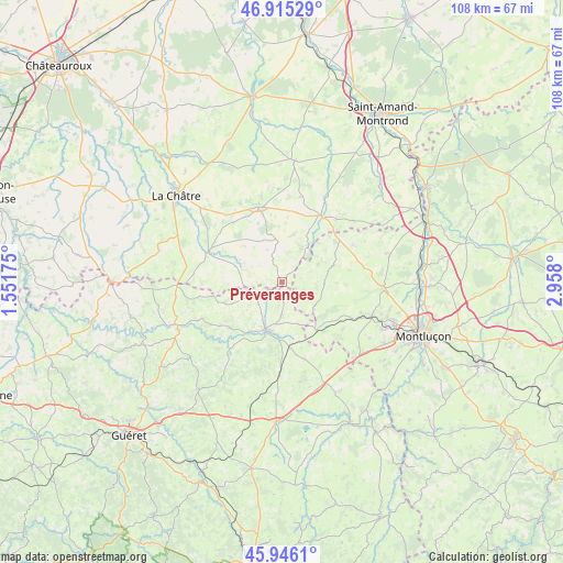
Préveranges GPS coordinates[2]
46° 25' 58.26" North, 2° 15' 17.532" East
| Map corner | latitude | longitude |
|---|---|---|
| Upper-left | 46.91529°, | 1.55175° |
| Center: | 46.43285°, | 2.25487° |
| Lower-right: | 45.9461°, | 2.958° |
| Map W x H: | 107.8×107.8 km | = 67×67mi |
| max Lat: | 51.07786° ⇑60.7% North |
| Préveranges: | 46.43285° |
| min Lat: | ⇓39.3% South 41.3874° |
| min Long | Préveranges | max Long |
| -5.08615° | 2.25487° | 9.52242° |
| W 46.6%⇐ | ⇒53.4% E |
Elevation
Elevation of Préveranges is 427 m = 1401 ft, and this is 233.3 m = 765 ft above average elevation for this country.
| Max E: |
2333 m = 7654 ft | 10% |
| Préveranges | 427 m 1401 ft | |
| Avg. | 193.7 m = 635 ft | |
Min E: |
-1 m = -3 ft | 90% |
See also: France elevation on elevation.city.
Geographical zone
Préveranges is located in North temperate zone (between Tropic of Cancer and the Arctic Circle). Distance of this North polar circle is 2238.3 km =1390.8 mi to North.| Distance of | km | miles | from Préveranges |
|---|---|---|---|
| North Pole | 4844.2 | 3010 | to North |
| Arctic Circle | 2238.3 | 1390.8 | to North |
| Tropic Cancer | 2556.9 | 1588.8 | to South |
| Equator | 5162.8 | 3208 | to South |


Nearby cities:
15 places around Préveranges: (largest is in red/bold)
• Boussac
9.8 km =6.1 mi,  195°
195°
• Boussac-Bourg
8.2 km =5.1 mi,  191°
191°
• Briantes
22.6 km =14 mi,  307°
307°
• Châteaumeillant
15.1 km =9.4 mi,  342°
342°
• Clugnat
17.3 km =10.7 mi,  217°
217°
• Culan
14.8 km =9.2 mi,  29°
29°
• Genouillac
22.1 km =13.7 mi,  245°
245°
• Huriel
18.3 km =11.4 mi,  111°
111°
• La Chapelaude
19.2 km =11.9 mi,  94°
94°
• Pouligny-Notre-Dame
19.1 km =11.9 mi,  287°
287°
• Saint-Martinien
19.8 km =12.3 mi,  123°
123°
• Saint-Silvain-Bas-le-Roc
11.5 km =7.1 mi, 190°
• Sainte-Sévère-sur-Indre
15.3 km =9.5 mi, 292°
• Soumans
15.2 km =9.4 mi,  164°
164°
• Vesdun
17.8 km =11.1 mi,  48°
48°
Sources, notices
• [Note1] Compared only with cities in France existing in our database
• [Src1] Map data: © OpenStreetMap contributors (CC-BY-SA)
• [Src2] Other city data from geonames.org with taken over terms of usage.
• [Src3] Geographical zone / Annual Mean Temperature by Robert A. Rohde @ Wikipedia
