Boussac-Bourg geodata
Boussac-Bourg (Nouvelle-Aquitaine) is a populated place; located in France in Europe/Paris (GMT+2) time zone. With population of 800 people, there are 10613 cities with bigger population in this country. Compared to other cities in France, 61.6% of cities are located further ↑North; 53.8% of cities are located further →East and 90% of cities have lower elevation than Boussac-Bourg. Note1
Administrative division(s):
- Level 1: Nouvelle-Aquitaine
- Level 2: Creuse
- Level 3: Aubusson
- Level 4: Boussac-Bourg


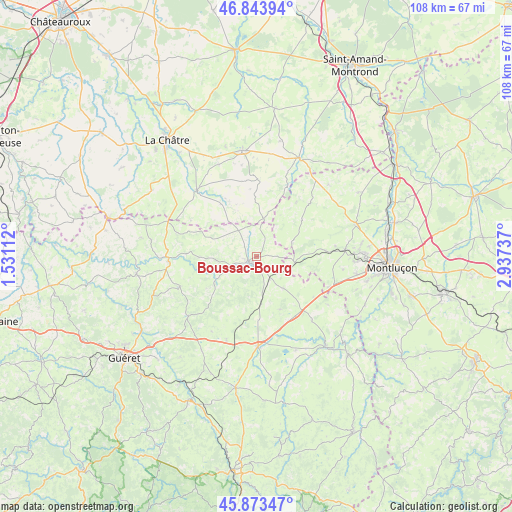
Boussac-Bourg GPS coordinates[2]
46° 21' 39.096" North, 2° 14' 3.3" East
| Map corner | latitude | longitude |
|---|---|---|
| Upper-left | 46.84394°, | 1.53112° |
| Center: | 46.36086°, | 2.23425° |
| Lower-right: | 45.87347°, | 2.93737° |
| Map W x H: | 107.9×107.9 km | = 67×67mi |
| max Lat: | 51.07786° ⇑61.6% North |
| Boussac-Bourg: | 46.36086° |
| min Lat: | ⇓38.4% South 41.3874° |
| min Long | Boussac-Bourg | max Long |
| -5.08615° | 2.23425° | 9.52242° |
| W 46.2%⇐ | ⇒53.8% E |
Elevation
Elevation of Boussac-Bourg is 426 m = 1398 ft, and this is 232.3 m = 762 ft above average elevation for this country.
| Max E: |
2333 m = 7654 ft | 10% |
| Boussac-Bourg | 426 m 1398 ft | |
| Avg. | 193.7 m = 635 ft | |
Min E: |
-1 m = -3 ft | 90% |
See also: France elevation on elevation.city.
Geographical zone
Boussac-Bourg is located in North temperate zone (between Tropic of Cancer and the Arctic Circle). Distance of this North polar circle is 2246.3 km =1395.8 mi to North.| Distance of | km | miles | from Boussac-Bourg |
|---|---|---|---|
| North Pole | 4852.2 | 3015 | to North |
| Arctic Circle | 2246.3 | 1395.8 | to North |
| Tropic Cancer | 2548.9 | 1583.8 | to South |
| Equator | 5154.8 | 3203 | to South |


Nearby cities:
15 places around Boussac-Bourg: (largest is in red/bold)
• Boussac
1.8 km =1.1 mi,  217°
217°
• Châtelus-Malvaleix
17.3 km =10.7 mi,  248°
248°
• Clugnat
10.7 km =6.6 mi,  237°
237°
• Genouillac
18.6 km =11.6 mi,  266°
266°
• Gouzon
18.8 km =11.7 mi,  178°
178°
• Huriel
18.7 km =11.6 mi,  85°
85°
• Parsac
18.7 km =11.6 mi,  199°
199°
• Pouligny-Notre-Dame
21.5 km =13.4 mi,  309°
309°
• Préveranges
8.2 km =5.1 mi,  11°
11°
• Quinssaines
21.5 km =13.4 mi,  100°
100°
• Saint-Martinien
18.4 km =11.4 mi, 98°
• Saint-Silvain-Bas-le-Roc
3.3 km =2.1 mi,  187°
187°
• Sainte-Sévère-sur-Indre
18.8 km =11.7 mi,  318°
318°
• Soumans
8.6 km =5.3 mi,  139°
139°
• Vallière
19.5 km =12.1 mi,  123°
123°
Sources, notices
• [Note1] Compared only with cities in France existing in our database
• [Src1] Map data: © OpenStreetMap contributors (CC-BY-SA)
• [Src2] Other city data from geonames.org with taken over terms of usage.
• [Src3] Geographical zone / Annual Mean Temperature by Robert A. Rohde @ Wikipedia
