Sainte-Cécile-les-Vignes geodata
Sainte-Cécile-les-Vignes (Provence-Alpes-Côte d'Azur) is a populated place; located in France in Europe/Paris (GMT+2) time zone. With population of 2,273 people, there are 4236 cities with bigger population in this country. Compared to other cities in France, 85.2% of cities are located further ↑North; 76.3% of cities are located further ←West and 56.5% of cities have higher elevation than Sainte-Cécile-les-Vignes. Note1
Administrative division(s):
- Level 1: Provence-Alpes-Côte d'Azur
- Level 2: Département du Vaucluse
- Level 3: Arrondissement de Carpentras
- Level 4: Sainte-Cécile-les-Vignes
Current local time in Sainte-Cécile-les-Vignes:
04:22 AM, WednesdayDifference from your time zone: hours


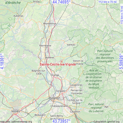
Sainte-Cécile-les-Vignes GPS coordinates[2]
44° 14' 43.512" North, 4° 53' 10.068" East
| Map corner | latitude | longitude |
|---|---|---|
| Upper-left | 44.74695°, | 4.18301° |
| Center: | 44.24542°, | 4.88613° |
| Lower-right: | 43.73957°, | 5.58926° |
| Map W x H: | 112×112 km | = 69.6×69.6mi |
| max Lat: | 51.07786° ⇑85.2% North |
| Sainte-Cécile-les-Vignes: | 44.24542° |
| min Lat: | ⇓14.8% South 41.3874° |
| min Long | Sainte-Cécile- | max Long |
| -5.08615° | 4.88613° | 9.52242° |
| W 76.3%⇐ | ⇒23.7% E |
Elevation
Elevation of Sainte-Cécile-les-Vignes is 112 m = 367 ft, and this is 81.7 m = 268 ft below average elevation for this country.
| Max E: |
2333 m = 7654 ft | 56.5% |
| Avg. | 193.7 m = 635 ft | |
| Sainte-Cécile-les-Vignes | 112 m = 367 ft | |
Min E: |
-1 m = -3 ft | 43.5% |
See also: France elevation on elevation.city.
Geographical zone
Sainte-Cécile-les-Vignes is located in North temperate zone (between Tropic of Cancer and the Arctic Circle). Distance of this Northern Tropic circle is 2313.7 km =1437.7 mi to South.| Distance of | km | miles | from Sainte-Cécile-les-Vignes |
|---|---|---|---|
| North Pole | 5087.4 | 3161.2 | to North |
| Arctic Circle | 2481.5 | 1541.9 | to North |
| Tropic Cancer | 2313.7 | 1437.7 | to South |
| Equator | 4919.6 | 3056.9 | to South |


Nearby cities:
15 places around Sainte-Cécile-les-Vignes: (largest is in red/bold)
• Bouchet
6.1 km =3.8 mi,  350°
350°
• Cairanne
4 km =2.5 mi,  110°
110°
• Camaret-sur-Aigues
9.1 km =5.7 mi,  186°
186°
• La Baume-de-Transit
10.3 km =6.4 mi, 350°
• Rasteau
8.2 km =5.1 mi,  101°
101°
• Roaix
10.4 km =6.5 mi,  89°
89°
• Rochegude
4.7 km =2.9 mi,  268°
268°
• Sablet
11.2 km =7 mi,  121°
121°
• Suze-la-Rousse
5.9 km =3.7 mi,  322°
322°
• Sérignan-du-Comtat
7.1 km =4.4 mi,  208°
208°
• Travaillan
7 km =4.3 mi,  170°
170°
• Tulette
5.8 km =3.6 mi,  38°
38°
• Uchaux
7.6 km =4.7 mi,  245°
245°
• Violès
10.8 km =6.7 mi,  149°
149°
• Visan
9.2 km =5.7 mi,  33°
33°
Sources, notices
• [Note1] Compared only with cities in France existing in our database
• [Src1] Map data: © OpenStreetMap contributors (CC-BY-SA)
• [Src2] Other city data from geonames.org with taken over terms of usage.
• [Src3] Geographical zone / Annual Mean Temperature by Robert A. Rohde @ Wikipedia
