Saint-Cyr-sur-Mer geodata
Saint-Cyr-sur-Mer (Provence-Alpes-Côte d'Azur) is a populated place; located in France in Europe/Paris (GMT+2) time zone. With population of 12,185 people, there are 788 cities with bigger population in this country. Compared to other cities in France, 97.4% of cities are located further ↑North; 84.4% of cities are located further ←West and 85.9% of cities have higher elevation than Saint-Cyr-sur-Mer. Note1
Administrative division(s):
- Level 1: Provence-Alpes-Côte d'Azur
- Level 2: Var
- Level 3: Arrondissement de Toulon
- Level 4: Saint-Cyr-sur-Mer


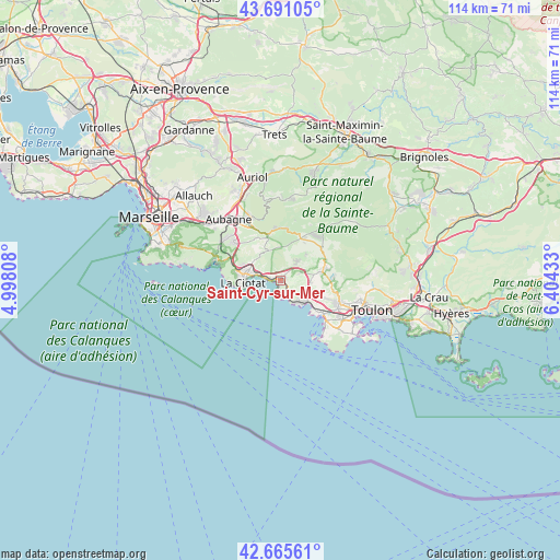
Saint-Cyr-sur-Mer GPS coordinates[2]
43° 10' 49.728" North, 5° 42' 4.32" East
| Map corner | latitude | longitude |
|---|---|---|
| Upper-left | 43.69105°, | 4.99808° |
| Center: | 43.18048°, | 5.7012° |
| Lower-right: | 42.66561°, | 6.40433° |
| Map W x H: | 114×114 km | = 70.8×70.8mi |
| max Lat: | 51.07786° ⇑97.4% North |
| Saint-Cyr-sur-Mer: | 43.18048° |
| min Lat: | ⇓2.6% South 41.3874° |
| min Long | Saint-Cyr-sur-M | max Long |
| -5.08615° | 5.7012° | 9.52242° |
| W 84.4%⇐ | ⇒15.6% E |
Elevation
Elevation of Saint-Cyr-sur-Mer is 40 m = 131 ft, and this is 153.7 m = 504 ft below average elevation for this country.
| Max E: |
2333 m = 7654 ft | 85.9% |
| Avg. | 193.7 m = 635 ft | |
| Saint-Cyr-sur-Mer | 40 m = 131 ft | |
Min E: |
-1 m = -3 ft | 14.1% |
See also: France elevation on elevation.city.
Geographical zone
Saint-Cyr-sur-Mer is located in North temperate zone (between Tropic of Cancer and the Arctic Circle). Distance of this Northern Tropic circle is 2195.3 km =1364.1 mi to South.| Distance of | km | miles | from Saint-Cyr-sur-Mer |
|---|---|---|---|
| North Pole | 5205.8 | 3234.7 | to North |
| Arctic Circle | 2600 | 1615.6 | to North |
| Tropic Cancer | 2195.3 | 1364.1 | to South |
| Equator | 4801.2 | 2983.3 | to South |


Nearby cities:
15 places around Saint-Cyr-sur-Mer: (largest is in red/bold)
• Aubagne
16.4 km =10.2 mi,  319°
319°
• Bandol
5.6 km =3.5 mi,  138°
138°
• Carnoux-en-Provence
13.9 km =8.6 mi,  307°
307°
• Cassis
13.8 km =8.6 mi,  286°
286°
• Ceyreste
6.9 km =4.3 mi,  302°
302°
• Cuges-les-Pins
10.6 km =6.6 mi,  359°
359°
• Gémenos
14.3 km =8.9 mi,  335°
335°
• La Ciotat
7.9 km =4.9 mi,  265°
265°
• Le Beausset
8.5 km =5.3 mi,  76°
76°
• Le Castellet
6.6 km =4.1 mi,  67°
67°
• Ollioules
12.7 km =7.9 mi,  110°
110°
• Roquefort-la-Bédoule
11.8 km =7.3 mi, 310°
• Sanary-sur-Mer
10.6 km =6.6 mi,  129°
129°
• Six-Fours-les-Plages
14.1 km =8.8 mi, 134°
• Évenos
11.9 km =7.4 mi,  99°
99°
Sources, notices
• [Note1] Compared only with cities in France existing in our database
• [Src1] Map data: © OpenStreetMap contributors (CC-BY-SA)
• [Src2] Other city data from geonames.org with taken over terms of usage.
• [Src3] Geographical zone / Annual Mean Temperature by Robert A. Rohde @ Wikipedia
