Saint-Bonnet-de-Mure geodata
Saint-Bonnet-de-Mure (Auvergne-Rhône-Alpes) is a populated place; located in France in Europe/Paris (GMT+2) time zone. With population of 5,890 people, there are 1678 cities with bigger population in this country. Compared to other cities in France, 71.1% of cities are located further ↑North; 77.9% of cities are located further ←West and 77.5% of cities have lower elevation than Saint-Bonnet-de-Mure. Note1
Administrative division(s):
- Level 1: Auvergne-Rhône-Alpes
- Level 2: Département du Rhône
- Level 3: Arrondissement de Lyon
- Level 4: Saint-Bonnet-de-Mure


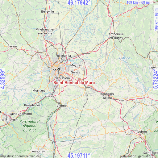
Saint-Bonnet-de-Mure GPS coordinates[2]
45° 41' 25.512" North, 5° 1' 44.832" East
| Map corner | latitude | longitude |
|---|---|---|
| Upper-left | 46.17942°, | 4.32599° |
| Center: | 45.69042°, | 5.02912° |
| Lower-right: | 45.19711°, | 5.73224° |
| Map W x H: | 109.2×109.2 km | = 67.9×67.9mi |
| max Lat: | 51.07786° ⇑71.1% North |
| Saint-Bonnet-de-Mure: | 45.69042° |
| min Lat: | ⇓28.9% South 41.3874° |
| min Long | Saint-Bonnet-de | max Long |
| -5.08615° | 5.02912° | 9.52242° |
| W 77.9%⇐ | ⇒22.1% E |
Elevation
Elevation of Saint-Bonnet-de-Mure is 268 m = 879 ft, and this is 74.3 m = 244 ft above average elevation for this country.
| Max E: |
2333 m = 7654 ft | 22.5% |
| Saint-Bonnet-de-Mure | 268 m 879 ft | |
| Avg. | 193.7 m = 635 ft | |
Min E: |
-1 m = -3 ft | 77.5% |
See also: France elevation on elevation.city.
Geographical zone
Saint-Bonnet-de-Mure is located in North temperate zone (between Tropic of Cancer and the Arctic Circle). Distance of this North polar circle is 2320.9 km =1442.1 mi to North.| Distance of | km | miles | from Saint-Bonnet-de-Mure |
|---|---|---|---|
| North Pole | 4926.8 | 3061.4 | to North |
| Arctic Circle | 2320.9 | 1442.1 | to North |
| Tropic Cancer | 2474.4 | 1537.5 | to South |
| Equator | 5080.3 | 3156.8 | to South |


Nearby cities:
15 places around Saint-Bonnet-de-Mure: (largest is in red/bold)
• Chassieu
7.6 km =4.7 mi,  323°
323°
• Genas
5 km =3.1 mi,  335°
335°
• Grenay
5 km =3.1 mi,  126°
126°
• Heyrieux
7 km =4.3 mi,  158°
158°
• Janneyrias
9.5 km =5.9 mi,  43°
43°
• Meyzieu
8.7 km =5.4 mi,  346°
346°
• Mions
6.7 km =4.2 mi,  242°
242°
• Pusignan
7.8 km =4.8 mi,  22°
22°
• Saint-Laurent-de-Mure
1.3 km =0.8 mi,  113°
113°
• Saint-Pierre-de-Chandieu
5 km =3.1 mi,  192°
192°
• Saint-Priest
6.7 km =4.2 mi,  275°
275°
• Saint-Quentin-Fallavier
8.3 km =5.2 mi, 128°
• Satolas-et-Bonce
7.9 km =4.9 mi,  87°
87°
• Toussieu
5.3 km =3.3 mi,  220°
220°
• Valencin
8.8 km =5.5 mi,  179°
179°
Sources, notices
• [Note1] Compared only with cities in France existing in our database
• [Src1] Map data: © OpenStreetMap contributors (CC-BY-SA)
• [Src2] Other city data from geonames.org with taken over terms of usage.
• [Src3] Geographical zone / Annual Mean Temperature by Robert A. Rohde @ Wikipedia
