Plémet geodata
Plémet (Brittany) is a populated place; located in France in Europe/Paris (GMT+2) time zone. With population of 3,161 people, there are 3079 cities with bigger population in this country. Compared to other cities in France, 62.4% of cities are located further ↓South; 96.5% of cities are located further →East and 54.2% of cities have lower elevation than Plémet. Note1
Administrative division(s):
- Level 1: Brittany
- Level 2: Département des Côtes-d’Armor
- Level 3: Arrondissement de Saint-Brieuc
- Level 4: Plémet


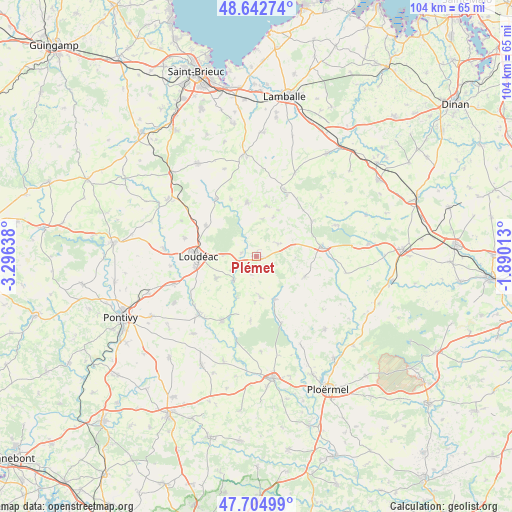
Plémet GPS coordinates[2]
48° 10' 33.636" North, 2° 35' 35.7" West
| Map corner | latitude | longitude |
|---|---|---|
| Upper-left | 48.64274°, | -3.29638° |
| Center: | 48.17601°, | -2.59325° |
| Lower-right: | 47.70499°, | -1.89013° |
| Map W x H: | 104.3×104.3 km | = 64.8×64.8mi |
| max Lat: | 51.07786° ⇑37.6% North |
| Plémet: | 48.17601° |
| min Lat: | ⇓62.4% South 41.3874° |
| min Long | Plémet | max Long |
| -5.08615° | -2.59325° | 9.52242° |
| W 3.5%⇐ | ⇒96.5% E |
Elevation
Elevation of Plémet is 147 m = 482 ft, and this is 46.7 m = 153 ft below average elevation for this country.
| Max E: |
2333 m = 7654 ft | 45.8% |
| Avg. | 193.7 m = 635 ft | |
| Plémet | 147 m = 482 ft | |
Min E: |
-1 m = -3 ft | 54.2% |
See also: France elevation on elevation.city.
Geographical zone
Plémet is located in North temperate zone (between Tropic of Cancer and the Arctic Circle). Distance of this North polar circle is 2044.5 km =1270.4 mi to North.| Distance of | km | miles | from Plémet |
|---|---|---|---|
| North Pole | 4650.4 | 2889.6 | to North |
| Arctic Circle | 2044.5 | 1270.4 | to North |
| Tropic Cancer | 2750.8 | 1709.3 | to South |
| Equator | 5356.7 | 3328.5 | to South |


Nearby cities:
15 places around Plémet: (largest is in red/bold)
• La Chèze
6.9 km =4.3 mi,  222°
222°
• La Motte
12.2 km =7.6 mi,  301°
301°
• La Prénessaye
3.2 km =2 mi,  282°
282°
• La Trinité-Porhoët
9.5 km =5.9 mi,  156°
156°
• Langast
12.7 km =7.9 mi,  336°
336°
• Laurenan
5 km =3.1 mi,  59°
59°
• Le Cambout
13.1 km =8.1 mi,  185°
185°
• Loudéac
11.9 km =7.4 mi,  271°
271°
• Merdrignac
13.3 km =8.3 mi,  81°
81°
• Ménéac
10.6 km =6.6 mi,  112°
112°
• Plessala
11.3 km =7 mi,  350°
350°
• Plumieux
8.1 km =5 mi,  175°
175°
• Saint-Barnabé
9.3 km =5.8 mi,  242°
242°
• Saint-Gouéno
10.4 km =6.5 mi,  10°
10°
• Saint-Vran
13 km =8.1 mi, 59°
Sources, notices
• [Note1] Compared only with cities in France existing in our database
• [Src1] Map data: © OpenStreetMap contributors (CC-BY-SA)
• [Src2] Other city data from geonames.org with taken over terms of usage.
• [Src3] Geographical zone / Annual Mean Temperature by Robert A. Rohde @ Wikipedia
