Saignon geodata
Saignon (Provence-Alpes-Côte d'Azur) is a populated place; located in France in Europe/Paris (GMT+2) time zone. With population of 1,009 people, there are 8775 cities with bigger population in this country. Compared to other cities in France, 88.5% of cities are located further ↑North; 82.3% of cities are located further ←West and 90.2% of cities have lower elevation than Saignon. Note1
Administrative division(s):
- Level 1: Provence-Alpes-Côte d'Azur
- Level 2: Département du Vaucluse
- Level 3: Apt
- Level 4: Saignon


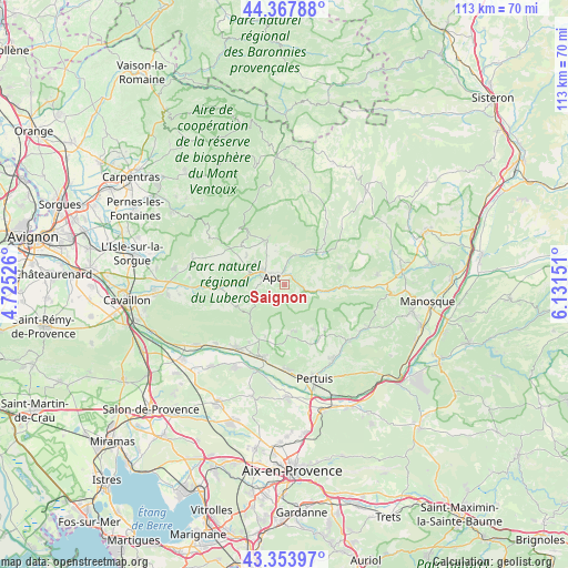
Saignon GPS coordinates[2]
43° 51' 47.088" North, 5° 25' 42.168" East
| Map corner | latitude | longitude |
|---|---|---|
| Upper-left | 44.36788°, | 4.72526° |
| Center: | 43.86308°, | 5.42838° |
| Lower-right: | 43.35397°, | 6.13151° |
| Map W x H: | 112.7×112.7 km | = 70×70mi |
| max Lat: | 51.07786° ⇑88.5% North |
| Saignon: | 43.86308° |
| min Lat: | ⇓11.5% South 41.3874° |
| min Long | Saignon | max Long |
| -5.08615° | 5.42838° | 9.52242° |
| W 82.3%⇐ | ⇒17.7% E |
Elevation
Elevation of Saignon is 430 m = 1411 ft, and this is 236.3 m = 775 ft above average elevation for this country.
| Max E: |
2333 m = 7654 ft | 9.8% |
| Saignon | 430 m 1411 ft | |
| Avg. | 193.7 m = 635 ft | |
Min E: |
-1 m = -3 ft | 90.2% |
See also: France elevation on elevation.city.
Geographical zone
Saignon is located in North temperate zone (between Tropic of Cancer and the Arctic Circle). Distance of this Northern Tropic circle is 2271.2 km =1411.3 mi to South.| Distance of | km | miles | from Saignon |
|---|---|---|---|
| North Pole | 5129.9 | 3187.6 | to North |
| Arctic Circle | 2524.1 | 1568.4 | to North |
| Tropic Cancer | 2271.2 | 1411.3 | to South |
| Equator | 4877.1 | 3030.5 | to South |


Nearby cities:
15 places around Saignon: (largest is in red/bold)
• Ansouis
14.2 km =8.8 mi,  168°
168°
• Apt
3 km =1.9 mi,  299°
299°
• Bonnieux
10.6 km =6.6 mi,  245°
245°
• Cucuron
10.1 km =6.3 mi,  175°
175°
• Céreste
12.7 km =7.9 mi,  93°
93°
• Gargas
7.1 km =4.4 mi,  307°
307°
• Lourmarin
12.2 km =7.6 mi,  205°
205°
• Puyvert
13.5 km =8.4 mi, 211°
• Roussillon
11.7 km =7.3 mi,  291°
291°
• Rustrel
8.2 km =5.1 mi,  33°
33°
• Saint-Martin-de-Castillon
6.7 km =4.2 mi, 93°
• Saint-Martin-de-la-Brasque
13.5 km =8.4 mi,  140°
140°
• Saint-Saturnin-lès-Apt
8.6 km =5.3 mi,  335°
335°
• Viens
11.5 km =7.1 mi,  72°
72°
• Villars
6.9 km =4.3 mi,  345°
345°
Sources, notices
• [Note1] Compared only with cities in France existing in our database
• [Src1] Map data: © OpenStreetMap contributors (CC-BY-SA)
• [Src2] Other city data from geonames.org with taken over terms of usage.
• [Src3] Geographical zone / Annual Mean Temperature by Robert A. Rohde @ Wikipedia
