Decize geodata
Decize (Bourgogne-Franche-Comté) is a populated place; located in France in Europe/Paris (GMT+2) time zone. With population of 6,605 people, there are 1496 cities with bigger population in this country. Compared to other cities in France, 56.9% of cities are located further ↑North; 63.9% of cities are located further ←West and 67.6% of cities have lower elevation than Decize. Note1
Administrative division(s):
- Level 1: Bourgogne-Franche-Comté
- Level 2: Département de la Nièvre
- Level 3: Arrondissement de Nevers
- Level 4: Decize


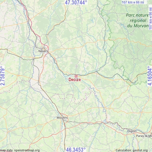
Decize GPS coordinates[2]
46° 49' 42.672" North, 3° 27' 42.912" East
| Map corner | latitude | longitude |
|---|---|---|
| Upper-left | 47.30744°, | 2.75879° |
| Center: | 46.82852°, | 3.46192° |
| Lower-right: | 46.3453°, | 4.16504° |
| Map W x H: | 107×107 km | = 66.5×66.5mi |
| max Lat: | 51.07786° ⇑56.9% North |
| Decize: | 46.82852° |
| min Lat: | ⇓43.1% South 41.3874° |
| min Long | Decize | max Long |
| -5.08615° | 3.46192° | 9.52242° |
| W 63.9%⇐ | ⇒36.1% E |
Elevation
Elevation of Decize is 207 m = 679 ft, and this is 13.3 m = 44 ft above average elevation for this country.
| Max E: |
2333 m = 7654 ft | 32.4% |
| Decize | 207 m 679 ft | |
| Avg. | 193.7 m = 635 ft | |
Min E: |
-1 m = -3 ft | 67.6% |
See also: France elevation on elevation.city.
Geographical zone
Decize is located in North temperate zone (between Tropic of Cancer and the Arctic Circle). Distance of this North polar circle is 2194.3 km =1363.5 mi to North.| Distance of | km | miles | from Decize |
|---|---|---|---|
| North Pole | 4800.2 | 2982.7 | to North |
| Arctic Circle | 2194.3 | 1363.5 | to North |
| Tropic Cancer | 2600.9 | 1616.1 | to South |
| Equator | 5206.8 | 3235.4 | to South |


Nearby cities:
15 places around Decize: (largest is in red/bold)
• Cercy-la-Tour
14.5 km =9 mi,  75°
75°
• Champvert
4 km =2.5 mi,  68°
68°
• Charrin
11.3 km =7 mi,  113°
113°
• Cossaye
9.1 km =5.7 mi,  168°
168°
• Dornes
15 km =9.3 mi,  213°
213°
• Fours
19.8 km =12.3 mi,  93°
93°
• Imphy
19.4 km =12.1 mi,  308°
308°
• La Fermeté
18.2 km =11.3 mi,  327°
327°
• La Machine
7.1 km =4.4 mi,  1°
1°
• Lucenay-lès-Aix
14.1 km =8.8 mi, 173°
• Luthenay-Uxeloup
15.1 km =9.4 mi,  279°
279°
• Saint-Benin-d’Azy
19.7 km =12.2 mi,  344°
344°
• Saint-Ennemond
17.2 km =10.7 mi,  190°
190°
• Saint-Léger-des-Vignes
1.4 km =0.9 mi, 338°
• Sougy-sur-Loire
6.2 km =3.9 mi,  299°
299°
Sources, notices
• [Note1] Compared only with cities in France existing in our database
• [Src1] Map data: © OpenStreetMap contributors (CC-BY-SA)
• [Src2] Other city data from geonames.org with taken over terms of usage.
• [Src3] Geographical zone / Annual Mean Temperature by Robert A. Rohde @ Wikipedia
