Champvert geodata
Champvert (Bourgogne-Franche-Comté) is a populated place; located in France in Europe/Paris (GMT+2) time zone. With population of 869 people, there are 9902 cities with bigger population in this country. Compared to other cities in France, 56.7% of cities are located further ↑North; 64.3% of cities are located further ←West and 65.8% of cities have lower elevation than Champvert. Note1
Administrative division(s):
- Level 1: Bourgogne-Franche-Comté
- Level 2: Département de la Nièvre
- Level 3: Arrondissement de Nevers
- Level 4: Champvert


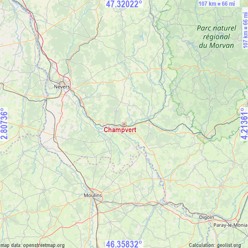
Champvert GPS coordinates[2]
46° 50' 29.112" North, 3° 30' 37.728" East
| Map corner | latitude | longitude |
|---|---|---|
| Upper-left | 47.32022°, | 2.80736° |
| Center: | 46.84142°, | 3.51048° |
| Lower-right: | 46.35832°, | 4.21361° |
| Map W x H: | 107×107 km | = 66.5×66.5mi |
| max Lat: | 51.07786° ⇑56.7% North |
| Champvert: | 46.84142° |
| min Lat: | ⇓43.3% South 41.3874° |
| min Long | Champvert | max Long |
| -5.08615° | 3.51048° | 9.52242° |
| W 64.3%⇐ | ⇒35.7% E |
Elevation
Elevation of Champvert is 198 m = 650 ft, and this is 4.3 m = 14 ft above average elevation for this country.
| Max E: |
2333 m = 7654 ft | 34.2% |
| Champvert | 198 m 650 ft | |
| Avg. | 193.7 m = 635 ft | |
Min E: |
-1 m = -3 ft | 65.8% |
See also: France elevation on elevation.city.
Geographical zone
Champvert is located in North temperate zone (between Tropic of Cancer and the Arctic Circle). Distance of this North polar circle is 2192.9 km =1362.6 mi to North.| Distance of | km | miles | from Champvert |
|---|---|---|---|
| North Pole | 4798.8 | 2981.8 | to North |
| Arctic Circle | 2192.9 | 1362.6 | to North |
| Tropic Cancer | 2602.4 | 1617.1 | to South |
| Equator | 5208.3 | 3236.3 | to South |


Nearby cities:
15 places around Champvert: (largest is in red/bold)
• Cercy-la-Tour
10.6 km =6.6 mi,  77°
77°
• Charrin
8.9 km =5.5 mi,  131°
131°
• Cossaye
10.5 km =6.5 mi,  190°
190°
• Cronat
18.8 km =11.7 mi, 134°
• Decize
4 km =2.5 mi,  248°
248°
• Dornes
18.4 km =11.4 mi,  220°
220°
• Fours
16.3 km =10.1 mi,  99°
99°
• La Fermeté
19.4 km =12.1 mi,  315°
315°
• La Machine
6.7 km =4.2 mi,  328°
328°
• Lucenay-lès-Aix
15.6 km =9.7 mi, 187°
• Luthenay-Uxeloup
18.6 km =11.6 mi,  273°
273°
• Saint-Benin-d’Azy
19.7 km =12.2 mi, 332°
• Saint-Ennemond
19.6 km =12.2 mi,  200°
200°
• Saint-Léger-des-Vignes
4.2 km =2.6 mi, 268°
• Sougy-sur-Loire
9.2 km =5.7 mi,  280°
280°
Sources, notices
• [Note1] Compared only with cities in France existing in our database
• [Src1] Map data: © OpenStreetMap contributors (CC-BY-SA)
• [Src2] Other city data from geonames.org with taken over terms of usage.
• [Src3] Geographical zone / Annual Mean Temperature by Robert A. Rohde @ Wikipedia
