Saint-Léger-des-Vignes geodata
Saint-Léger-des-Vignes (Bourgogne-Franche-Comté) is a populated place; located in France in Europe/Paris (GMT+2) time zone. With population of 2,086 people, there are 4620 cities with bigger population in this country. Compared to other cities in France, 56.8% of cities are located further ↑North; 63.8% of cities are located further ←West and 67.8% of cities have lower elevation than Saint-Léger-des-Vignes. Note1
Administrative division(s):
- Level 1: Bourgogne-Franche-Comté
- Level 2: Département de la Nièvre
- Level 3: Arrondissement de Nevers
- Level 4: Saint-Léger-des-Vignes
Current local time in Saint-Léger-des-Vignes:
07:42 AM, SaturdayDifference from your time zone: hours


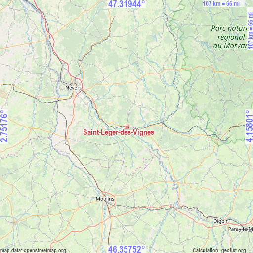
Saint-Léger-des-Vignes GPS coordinates[2]
46° 50' 26.268" North, 3° 27' 17.568" East
| Map corner | latitude | longitude |
|---|---|---|
| Upper-left | 47.31944°, | 2.75176° |
| Center: | 46.84063°, | 3.45488° |
| Lower-right: | 46.35752°, | 4.15801° |
| Map W x H: | 107×107 km | = 66.5×66.5mi |
| max Lat: | 51.07786° ⇑56.8% North |
| Saint-Léger-des-Vignes: | 46.84063° |
| min Lat: | ⇓43.2% South 41.3874° |
| min Long | Saint-Léger-de | max Long |
| -5.08615° | 3.45488° | 9.52242° |
| W 63.8%⇐ | ⇒36.2% E |
Elevation
Elevation of Saint-Léger-des-Vignes is 208 m = 682 ft, and this is 14.3 m = 47 ft above average elevation for this country.
| Max E: |
2333 m = 7654 ft | 32.2% |
| Saint-Léger-des-Vignes | 208 m 682 ft | |
| Avg. | 193.7 m = 635 ft | |
Min E: |
-1 m = -3 ft | 67.8% |
See also: France elevation on elevation.city.
Geographical zone
Saint-Léger-des-Vignes is located in North temperate zone (between Tropic of Cancer and the Arctic Circle). Distance of this North polar circle is 2193 km =1362.7 mi to North.| Distance of | km | miles | from Saint-Léger-des-Vignes |
|---|---|---|---|
| North Pole | 4798.9 | 2981.9 | to North |
| Arctic Circle | 2193 | 1362.7 | to North |
| Tropic Cancer | 2602.3 | 1617 | to South |
| Equator | 5208.2 | 3236.2 | to South |


Nearby cities:
15 places around Saint-Léger-des-Vignes: (largest is in red/bold)
• Cercy-la-Tour
14.8 km =9.2 mi,  80°
80°
• Champvert
4.2 km =2.6 mi,  88°
88°
• Charrin
12.4 km =7.7 mi,  118°
118°
• Chevenon
19.3 km =12 mi,  297°
297°
• Cossaye
10.5 km =6.5 mi,  167°
167°
• Decize
1.4 km =0.9 mi,  158°
158°
• Dornes
15.9 km =9.9 mi,  209°
209°
• Imphy
18.2 km =11.3 mi,  305°
305°
• La Fermeté
16.8 km =10.4 mi,  326°
326°
• La Machine
5.8 km =3.6 mi,  7°
7°
• Lucenay-lès-Aix
15.5 km =9.6 mi, 172°
• Luthenay-Uxeloup
14.4 km =8.9 mi,  274°
274°
• Saint-Benin-d’Azy
18.2 km =11.3 mi,  344°
344°
• Saint-Ennemond
18.5 km =11.5 mi,  187°
187°
• Sougy-sur-Loire
5.1 km =3.2 mi,  289°
289°
Sources, notices
• [Note1] Compared only with cities in France existing in our database
• [Src1] Map data: © OpenStreetMap contributors (CC-BY-SA)
• [Src2] Other city data from geonames.org with taken over terms of usage.
• [Src3] Geographical zone / Annual Mean Temperature by Robert A. Rohde @ Wikipedia
