Roquefort-sur-Soulzon geodata
Roquefort-sur-Soulzon (Occitanie) is a populated place; located in France in Europe/Paris (GMT+2) time zone. With population of 713 people, there are 11611 cities with bigger population in this country. Compared to other cities in France, 87.3% of cities are located further ↑North; 57.7% of cities are located further ←West and 95% of cities have lower elevation than Roquefort-sur-Soulzon. Note1
Administrative division(s):
- Level 1: Occitanie
- Level 2: Département de l'Aveyron
- Level 3: Arrondissement de Millau
- Level 4: Roquefort-sur-Soulzon
Current local time in Roquefort-sur-Soulzon:
04:55 PM, SaturdayDifference from your time zone: hours


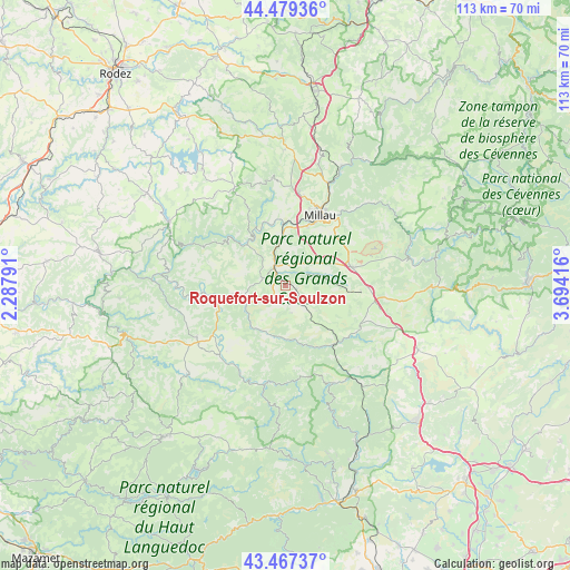
Roquefort-sur-Soulzon GPS coordinates[2]
43° 58' 31.872" North, 2° 59' 27.708" East
| Map corner | latitude | longitude |
|---|---|---|
| Upper-left | 44.47936°, | 2.28791° |
| Center: | 43.97552°, | 2.99103° |
| Lower-right: | 43.46737°, | 3.69416° |
| Map W x H: | 112.5×112.5 km | = 69.9×69.9mi |
| max Lat: | 51.07786° ⇑87.3% North |
| Roquefort-sur-Soulzon: | 43.97552° |
| min Lat: | ⇓12.7% South 41.3874° |
| min Long | Roquefort-sur-S | max Long |
| -5.08615° | 2.99103° | 9.52242° |
| W 57.7%⇐ | ⇒42.3% E |
Elevation
Elevation of Roquefort-sur-Soulzon is 583 m = 1913 ft, and this is 389.3 m = 1277 ft above average elevation for this country.
| Max E: |
2333 m = 7654 ft | 5% |
| Roquefort-sur-Soulzon | 583 m 1913 ft | |
| Avg. | 193.7 m = 635 ft | |
Min E: |
-1 m = -3 ft | 95% |
See also: France elevation on elevation.city.
Geographical zone
Roquefort-sur-Soulzon is located in North temperate zone (between Tropic of Cancer and the Arctic Circle). Distance of this Northern Tropic circle is 2283.7 km =1419 mi to South.| Distance of | km | miles | from Roquefort-sur-Soulzon |
|---|---|---|---|
| North Pole | 5117.4 | 3179.8 | to North |
| Arctic Circle | 2511.6 | 1560.6 | to North |
| Tropic Cancer | 2283.7 | 1419 | to South |
| Equator | 4889.6 | 3038.3 | to South |


Nearby cities:
15 places around Roquefort-sur-Soulzon: (largest is in red/bold)
• Aguessac
21.9 km =13.6 mi,  23°
23°
• Broquiès
23.8 km =14.8 mi,  277°
277°
• Camarès
19.2 km =11.9 mi,  207°
207°
• Compeyre
22.5 km =14 mi, 23°
• Creissels
13.5 km =8.4 mi, 24°
• La Cavalerie
13.9 km =8.6 mi,  74°
74°
• Millau
15.3 km =9.5 mi,  27°
27°
• Montlaur
16.5 km =10.3 mi,  230°
230°
• Nant
25.4 km =15.8 mi,  78°
78°
• Saint-Affrique
8.4 km =5.2 mi,  254°
254°
• Saint-Beauzély
21.3 km =13.2 mi,  352°
352°
• Saint-Georges-de-Luzençon
9.9 km =6.2 mi,  357°
357°
• Saint-Rome-de-Cernon
4.7 km =2.9 mi,  332°
332°
• Saint-Rome-de-Tarn
11.1 km =6.9 mi,  317°
317°
• Viala-du-Tarn
14 km =8.7 mi, 319°
Sources, notices
• [Note1] Compared only with cities in France existing in our database
• [Src1] Map data: © OpenStreetMap contributors (CC-BY-SA)
• [Src2] Other city data from geonames.org with taken over terms of usage.
• [Src3] Geographical zone / Annual Mean Temperature by Robert A. Rohde @ Wikipedia
