Saint-Georges-de-Luzençon geodata
Saint-Georges-de-Luzençon (Occitanie) is a populated place; located in France in Europe/Paris (GMT+2) time zone. With population of 1,357 people, there are 6778 cities with bigger population in this country. Compared to other cities in France, 86.5% of cities are located further ↑North; 57.6% of cities are located further ←West and 86.2% of cities have lower elevation than Saint-Georges-de-Luzençon. Note1
Administrative division(s):
- Level 1: Occitanie
- Level 2: Département de l'Aveyron
- Level 3: Arrondissement de Millau
- Level 4: Saint-Georges-de-Luzençon
Current local time in Saint-Georges-de-Luzençon:
03:51 PM, SaturdayDifference from your time zone: hours


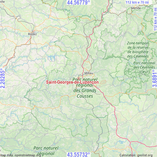
Saint-Georges-de-Luzençon GPS coordinates[2]
44° 3' 52.956" North, 2° 59' 9.492" East
| Map corner | latitude | longitude |
|---|---|---|
| Upper-left | 44.56779°, | 2.28285° |
| Center: | 44.06471°, | 2.98597° |
| Lower-right: | 43.55732°, | 3.6891° |
| Map W x H: | 112.4×112.4 km | = 69.8×69.8mi |
| max Lat: | 51.07786° ⇑86.5% North |
| Saint-Georges-de-Luzençon: | 44.06471° |
| min Lat: | ⇓13.5% South 41.3874° |
| min Long | Saint-Georges-d | max Long |
| -5.08615° | 2.98597° | 9.52242° |
| W 57.6%⇐ | ⇒42.4% E |
Elevation
Elevation of Saint-Georges-de-Luzençon is 362 m = 1188 ft, and this is 168.3 m = 552 ft above average elevation for this country.
| Max E: |
2333 m = 7654 ft | 13.8% |
| Saint-Georges-de-Luzençon | 362 m 1188 ft | |
| Avg. | 193.7 m = 635 ft | |
Min E: |
-1 m = -3 ft | 86.2% |
See also: France elevation on elevation.city.
Geographical zone
Saint-Georges-de-Luzençon is located in North temperate zone (between Tropic of Cancer and the Arctic Circle). Distance of this Northern Tropic circle is 2293.6 km =1425.2 mi to South.| Distance of | km | miles | from Saint-Georges-de-Luzençon |
|---|---|---|---|
| North Pole | 5107.5 | 3173.7 | to North |
| Arctic Circle | 2501.6 | 1554.4 | to North |
| Tropic Cancer | 2293.6 | 1425.2 | to South |
| Equator | 4899.5 | 3044.4 | to South |


Nearby cities:
15 places around Saint-Georges-de-Luzençon: (largest is in red/bold)
• Aguessac
13.6 km =8.5 mi,  41°
41°
• Compeyre
14.2 km =8.8 mi, 40°
• Creissels
6.4 km =4 mi,  68°
68°
• La Cavalerie
15.1 km =9.4 mi,  113°
113°
• Millau
8.2 km =5.1 mi,  63°
63°
• Montlaur
23.9 km =14.9 mi,  210°
210°
• Rivière-sur-Tarn
18.1 km =11.2 mi, 40°
• Roquefort-sur-Soulzon
9.9 km =6.2 mi,  177°
177°
• Saint-Affrique
14.4 km =8.9 mi, 212°
• Saint-Beauzély
11.5 km =7.1 mi,  348°
348°
• Saint-Rome-de-Cernon
6 km =3.7 mi,  196°
196°
• Saint-Rome-de-Tarn
7.4 km =4.6 mi,  255°
255°
• Salles-Curan
20.5 km =12.7 mi,  309°
309°
• Viala-du-Tarn
8.6 km =5.3 mi,  275°
275°
• Villefranche-de-Panat
22.6 km =14 mi, 276°
Sources, notices
• [Note1] Compared only with cities in France existing in our database
• [Src1] Map data: © OpenStreetMap contributors (CC-BY-SA)
• [Src2] Other city data from geonames.org with taken over terms of usage.
• [Src3] Geographical zone / Annual Mean Temperature by Robert A. Rohde @ Wikipedia
