Nant geodata
Nant (Occitanie) is a populated place; located in France in Europe/Paris (GMT+2) time zone. With population of 876 people, there are 9846 cities with bigger population in this country. Compared to other cities in France, 86.9% of cities are located further ↑North; 62% of cities are located further ←West and 92.7% of cities have lower elevation than Nant. Note1
Administrative division(s):
- Level 1: Occitanie
- Level 2: Département de l'Aveyron
- Level 3: Arrondissement de Millau
- Level 4: Nant


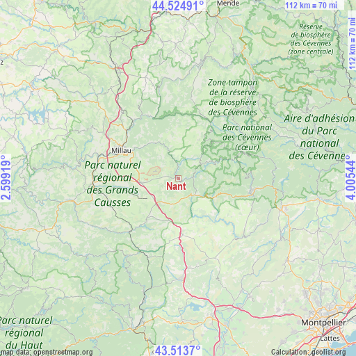
Nant GPS coordinates[2]
44° 1' 17.256" North, 3° 18' 8.316" East
| Map corner | latitude | longitude |
|---|---|---|
| Upper-left | 44.52491°, | 2.59919° |
| Center: | 44.02146°, | 3.30231° |
| Lower-right: | 43.5137°, | 4.00544° |
| Map W x H: | 112.4×112.4 km | = 69.8×69.8mi |
| max Lat: | 51.07786° ⇑86.9% North |
| Nant: | 44.02146° |
| min Lat: | ⇓13.1% South 41.3874° |
| min Long | Nant | max Long |
| -5.08615° | 3.30231° | 9.52242° |
| W 62%⇐ | ⇒38% E |
Elevation
Elevation of Nant is 496 m = 1627 ft, and this is 302.3 m = 992 ft above average elevation for this country.
| Max E: |
2333 m = 7654 ft | 7.3% |
| Nant | 496 m 1627 ft | |
| Avg. | 193.7 m = 635 ft | |
Min E: |
-1 m = -3 ft | 92.7% |
See also: France elevation on elevation.city.
Geographical zone
Nant is located in North temperate zone (between Tropic of Cancer and the Arctic Circle). Distance of this Northern Tropic circle is 2288.8 km =1422.2 mi to South.| Distance of | km | miles | from Nant |
|---|---|---|---|
| North Pole | 5112.3 | 3176.6 | to North |
| Arctic Circle | 2506.4 | 1557.4 | to North |
| Tropic Cancer | 2288.8 | 1422.2 | to South |
| Equator | 4894.7 | 3041.4 | to South |


Nearby cities:
15 places around Nant: (largest is in red/bold)
• Aguessac
22.1 km =13.7 mi,  312°
312°
• Avèze
24.5 km =15.2 mi,  103°
103°
• Compeyre
22.3 km =13.9 mi, 314°
• Creissels
20.6 km =12.8 mi,  290°
290°
• La Cavalerie
11.6 km =7.2 mi,  263°
263°
• Le Vigan
24.5 km =15.2 mi, 97°
• Meyrueis
20.1 km =12.5 mi,  30°
30°
• Millau
19.8 km =12.3 mi,  295°
295°
• Molières-Cavaillac
22.6 km =14 mi, 103°
• Rivière-sur-Tarn
23.1 km =14.4 mi,  323°
323°
• Roquefort-sur-Soulzon
25.4 km =15.8 mi, 258°
• Saint-Georges-de-Luzençon
25.7 km =16 mi,  280°
280°
• Saint-Jean-du-Bruel
4.7 km =2.9 mi,  89°
89°
• Saint-Rome-de-Cernon
27 km =16.8 mi,  267°
267°
• Valleraugue
27.9 km =17.3 mi,  76°
76°
Sources, notices
• [Note1] Compared only with cities in France existing in our database
• [Src1] Map data: © OpenStreetMap contributors (CC-BY-SA)
• [Src2] Other city data from geonames.org with taken over terms of usage.
• [Src3] Geographical zone / Annual Mean Temperature by Robert A. Rohde @ Wikipedia
