Roquebrun geodata
Roquebrun (Occitanie) is a populated place; located in France in Europe/Paris (GMT+2) time zone. With population of 655 people, there are 12455 cities with bigger population in this country. Compared to other cities in France, 93% of cities are located further ↑North; 58.2% of cities are located further ←West and 62% of cities have higher elevation than Roquebrun. Note1
Administrative division(s):
- Level 1: Occitanie
- Level 2: Département de l'Hérault
- Level 3: Arrondissement de Béziers
- Level 4: Roquebrun


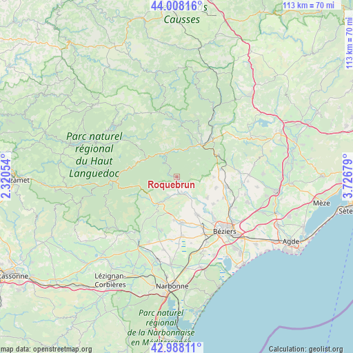
Roquebrun GPS coordinates[2]
43° 30' 1.044" North, 3° 1' 25.176" East
| Map corner | latitude | longitude |
|---|---|---|
| Upper-left | 44.00816°, | 2.32054° |
| Center: | 43.50029°, | 3.02366° |
| Lower-right: | 42.98811°, | 3.72679° |
| Map W x H: | 113.4×113.4 km | = 70.5×70.5mi |
| max Lat: | 51.07786° ⇑93% North |
| Roquebrun: | 43.50029° |
| min Lat: | ⇓7% South 41.3874° |
| min Long | Roquebrun | max Long |
| -5.08615° | 3.02366° | 9.52242° |
| W 58.2%⇐ | ⇒41.8% E |
Elevation
Elevation of Roquebrun is 97 m = 318 ft, and this is 96.7 m = 317 ft below average elevation for this country.
| Max E: |
2333 m = 7654 ft | 62% |
| Avg. | 193.7 m = 635 ft | |
| Roquebrun | 97 m = 318 ft | |
Min E: |
-1 m = -3 ft | 38% |
See also: France elevation on elevation.city.
Geographical zone
Roquebrun is located in North temperate zone (between Tropic of Cancer and the Arctic Circle). Distance of this Northern Tropic circle is 2230.9 km =1386.2 mi to South.| Distance of | km | miles | from Roquebrun |
|---|---|---|---|
| North Pole | 5170.3 | 3212.7 | to North |
| Arctic Circle | 2564.4 | 1593.4 | to North |
| Tropic Cancer | 2230.9 | 1386.2 | to South |
| Equator | 4836.8 | 3005.4 | to South |


Nearby cities:
15 places around Roquebrun: (largest is in red/bold)
• Autignac
11.7 km =7.3 mi,  90°
90°
• Causses-et-Veyran
5.8 km =3.6 mi,  119°
119°
• Cazouls-lès-Béziers
13.5 km =8.4 mi,  152°
152°
• Cessenon-sur-Orb
6 km =3.7 mi,  158°
158°
• Creissan
13.9 km =8.6 mi,  183°
183°
• Hérépian
12.7 km =7.9 mi,  35°
35°
• Lamalou-les-Bains
11.8 km =7.3 mi,  22°
22°
• Laurens
14.2 km =8.8 mi,  80°
80°
• Le Poujol-sur-Orb
9.3 km =5.8 mi, 19°
• Les Aires
11.1 km =6.9 mi, 35°
• Mons
9.5 km =5.9 mi,  325°
325°
• Murviel-lès-Béziers
11.6 km =7.2 mi,  130°
130°
• Olargues
10.8 km =6.7 mi,  305°
305°
• Saint-Chinian
10.7 km =6.6 mi,  215°
215°
• Saint-Geniès-de-Fontedit
13.4 km =8.3 mi,  106°
106°
Sources, notices
• [Note1] Compared only with cities in France existing in our database
• [Src1] Map data: © OpenStreetMap contributors (CC-BY-SA)
• [Src2] Other city data from geonames.org with taken over terms of usage.
• [Src3] Geographical zone / Annual Mean Temperature by Robert A. Rohde @ Wikipedia
