Rocquencourt geodata
Rocquencourt (Île-de-France) is a populated place; located in France in Europe/Paris (GMT+2) time zone. With population of 3,389 people, there are 2873 cities with bigger population in this country. Compared to other cities in France, 76.3% of cities are located further ↓South; 55.8% of cities are located further →East and 53.1% of cities have lower elevation than Rocquencourt. Note1
Administrative division(s):
- Level 1: Île-de-France
- Level 2: Yvelines
- Level 3: Arrondissement de Versailles
- Level 4: Le Chesnay-Rocquencourt


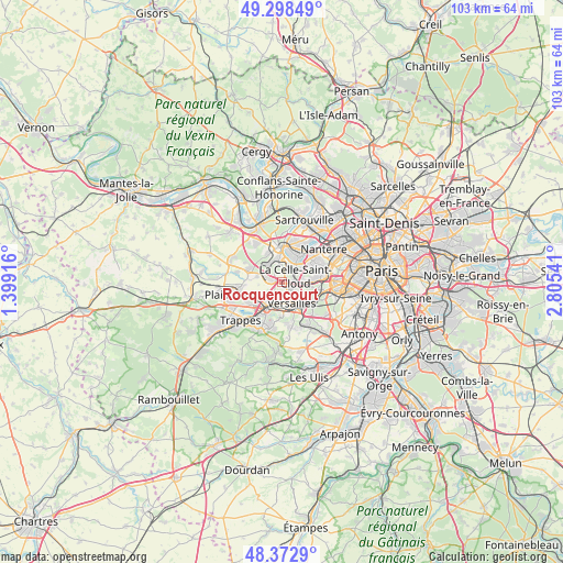
Rocquencourt GPS coordinates[2]
48° 50' 16.188" North, 2° 6' 8.208" East
| Map corner | latitude | longitude |
|---|---|---|
| Upper-left | 49.29849°, | 1.39916° |
| Center: | 48.83783°, | 2.10228° |
| Lower-right: | 48.3729°, | 2.80541° |
| Map W x H: | 102.9×102.9 km | = 63.9×63.9mi |
| max Lat: | 51.07786° ⇑23.7% North |
| Rocquencourt: | 48.83783° |
| min Lat: | ⇓76.3% South 41.3874° |
| min Long | Rocquencourt | max Long |
| -5.08615° | 2.10228° | 9.52242° |
| W 44.2%⇐ | ⇒55.8% E |
Elevation
Elevation of Rocquencourt is 143 m = 469 ft, and this is 50.7 m = 166 ft below average elevation for this country.
| Max E: |
2333 m = 7654 ft | 46.9% |
| Avg. | 193.7 m = 635 ft | |
| Rocquencourt | 143 m = 469 ft | |
Min E: |
-1 m = -3 ft | 53.1% |
See also: France elevation on elevation.city.
Geographical zone
Rocquencourt is located in North temperate zone (between Tropic of Cancer and the Arctic Circle). Distance of this North polar circle is 1970.9 km =1224.7 mi to North.| Distance of | km | miles | from Rocquencourt |
|---|---|---|---|
| North Pole | 4576.8 | 2843.9 | to North |
| Arctic Circle | 1970.9 | 1224.7 | to North |
| Tropic Cancer | 2824.3 | 1754.9 | to South |
| Equator | 5430.3 | 3374.2 | to South |


Nearby cities:
15 places around Rocquencourt: (largest is in red/bold)
• Bailly
1.9 km =1.2 mi,  282°
282°
• Bougival
3.9 km =2.4 mi,  46°
46°
• Croissy-sur-Seine
5.3 km =3.3 mi,  29°
29°
• Fontenay-le-Fleury
4.8 km =3 mi,  234°
234°
• La Celle-Saint-Cloud
3.4 km =2.1 mi,  66°
66°
• Le Chesnay
2.3 km =1.4 mi,  140°
140°
• Louveciennes
2.7 km =1.7 mi,  19°
19°
• L’Étang-la-Ville
4.8 km =3 mi,  316°
316°
• Mareil-Marly
5.4 km =3.4 mi,  336°
336°
• Marly-le-Roi
3.5 km =2.2 mi, 336°
• Marnes-la-Coquette
5.2 km =3.2 mi,  102°
102°
• Noisy-le-Roi
2.9 km =1.8 mi, 284°
• Saint-Cyr-l’École
5 km =3.1 mi,  209°
209°
• Vaucresson
4 km =2.5 mi,  85°
85°
• Versailles
4.5 km =2.8 mi,  148°
148°
Sources, notices
• [Note1] Compared only with cities in France existing in our database
• [Src1] Map data: © OpenStreetMap contributors (CC-BY-SA)
• [Src2] Other city data from geonames.org with taken over terms of usage.
• [Src3] Geographical zone / Annual Mean Temperature by Robert A. Rohde @ Wikipedia
